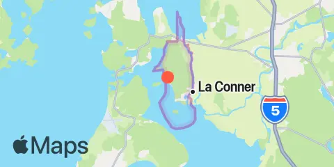
TidesPro
  • Recents
    • Sneeoosh Point
  • Tides
    United States
    Alabama Alaska California Connecticut Delaware District of Columbia Florida Georgia Hawaii
    Louisiana Maine Maryland Massachusetts Mississippi New Hampshire New Jersey New York North Carolina
    Oregon Pennsylvania Rhode Island South Carolina Texas US Outlying Islands Virginia Washington Puerto Rico
    Caribbean
    The Bahamas Cayman Islands Cuba Dominican Republic Haiti Jamaica Virgin Islands (US)
  • Fishing  Coordinates
    Alabama - Alabama Inshore Public Reefs Alabama - Alabama Nearshore Public Reefs Alabama - Alabama Offshore Public Reefs California - California Artificial Reefs Delaware - Delaware Artificial Reefs Florida - Bay County Florida - Brevard County Florida - Broward County Florida - Charlote and Lee Counties Florida - Citrus County Florida - Collier County Florida - Dixie County Florida - Duval County Florida - Escambia County Florida - Flagler County Florida - Florida Keys Florida - Franklin County Florida - Gulf County Florida - Hernando County
    Florida - Indian River County Florida - Levy County Florida - Manatee County Florida - Martin County Florida - Miami-Dade County Florida - Monroe County Florida - Nassau County Florida - Okaloosa County Florida - Palm Beach County Florida - Pasco County Florida - Santa Rosa County Florida - Sarasota County Florida - St. Johns County Florida - St. Lucie County Florida - Tampa Bay Florida - Taylor County Florida - Volusia County Florida - Wakulla County Florida - Walton County
    Georgia - Georgia Reefs Hawaii - Hawaii Artificial Reefs Louisiana - Louisiana Artificial Reefs Maryland - Maryland Artificial Reefs Massachusetts - Massachusetts Artificial Reefs Mississippi - Mississippi Inshore Artificial Reefs Mississippi - Mississippi Offshore Artificial Reefs New Jersey - New Jersey Artificial Reefs New York - New York Artificial Reefs North Carolina - Estuarine North Carolina - Long Bay North Carolina - Onslow Bay North Carolina - Outer Banks North Carolina - Raleigh Bay Puerto Rico - Puerto Rico Artificial Reefs Rhode Island - Rhode Island Artificial Reefs South Carolina - South Carolina Reefs Texas - Texas Artificial Reefs Virginia - Virginia Artificial Reefs
  • Solunar Tables
Sneeoosh Point Location
  1. United States
  2. Washington
  3. Sneeoosh Point

Sneeoosh Point Map

Day Week Month Table Month Chart Map
Latitude
48° 24' 0" N (48.4)
Longitude
122° 32' 53" W (-122.548)
State
Washington
County
Skagit County
Nearest ZIP
98257
Nearby
Tides 1.8 mi Ala Spit, Whidbey Island 2.4 mi La Conner, Swinomish Channel 3.1 mi Turner Bay, Similk Bay 3.2 mi Yokeko Point, Deception Pass 3.4 mi Cornet Bay, Deception Pass 4.3 mi Swinomish Channel entrance, Padilla Bay 4.9 mi Deception Pass St. Park, Bowman Bay, Fidalgo I. 7.5 mi Naval Air Station Whidbey Island 7.9 mi Burrows Bay (Allan Island) 8.5 mi Crescent Harbor, N. Whidbey Island 8.8 mi Anacortes, Guemes Channel 9.5 mi Ship Harbor, Fidalgo Island 11.6 mi Sunset Beach, Whidbey Island, Strait of Juan de Fuca 12.2 mi Telegraph Bay Currents 1.5 mi Skagit Bay channel, SW of Hope Island 3.1 mi Yokeko Point, Deception Pass 3.8 mi Skagit Bay, 1 mi. south of Goat Island 4.4 mi Deception Pass (Narrows) 7.6 mi Burrows Bay, 0.5 mile east of Allan I 8.5 mi Allan Pass 8.9 mi Point Colville, 3.0 nm east of (Lawson Reef, 1 nm 8.9 mi Burrows Pass 9.2 mi Guemes Channel, East Entrance 9.2 mi Skagit Bay, 1 mi. north of Rocky Point 9.4 mi Saddle Bag Island Passage 9.6 mi Guemes Channel, West Entrance 10.1 mi Rosario Strait 10.1 mi Huckleberry Island, 0.5 mile north of 10.2 mi Green Point, 0.8 mile northwest of 10.7 mi Belle Rock Light, east of 10.8 mi Point Colville, 1.4 nm east of 11.5 mi Bellingham Channel South 12.1 mi Bellingham Channel, off Cypress Head Light 12.3 mi Colville Island, 1 mile SSE of

About

TidesPro was created as an easy-to-use tides and solunar site. It provides tide predictions and marine weather for many types of people, whether you’re fishing, going to the beach, boating, kayaking, surfing, or planning a trip. With anglers in mind, it also provides an accessible way to find fishing spots and the best times to fish in those locations.

More About TidesPro

App

Apple App Store
[More Info]
Quick Links
  • When to Fish
  • Solunar Theory
  • Tide & Solunar Widgets for Your Site
  • Tide & Solunar Predictions in Google Earth
  • Things to Do
  • About

© Copyright 2017 - 2025 ASR Concepts LLC. All rights reserved.

  • Privacy Policy
  • •
  • Terms of Use
  • •
  • Contact
  • •
  • Bluesky
  • •
  • Mastodon