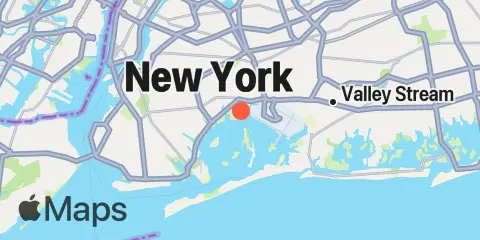
North Channel Bridge Map
Latitude
40° 38' 42" N (40.645)
Longitude
73° 50' 12" W (-73.8367)
State
County
Nearby
Tides
2.7 mi
Canarsie, Jamaica Bay
3.2 mi
J.F.K. International Airport, Jamaica Bay
4.0 mi
Beach Channel (Bridge), Jamaica Bay
4.6 mi
Motts Basin, Jamaica Bay
4.8 mi
Norton Point, Head of Bay, Jamaica Bay
5.1 mi
Mill Basin, Jamaica Bay
5.3 mi
Barren Island, Rockaway Inlet, Jamaica Bay
6.0 mi
Atlantic Beach, East Rockaway Inlet, Long Island
6.2 mi
Plumb Beach Channel, Jamaica Bay
6.7 mi
Kingsborough Community College, Sheepshead Bay, Long Island
7.5 mi
Woodmere, Brosewere Bay, Hempstead Bay
8.3 mi
Williamsburg Bridge, East River
8.4 mi
Wallabout Bay, Brooklyn Navy Yard, East River
8.8 mi
Bay Park, East Rockaway, Hewlett Bay
9.2 mi
Brooklyn Bridge, East River
9.3 mi
Hunters Point, Newtown Creek, East River
9.3 mi
Coney Island
9.3 mi
Norton Point, Gravesend Bay
9.4 mi
Gowanus Bay
9.6 mi
College Pt, Ft. of 110th Street, Long Island
9.9 mi
East 41st Street, New York City, East River
10.1 mi
The Battery, New York Harbor
10.1 mi
Queensboro Bridge, East River
10.1 mi
Long Beach (Bridgeview Yacht Club)
10.3 mi
Long Beach (Inside), Hempstead Bay
10.6 mi
Horns Hook, East 90th Street, East River, New York
10.7 mi
Willets Point, Little Bay, East River
10.7 mi
Whitestone, East River
10.7 mi
Fort Hamilton, The Narrows
10.8 mi
Hell Gate, Wards Island, East River
10.9 mi
Hunts Point, East River
11.1 mi
North Brother Island, East River
11.3 mi
Throgs Neck
11.4 mi
Port Morris (Stony Point), East River
11.6 mi
Parsonnage Cove, Long Island
11.7 mi
Harlem River, Randalls Island, East River
11.9 mi
USCG Station, The Narrows
12.0 mi
Kings Point, Long Island Sound
12.4 mi
St. George, Staten Island
Currents
2.7 mi
Canarsie (midchannel), Jamaica Bay
3.6 mi
Grass Hassock Channel
4.4 mi
Beach Channel (bridge)
5.7 mi
Marine Parkway Bridge, Rockaway Inlet
5.7 mi
East Rockaway Inlet
7.8 mi
Rockaway Inlet Entrance
8.6 mi
Corlears Hook
9.2 mi
Newtown Creek
9.3 mi
Rockaway Point
9.4 mi
Brooklyn Bridge
9.6 mi
Manhattan, off 31st Street
9.6 mi
Gowanus Bay Entrance
9.9 mi
Roosevelt Island, east of
9.9 mi
Rikers I. chan., off La Guardia Field
9.9 mi
Long Beach, inside, between bridges
10.0 mi
Roosevelt Island, east of, off 36th Avenue
10.0 mi
Red Hook Channel
10.1 mi
Roosevelt Is., west of, off 63rd Street
10.1 mi
Rockaway Inlet Jetty, 1 nm SW of
10.2 mi
Roosevelt Is., west of, off 67th Street
10.3 mi
Roosevelt Is., west of, off 75th Street
10.4 mi
Dimond Reef
10.4 mi
Coney Island Channel, west end
10.6 mi
Statue of Liberty, east of
10.6 mi
Hell Gate
10.7 mi
Off Winthrop Ave., Astoria
10.8 mi
Hudson River Entrance
10.8 mi
Gowanus Flats LBB 32
10.8 mi
College Point Reef, 0.25 n.mi. NW of
10.8 mi
Bronx-Whitestone Bridge, East of
10.9 mi
Throgs Neck, 0.4 mile south of
10.9 mi
The Narrows
10.9 mi
Cryders Point, 0.4 mile NNW of
10.9 mi
Coney Island Lt., 1.5 miles SSE of
11.0 mi
Hunts Point, southwest of
11.0 mi
South Brother Island, NW of
11.0 mi
Throgs Neck Bridge
11.1 mi
Harlem River, south end
11.1 mi
Throgs Neck, 0.2 mile S of (Willets Point)
11.2 mi
Robbins Reef Light, 0.6 nm E of
11.5 mi
Ambrose Channel
11.5 mi
Bay Ridge, west of
11.5 mi
Norton Point, WSW of
11.8 mi
Constable Hook Approach
11.8 mi
Throgs Neck, 0.3 n.mi. NE of
12.1 mi
Willis Ave. Bridge, 0.1 mile NW of
12.3 mi
Hudson River, Pier 92