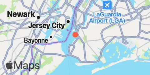
Gowanus Bay Map
Latitude
40° 39' 54" N (40.665)
Longitude
74° 0' 48" W (-74.0133)
State
County
Nearest ZIP
11231
Nearby
Tides
2.5 mi
The Battery, New York Harbor
2.8 mi
Brooklyn Bridge, East River
3.5 mi
St. George, Staten Island
3.5 mi
Wallabout Bay, Brooklyn Navy Yard, East River
3.8 mi
Constable Hook, Kill Van Kull
4.0 mi
Williamsburg Bridge, East River
4.1 mi
Fort Hamilton, The Narrows
4.4 mi
USCG Station, The Narrows
5.2 mi
Norton Point, Gravesend Bay
5.8 mi
Hunters Point, Newtown Creek, East River
6.1 mi
East 41st Street, New York City, East River
6.2 mi
Mill Basin, Jamaica Bay
6.4 mi
Kearny Point, Hackensack River
6.5 mi
Port Newark Terminal
6.7 mi
Port Elizabeth
6.8 mi
Coney Island
6.9 mi
Weehawken, Union City, Hudson River
7.1 mi
Queensboro Bridge, East River
7.1 mi
Point No Point, Passaic River
7.1 mi
Kingsborough Community College, Sheepshead Bay, Long Island
7.2 mi
Canarsie, Jamaica Bay
7.2 mi
Bergen Point West Reach, Kill Van Kull
7.2 mi
Plumb Beach Channel, Jamaica Bay
7.4 mi
Amtrak RR. swing bridge, Hackensack River
8.6 mi
Horns Hook, East 90th Street, East River, New York
8.9 mi
Port Ivory, Howland Hook, Arthur Kill
8.9 mi
Barren Island, Rockaway Inlet, Jamaica Bay
9.4 mi
North Channel Bridge, Grassy Bay, Jamaica Bay
9.7 mi
Hell Gate, Wards Island, East River
9.8 mi
Fish Creek, Berrys Creek, Hackensack River
9.9 mi
North Secaucus, Garretts Reach, Hackensack River
10.1 mi
Carlstadt, Garretts Reach, Hackensack River
10.3 mi
Harlem River, Randalls Island, East River
10.4 mi
Edgewater, Hudson River
10.7 mi
Great Kills Harbor
10.8 mi
Chelsea, Arthur Kill
10.9 mi
Belleville, Passaic River
11.0 mi
Port Morris (Stony Point), East River
11.0 mi
North Brother Island, East River
11.4 mi
Beach Channel (Bridge), Jamaica Bay
11.6 mi
College Pt, Ft. of 110th Street, Long Island
11.7 mi
Carteret, Arthur Kill
11.9 mi
Hunts Point, East River
12.4 mi
Rahway River, RR. Bridge, Arthur Kill
12.4 mi
J.F.K. International Airport, Jamaica Bay
Currents
0.3 mi
Gowanus Bay Entrance
0.8 mi
Red Hook Channel
1.5 mi
Gowanus Flats LBB 32
1.9 mi
Statue of Liberty, east of
2.1 mi
Robbins Reef Light, 0.6 nm E of
2.3 mi
Dimond Reef
2.7 mi
Constable Hook Approach
3.0 mi
Brooklyn Bridge
3.0 mi
Hudson River Entrance
3.5 mi
Bay Ridge, west of
3.6 mi
Corlears Hook
4.3 mi
The Narrows
5.4 mi
Newtown Creek
5.7 mi
Manhattan, off 31st Street
6.1 mi
Bergen Point, East Reach
6.3 mi
Hoffman Island, 0.2 mile west of
6.4 mi
Middle Reach, Newark Bay
6.5 mi
South Reach, Newark Bay
6.6 mi
Lincoln Highway Bridge, Hackensack River
6.6 mi
Coney Island Channel, west end
6.8 mi
Kill Van Kull LB 14, east of Bayonne Bridge
7.0 mi
Bayonne Bridge
7.2 mi
Lincoln Highway Bridge, Passaic River
7.2 mi
Roosevelt Island, east of
7.2 mi
Roosevelt Is., west of, off 63rd Street
7.3 mi
Hudson River, Pier 92
7.4 mi
Canarsie (midchannel), Jamaica Bay
7.4 mi
Bergen Point
7.4 mi
Roosevelt Is., west of, off 67th Street
7.6 mi
Newark Bay Entrance LB 18
7.6 mi
Norton Point, WSW of
7.7 mi
Roosevelt Island, east of, off 36th Avenue
7.8 mi
Roosevelt Is., west of, off 75th Street
7.8 mi
Coney Island Lt., 1.5 miles SSE of
8.2 mi
Rockaway Inlet Entrance
8.8 mi
Hell Gate
8.9 mi
Elizabethport
9.3 mi
Harlem River, south end
9.4 mi
Marine Parkway Bridge, Rockaway Inlet
9.5 mi
Rockaway Inlet Jetty, 1 nm SW of
9.7 mi
Rockaway Point
9.7 mi
New Dorp Beach, 1.2 miles south of
9.8 mi
Off Winthrop Ave., Astoria
10.2 mi
Grants Tomb
10.3 mi
Gulfport, Arthur Kill
10.5 mi
Ambrose Channel
10.6 mi
Willis Ave. Bridge, 0.1 mile NW of
10.6 mi
Old Orchard Shoal Lt., 1.2 mi. ENE of
10.6 mi
Rikers I. chan., off La Guardia Field
10.8 mi
South Brother Island, NW of
11.0 mi
Madison Ave. Bridge
11.4 mi
Tremley Point
11.6 mi
Hunts Point, southwest of
11.8 mi
Beach Channel (bridge)
12.0 mi
Macombs Dam Bridge
12.3 mi
Sandy Hook Channel, Front Range Light