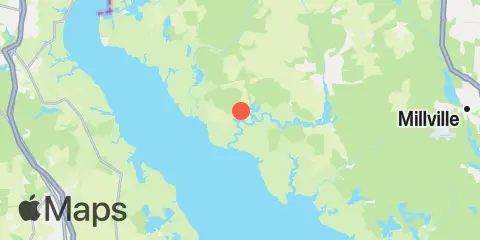
TidesPro
  • Recents
    • Greenwich Pier, Cohansey River, Delaware Bay
  • Tides
    United States
    Alabama Alaska California Connecticut Delaware District of Columbia Florida Georgia Hawaii
    Louisiana Maine Maryland Massachusetts Mississippi New Hampshire New Jersey New York North Carolina
    Oregon Pennsylvania Rhode Island South Carolina Texas US Outlying Islands Virginia Washington Puerto Rico
    Caribbean
    The Bahamas Cayman Islands Cuba Dominican Republic Haiti Jamaica Virgin Islands (US)
  • Fishing  Coordinates
    Alabama - Alabama Inshore Public Reefs Alabama - Alabama Nearshore Public Reefs Alabama - Alabama Offshore Public Reefs California - California Artificial Reefs Delaware - Delaware Artificial Reefs Florida - Bay County Florida - Brevard County Florida - Broward County Florida - Charlote and Lee Counties Florida - Citrus County Florida - Collier County Florida - Dixie County Florida - Duval County Florida - Escambia County Florida - Flagler County Florida - Florida Keys Florida - Franklin County Florida - Gulf County Florida - Hernando County
    Florida - Indian River County Florida - Levy County Florida - Manatee County Florida - Martin County Florida - Miami-Dade County Florida - Monroe County Florida - Nassau County Florida - Okaloosa County Florida - Palm Beach County Florida - Pasco County Florida - Santa Rosa County Florida - Sarasota County Florida - St. Johns County Florida - St. Lucie County Florida - Tampa Bay Florida - Taylor County Florida - Volusia County Florida - Wakulla County Florida - Walton County
    Georgia - Georgia Reefs Hawaii - Hawaii Artificial Reefs Louisiana - Louisiana Artificial Reefs Maryland - Maryland Artificial Reefs Massachusetts - Massachusetts Artificial Reefs Mississippi - Mississippi Inshore Artificial Reefs Mississippi - Mississippi Offshore Artificial Reefs New Jersey - New Jersey Artificial Reefs New York - New York Artificial Reefs North Carolina - Estuarine North Carolina - Long Bay North Carolina - Onslow Bay North Carolina - Outer Banks North Carolina - Raleigh Bay Puerto Rico - Puerto Rico Artificial Reefs Rhode Island - Rhode Island Artificial Reefs South Carolina - South Carolina Reefs Texas - Texas Artificial Reefs Virginia - Virginia Artificial Reefs
  • Solunar Tables
Greenwich Pier Location
  1. United States
  2. New Jersey
  3. Greenwich Pier, Cohansey River, Delaware Bay

Greenwich Pier Map

Day Week Month Table Month Chart Map
Latitude
39° 22' 60" N (39.3833)
Longitude
75° 21' 0" W (-75.35)
State
New Jersey
County
Cumberland County
Nearest ZIP
08323
Nearby
Tides 3.1 mi Raccoon Ditch, Newport Meadows, Stow Creek, Delaware River 3.4 mi Stathems Neck, Stow Creek, Delaware River 5.0 mi Pine Island, Malapartis Creek, Mad Horse Creek 5.6 mi Ship John Shoal, Delaware River 6.1 mi Canton, Stow Creek, Delaware River 6.2 mi 1 n.mi. above entrance, Mad Horse Creek 6.2 mi Tindalls Wharf, Cohansey River, Delaware Bay 6.6 mi Back Creek entrance, Nantuxent Cove, Delaware Bay 7.1 mi Woodland Beach, Delaware River 8.1 mi Cedar Creek entrance, Nantuxent Cove, Delaware Bay 9.1 mi Money Island, Nantuxent Creek entrance, Delaware Bay 9.3 mi Hope Creek, 0.6 n.mi. above entrance, Delaware River 10.3 mi Newport Landing, Nantuxent Creek, Delaware Bay 10.4 mi Coopers Creek bridge, Alloway Creek 11.0 mi 2.5 n.mi. above entrance, Alloway Creek 11.1 mi Artificial Island, Salem Nuclear Plant, Delaware River 11.7 mi Abbots Meadow, Alloway Creek 11.9 mi 0.8 n.mi. above entrance, Alloway Creek 11.9 mi Quinton, Alloway Creek Currents 2.5 mi Cohansey River, 0.5 mile above entrance 6.2 mi Arnold Point, 1.8 nm WSW of 7.5 mi Ben Davis Point, 0.8 mile southwest of 8.0 mi Ben Davis Point, 3.2 nm southwest of 8.8 mi Smyrna River entrance 9.5 mi Ben Davis Pt. Shoal, southwest of 11.3 mi New Bridge, Alloway Creek 11.8 mi Kelly Island, 1.5 miles east of 12.3 mi Alloway Creek ent., 0.2 mile above 12.3 mi Stony Point, channel west of

About

TidesPro was created as an easy-to-use tides and solunar site. It provides tide predictions and marine weather for many types of people, whether you’re fishing, going to the beach, boating, kayaking, surfing, or planning a trip. With anglers in mind, it also provides an accessible way to find fishing spots and the best times to fish in those locations.

More About TidesPro

App

Apple App Store
[More Info]
Quick Links
  • When to Fish
  • Solunar Theory
  • Tide & Solunar Widgets for Your Site
  • Tide & Solunar Predictions in Google Earth
  • Things to Do
  • About

© Copyright 2017 - 2025 ASR Concepts LLC. All rights reserved.

  • Privacy Policy
  • •
  • Terms of Use
  • •
  • Contact
  • •
  • Bluesky
  • •
  • Mastodon