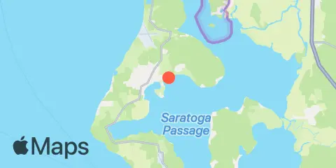
TidesPro
  • My Recent Sites
    • Crescent Harbor, N. Whidbey Island
  • States
    Alabama Alaska California Connecticut Delaware District of Columbia Florida Georgia Hawaii
    Louisiana Maine Maryland Massachusetts Mississippi New Hampshire New Jersey New York North Carolina
    Oregon Pennsylvania Rhode Island South Carolina Texas US Outlying Islands Virginia Washington Puerto Rico
  • Fishing  Coordinates
    Alabama - Alabama Inshore Public Reefs Alabama - Alabama Nearshore Public Reefs Alabama - Alabama Offshore Public Reefs Delaware - Delaware Artificial Reefs Florida - Bay County Florida - Brevard County Florida - Broward County Florida - Charlote and Lee Counties Florida - Citrus County Florida - Collier County Florida - Dixie County Florida - Duval County Florida - Escambia County Florida - Flagler County Florida - Florida Keys Florida - Franklin County
    Florida - Gulf County Florida - Hernando County Florida - Indian River County Florida - Levy County Florida - Manatee County Florida - Martin County Florida - Miami-Dade County Florida - Monroe County Florida - Nassau County Florida - Okaloosa County Florida - Palm Beach County Florida - Pasco County Florida - Santa Rosa County Florida - Sarasota County Florida - St. Johns County Florida - St. Lucie County
    Florida - Tampa Bay Florida - Taylor County Florida - Volusia County Florida - Wakulla County Florida - Walton County Georgia - Georgia Reefs Louisiana - Louisiana Artificial Reefs Maryland - Maryland Artificial Reefs Mississippi - Mississippi Inshore Artificial Reefs Mississippi - Mississippi Offshore Artificial Reefs North Carolina - Estuarine North Carolina - Long Bay North Carolina - Onslow Bay North Carolina - Outer Banks North Carolina - Raleigh Bay South Carolina - South Carolina Reefs Texas - Texas Artificial Reefs
  • Solunar Tables
  1. United States
  2. Washington
  3. Crescent Harbor, N. Whidbey Island

Crescent Harbor Map

Day Week Month Table Month Chart Map
Latitude
48° 17' 12" N (48.2867)
Longitude
122° 37' 1" W (-122.617)
State
Washington
County
Island County
Nearest ZIP
98277
Nearby Sites
5.0 mi Naval Air Station Whidbey Island 5.1 mi Sunset Beach, Whidbey Island, Strait of Juan de Fuca 5.5 mi Coupeville, Penn Cove, Whidbey Island 7.7 mi Ala Spit, Whidbey Island 7.8 mi Point Partridge, Whidbey Island, Strait of Juan de Fuca 8.0 mi Cornet Bay, Deception Pass 8.5 mi Sneeoosh Point 8.8 mi Yokeko Point, Deception Pass 9.0 mi Deception Pass St. Park, Bowman Bay, Fidalgo I. 9.1 mi La Conner, Swinomish Channel 9.2 mi Admiralty Head, Admiralty Inlet 10.3 mi Smith Island, Strait of Juan de Fuca 11.3 mi Turner Bay, Similk Bay

About Us

We created this site because we were looking for an easy to use tides & solunar site. We’re also avid fishermen, and wanted to make an accessible site that lists spots to fish, along with the best times to fish in those spots. We welcome any suggestions or feedback. Please Contact Us if you’d like to get in touch.

Learn More

Our Apps

Apple App Store
[More Info]
Quick Links
  • When to Fish
  • Solunar Theory
  • Tide & Solunar Widgets for Your Site
  • Tide & Solunar Predictions in Google Earth
  • About
  • Contact
  • Mastodon
  • Terms of Use
  • Privacy Policy

© Copyright 2017 - 2023 ASR Concepts LLC. All rights reserved.