Worlds Fair Marina Tides
Unfortunately, this tide station is no longer active, and predictions are no longer accurate.
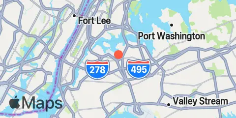
You can check out the map below -- any nearby locations will be displayed on the map and list below. Alternatively, you can browse the site for other active locations.
Location & Map
Latitude
40° 45' 40" N (40.761)
Longitude
73° 51' 1" W (-73.85036)
State
County
Nearest ZIP
11368
Nearby
Tides
1.6 mi
College Pt, Ft. of 110th Street, Long Island
3.0 mi
Hunts Point, East River
3.2 mi
Whitestone, East River
3.6 mi
North Brother Island, East River
4.1 mi
Port Morris (Stony Point), East River
4.1 mi
Hell Gate, Wards Island, East River
4.2 mi
Throgs Neck
4.2 mi
Willets Point, Little Bay, East River
4.9 mi
Harlem River, Randalls Island, East River
4.9 mi
Horns Hook, East 90th Street, East River, New York
5.6 mi
Kings Point, Long Island Sound
5.7 mi
Queensboro Bridge, East River
6.0 mi
Hunters Point, Newtown Creek, East River
6.3 mi
East 41st Street, New York City, East River
6.9 mi
City Island
7.1 mi
Williamsburg Bridge, East River
7.5 mi
Wallabout Bay, Brooklyn Navy Yard, East River
7.6 mi
Edgewater, Hudson River
8.1 mi
North Channel Bridge, Grassy Bay, Jamaica Bay
8.6 mi
Brooklyn Bridge, East River
8.6 mi
Ferry Slip, Dyckman Street, Hudson River
8.8 mi
Weehawken, Union City, Hudson River
9.0 mi
Spuyten Duyvil Creek Entrance, Hudson River
9.1 mi
Port Washington, Manhasset Bay, Long Island
9.2 mi
Canarsie, Jamaica Bay
9.5 mi
The Battery, New York Harbor
9.8 mi
New Rochelle
10.2 mi
J.F.K. International Airport, Jamaica Bay
10.3 mi
Norton Point, Head of Bay, Jamaica Bay
10.4 mi
Riverdale, Hudson River
10.8 mi
Gowanus Bay
11.1 mi
North Secaucus, Garretts Reach, Hackensack River
11.1 mi
Motts Basin, Jamaica Bay
11.2 mi
Mill Basin, Jamaica Bay
11.2 mi
Ridgefield Park, Hackensack River
11.4 mi
Carlstadt, Garretts Reach, Hackensack River
11.5 mi
Harry Tappen Marina, Hempstead Harbor, Long Island
12.0 mi
Beach Channel (Bridge), Jamaica Bay
Currents
2.3 mi
Rikers I. chan., off La Guardia Field
2.8 mi
College Point Reef, 0.25 n.mi. NW of
3.1 mi
Bronx-Whitestone Bridge, East of
3.2 mi
Hunts Point, southwest of
3.7 mi
South Brother Island, NW of
3.8 mi
Cryders Point, 0.4 mile NNW of
3.9 mi
Off Winthrop Ave., Astoria
4.0 mi
Throgs Neck, 0.4 mile south of
4.1 mi
Throgs Neck Bridge
4.2 mi
Throgs Neck, 0.2 mile S of (Willets Point)
4.8 mi
Hell Gate
4.8 mi
Throgs Neck, 0.3 n.mi. NE of
4.9 mi
Harlem River, south end
5.0 mi
Roosevelt Island, east of, off 36th Avenue
5.2 mi
Willis Ave. Bridge, 0.1 mile NW of
5.2 mi
Roosevelt Is., west of, off 75th Street
5.3 mi
Roosevelt Island, east of
5.4 mi
Roosevelt Is., west of, off 67th Street
5.5 mi
Roosevelt Is., west of, off 63rd Street
5.7 mi
Madison Ave. Bridge
6.0 mi
Eastchester Bay, near Big Tom
6.3 mi
Newtown Creek
6.4 mi
Manhattan, off 31st Street
6.4 mi
Macombs Dam Bridge
6.9 mi
Grants Tomb
7.0 mi
High Bridge
7.1 mi
Hart Island, 0.3 n.mi. SSE of
7.2 mi
Hutchinson R., Pelham Highway Bridge
7.3 mi
Hart Island, southeast of
7.3 mi
City Island Bridge
7.5 mi
Corlears Hook
7.8 mi
West 207th Street Bridge
7.9 mi
Manhasset Bay entrance
8.0 mi
Hudson River, Pier 92
8.0 mi
George Washington Bridge
8.4 mi
Broadway Bridge
8.6 mi
Brooklyn Bridge
8.8 mi
Henry Hudson Bridge, 0.7 nmi. SE of
9.1 mi
Spuyten Duyvil
9.4 mi
Canarsie (midchannel), Jamaica Bay
9.9 mi
Huckleberry Island, 0.6 mile SE of
9.9 mi
Hudson River Entrance
9.9 mi
Execution Rocks
10.0 mi
Dimond Reef
10.2 mi
Huckleberry Island, 0.2 mile NW of
10.2 mi
Riverdale
10.5 mi
Mount St. Vincent College, SW of
10.6 mi
Statue of Liberty, east of
11.0 mi
Red Hook Channel
11.0 mi
Grass Hassock Channel
11.1 mi
Gowanus Bay Entrance
11.5 mi
Hempstead Harbor, off Glenwood Landing
11.7 mi
Gowanus Flats LBB 32
12.4 mi
Beach Channel (bridge)