Fort Wadsworth Tides
Unfortunately, this tide station is no longer active, and predictions are no longer accurate.
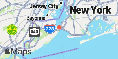
You can check out the map below -- any nearby locations will be displayed on the map and list below. Alternatively, you can browse the site for other active locations.
Location & Map
Latitude
40° 36' 24" N (40.6067)
Longitude
74° 3' 18" W (-74.055)
State
County
Nearest ZIP
10305
Nearby
Tides
0.4 mi
USCG Station, The Narrows
1.1 mi
Fort Hamilton, The Narrows
2.7 mi
St. George, Staten Island
3.2 mi
Norton Point, Gravesend Bay
3.7 mi
Constable Hook, Kill Van Kull
4.5 mi
Coney Island
4.6 mi
Gowanus Bay
5.3 mi
Bergen Point West Reach, Kill Van Kull
6.3 mi
Great Kills Harbor
6.4 mi
Port Elizabeth
6.6 mi
Kingsborough Community College, Sheepshead Bay, Long Island
6.8 mi
The Battery, New York Harbor
7.0 mi
Plumb Beach Channel, Jamaica Bay
7.0 mi
Mill Basin, Jamaica Bay
7.1 mi
Port Ivory, Howland Hook, Arthur Kill
7.1 mi
Port Newark Terminal
7.4 mi
Brooklyn Bridge, East River
7.6 mi
Chelsea, Arthur Kill
8.1 mi
Wallabout Bay, Brooklyn Navy Yard, East River
8.3 mi
Carteret, Arthur Kill
8.6 mi
Williamsburg Bridge, East River
8.8 mi
Kearny Point, Hackensack River
9.0 mi
Barren Island, Rockaway Inlet, Jamaica Bay
9.1 mi
Canarsie, Jamaica Bay
9.2 mi
Point No Point, Passaic River
9.3 mi
Rahway River, RR. Bridge, Arthur Kill
9.5 mi
Rossville, Arthur Kill
10.0 mi
Sandy Hook
10.1 mi
Princes Bay
10.3 mi
Amtrak RR. swing bridge, Hackensack River
10.4 mi
Hunters Point, Newtown Creek, East River
10.6 mi
Port Reading, Arthur Kill
10.7 mi
East 41st Street, New York City, East River
11.1 mi
Weehawken, Union City, Hudson River
11.6 mi
Queensboro Bridge, East River
11.8 mi
North Channel Bridge, Grassy Bay, Jamaica Bay
11.8 mi
Woodbridge Creek, 0.8 n.mi. above entrance, Arthur Kill
11.9 mi
Waackaack Creek
12.4 mi
Beach Channel (Bridge), Jamaica Bay
Currents
0.9 mi
The Narrows
1.3 mi
Bay Ridge, west of
1.7 mi
Hoffman Island, 0.2 mile west of
3.1 mi
Constable Hook Approach
3.4 mi
Robbins Reef Light, 0.6 nm E of
3.5 mi
Coney Island Channel, west end
4.0 mi
Norton Point, WSW of
4.3 mi
Gowanus Bay Entrance
4.3 mi
Bergen Point, East Reach
4.6 mi
Gowanus Flats LBB 32
4.6 mi
Coney Island Lt., 1.5 miles SSE of
4.8 mi
Red Hook Channel
5.1 mi
Kill Van Kull LB 14, east of Bayonne Bridge
5.1 mi
New Dorp Beach, 1.2 miles south of
5.2 mi
Bayonne Bridge
5.5 mi
South Reach, Newark Bay
5.6 mi
Bergen Point
5.9 mi
Statue of Liberty, east of
6.0 mi
Newark Bay Entrance LB 18
6.2 mi
Old Orchard Shoal Lt., 1.2 mi. ENE of
6.4 mi
Middle Reach, Newark Bay
6.5 mi
Dimond Reef
6.9 mi
Rockaway Inlet Entrance
7.1 mi
Rockaway Inlet Jetty, 1 nm SW of
7.1 mi
Hudson River Entrance
7.2 mi
Elizabethport
7.5 mi
Brooklyn Bridge
7.5 mi
Ambrose Channel
7.7 mi
Rockaway Point
7.9 mi
Gulfport, Arthur Kill
8.0 mi
Tremley Point
8.2 mi
Corlears Hook
8.8 mi
Raritan Bay Reach Channel
8.9 mi
Sandy Hook Channel, Front Range Light
8.9 mi
Sandy Hook Chan., 0.4 mi. W of N. Tip
9.1 mi
Chapel Hill Channel, South End
9.1 mi
Lincoln Highway Bridge, Hackensack River
9.2 mi
Canarsie (midchannel), Jamaica Bay
9.3 mi
Marine Parkway Bridge, Rockaway Inlet
9.3 mi
Lincoln Highway Bridge, Passaic River
9.5 mi
Tufts Point-Smoking Point
9.9 mi
Seguine Point
10.0 mi
Newtown Creek
10.2 mi
Manhattan, off 31st Street
11.7 mi
Hudson River, Pier 92
11.8 mi
Roosevelt Island, east of
11.8 mi
Roosevelt Is., west of, off 63rd Street
11.9 mi
Red Bank, 1.4 miles south of
12.0 mi
Roosevelt Is., west of, off 67th Street
12.1 mi
Ward Point, ESE
12.3 mi
Roosevelt Island, east of, off 36th Avenue
12.3 mi
Tottenville, Arthur Kill River
12.4 mi
Roosevelt Is., west of, off 75th Street