Brooklyn Bridge Weekly Tide Tables and Charts
Tide Chart for Next 7 Days
Brooklyn Bridge weekly tide chart key:
The tide chart above shows the times and heights of high tide and low tide for Brooklyn Bridge, for the next seven days. The red line highlights the current time and estimated height.The tidal range at Brooklyn Bridge for the next seven days is approximately 4.91 ft with a minimum tide of 0.3 ft and maximum tide of 5.21 ft. You can also check out all the daily details on tides & fishing times on the Day tab for Brooklyn Bridge.
Tide Table for Next 7 Days
▲ Blue = High Tide
▼ Red = Low Tide
| Day | 1st Tide | 2nd Tide | 3rd Tide | 4th Tide | ☀ Sun |
Major Solunars
|
Minor Solunars
|
|
|---|---|---|---|---|---|---|---|---|
| 29 Wed |
|
▼ 0.56 ft |
▲ 4.11 ft |
▼ 0.8 ft |
▲ 5.17 ft |
▲ 5:50 AM ▼ 8:14 PM |
11:46 PM → 1:46 AM 12:04 PM → 2:04 PM |
5:05 AM → 6:05 AM 8:03 PM → 9:03 PM |
| 30 Thu |
|
▼ 0.44 ft |
▲ 4.16 ft |
▼ 0.71 ft |
▲ 5.12 ft |
▲ 5:51 AM ▼ 8:13 PM |
12:32 AM → 2:32 AM 12:49 PM → 2:49 PM |
6:10 AM → 7:10 AM 8:28 PM → 9:28 PM |
| 31 Fri |
|
▼ 0.34 ft |
▲ 4.25 ft |
▼ 0.65 ft |
▲ 5.07 ft |
▲ 5:52 AM ▼ 8:12 PM |
1:17 AM → 3:17 AM 1:33 PM → 3:33 PM |
7:15 AM → 8:15 AM 8:51 PM → 9:51 PM |
| 1 Sat |
|
▼ 0.3 ft |
▲ 4.39 ft |
▼ 0.63 ft |
▲ 5 ft |
▲ 5:53 AM ▼ 8:11 PM |
2:00 AM → 4:00 AM 2:16 PM → 4:16 PM |
8:20 AM → 9:20 AM 9:12 PM → 10:12 PM |
| 2 Sun |
|
▼ 0.3 ft |
▲ 4.55 ft |
▼ 0.67 ft |
▲ 4.88 ft |
▲ 5:54 AM ▼ 8:10 PM |
2:43 AM → 4:43 AM 2:59 PM → 4:59 PM |
9:25 AM → 10:25 AM 9:33 PM → 10:33 PM |
| 3 Mon |
|
▼ 0.36 ft |
▲ 4.71 ft |
▼ 0.77 ft |
▲ 5:55 AM ▼ 8:09 PM |
3:27 AM → 5:27 AM 3:43 PM → 5:43 PM |
10:31 AM → 11:31 AM 9:56 PM → 10:56 PM |
|
| 4 Tue |
|
▲ 4.71 ft |
▼ 0.48 ft |
▲ 4.86 ft |
▼ 0.9 ft |
▲ 5:56 AM ▼ 8:08 PM |
4:12 AM → 6:12 AM 4:30 PM → 6:30 PM |
11:40 AM → 12:40 PM 10:21 PM → 11:21 PM |
Buoy Weather
Air Temperature
77° F
Water Temperature
74° F
Atmospheric Pressure
1003 hPa
Note: Observations are from a weather buoy 1.01 miles from the prediction site. Observations are not available at all prediction sites, and observation types vary between sites.
More details: Station batn6 Buoy Weather
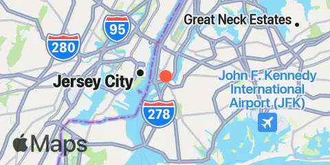
Location & Map
Latitude
40° 42' 12" N (40.7033)
Longitude
73° 59' 42" W (-73.995)
State
County
Nearest ZIP
11201
Nearby
Tides
1.0 mi
The Battery, New York Harbor
1.1 mi
Wallabout Bay, Brooklyn Navy Yard, East River
1.5 mi
Williamsburg Bridge, East River
2.8 mi
Gowanus Bay
3.1 mi
Hunters Point, Newtown Creek, East River
3.3 mi
East 41st Street, New York City, East River
4.3 mi
Queensboro Bridge, East River
4.4 mi
Weehawken, Union City, Hudson River
5.8 mi
Constable Hook, Kill Van Kull
5.8 mi
Horns Hook, East 90th Street, East River, New York
5.8 mi
St. George, Staten Island
5.9 mi
Kearny Point, Hackensack River
6.3 mi
Amtrak RR. swing bridge, Hackensack River
6.7 mi
Point No Point, Passaic River
6.9 mi
Fort Hamilton, The Narrows
6.9 mi
Hell Gate, Wards Island, East River
7.2 mi
USCG Station, The Narrows
7.3 mi
Port Newark Terminal
7.5 mi
Harlem River, Randalls Island, East River
7.6 mi
Mill Basin, Jamaica Bay
7.7 mi
Edgewater, Hudson River
7.7 mi
North Secaucus, Garretts Reach, Hackensack River
7.7 mi
Canarsie, Jamaica Bay
7.8 mi
Norton Point, Gravesend Bay
7.9 mi
Port Elizabeth
7.9 mi
Carlstadt, Garretts Reach, Hackensack River
8.0 mi
Fish Creek, Berrys Creek, Hackensack River
8.2 mi
Port Morris (Stony Point), East River
8.3 mi
North Brother Island, East River
9.0 mi
Plumb Beach Channel, Jamaica Bay
9.0 mi
Kingsborough Community College, Sheepshead Bay, Long Island
9.1 mi
Bergen Point West Reach, Kill Van Kull
9.1 mi
College Pt, Ft. of 110th Street, Long Island
9.2 mi
North Channel Bridge, Grassy Bay, Jamaica Bay
9.2 mi
Coney Island
9.2 mi
Hunts Point, East River
9.8 mi
Belleville, Passaic River
10.3 mi
Barren Island, Rockaway Inlet, Jamaica Bay
10.3 mi
Ridgefield Park, Hackensack River
10.5 mi
Port Ivory, Howland Hook, Arthur Kill
11.6 mi
Whitestone, East River
11.9 mi
Ferry Slip, Dyckman Street, Hudson River
11.9 mi
East Rutherford, Passaic River
12.1 mi
Beach Channel (Bridge), Jamaica Bay
12.4 mi
J.F.K. International Airport, Jamaica Bay
Currents
0.2 mi
Brooklyn Bridge
1.1 mi
Corlears Hook
1.4 mi
Dimond Reef
1.6 mi
Hudson River Entrance
2.1 mi
Statue of Liberty, east of
2.6 mi
Red Hook Channel
2.7 mi
Newtown Creek
2.9 mi
Manhattan, off 31st Street
3.1 mi
Gowanus Bay Entrance
3.2 mi
Gowanus Flats LBB 32
4.4 mi
Robbins Reef Light, 0.6 nm E of
4.4 mi
Roosevelt Island, east of
4.4 mi
Roosevelt Is., west of, off 63rd Street
4.6 mi
Roosevelt Is., west of, off 67th Street
4.7 mi
Hudson River, Pier 92
4.9 mi
Roosevelt Island, east of, off 36th Avenue
5.0 mi
Roosevelt Is., west of, off 75th Street
5.0 mi
Constable Hook Approach
5.9 mi
Lincoln Highway Bridge, Hackensack River
6.0 mi
Hell Gate
6.2 mi
Bay Ridge, west of
6.5 mi
Harlem River, south end
6.7 mi
Lincoln Highway Bridge, Passaic River
7.1 mi
The Narrows
7.1 mi
Off Winthrop Ave., Astoria
7.4 mi
Grants Tomb
7.6 mi
Middle Reach, Newark Bay
7.8 mi
Willis Ave. Bridge, 0.1 mile NW of
7.9 mi
Canarsie (midchannel), Jamaica Bay
8.1 mi
Rikers I. chan., off La Guardia Field
8.1 mi
Bergen Point, East Reach
8.1 mi
South Brother Island, NW of
8.1 mi
South Reach, Newark Bay
8.2 mi
Madison Ave. Bridge
8.6 mi
Kill Van Kull LB 14, east of Bayonne Bridge
8.9 mi
Bayonne Bridge
8.9 mi
Hunts Point, southwest of
9.1 mi
Hoffman Island, 0.2 mile west of
9.2 mi
Macombs Dam Bridge
9.2 mi
Bergen Point
9.2 mi
Coney Island Channel, west end
9.3 mi
Newark Bay Entrance LB 18
10.0 mi
College Point Reef, 0.25 n.mi. NW of
10.1 mi
High Bridge
10.2 mi
Rockaway Inlet Entrance
10.4 mi
Norton Point, WSW of
10.4 mi
George Washington Bridge
10.5 mi
Coney Island Lt., 1.5 miles SSE of
10.5 mi
Elizabethport
10.8 mi
Marine Parkway Bridge, Rockaway Inlet
11.1 mi
Bronx-Whitestone Bridge, East of
11.8 mi
West 207th Street Bridge
11.9 mi
Rockaway Point
11.9 mi
Rockaway Inlet Jetty, 1 nm SW of
12.1 mi
Gulfport, Arthur Kill
12.3 mi
Cryders Point, 0.4 mile NNW of
Note: Tide predictions are an estimate and NOT FOR NAVIGATION.
We also offer free widgets if you want to add tide or solunar tables to your own site.