Blessing Plantation Weekly Tide Tables and Charts
Tide Chart for Next 7 Days
Blessing Plantation weekly tide chart key:
The tide chart above shows the times and heights of high tide and low tide for Blessing Plantation, for the next seven days. The red line highlights the current time and estimated height.The tidal range at Blessing Plantation for the next seven days is approximately 3.13 ft with a minimum tide of 0.09 ft and maximum tide of 3.22 ft. You can also check out all the daily details on tides & fishing times on the Day tab for Blessing Plantation.
Tide Table for Next 7 Days
▲ Blue = High Tide
▼ Red = Low Tide
| Day | 1st Tide | 2nd Tide | 3rd Tide | 4th Tide | ☀ Sun |
Major Solunars
|
Minor Solunars
|
|
|---|---|---|---|---|---|---|---|---|
| 30 Thu |
|
▲ 3.22 ft |
▼ 0.56 ft |
▲ 2.66 ft |
▼ 0.41 ft |
▲ 6:32 AM ▼ 8:20 PM |
12:57 AM → 2:57 AM 1:14 PM → 3:14 PM |
6:50 AM → 7:50 AM 8:39 PM → 9:39 PM |
| 31 Fri |
|
▲ 3.19 ft |
▼ 0.45 ft |
▲ 2.71 ft |
▼ 0.45 ft |
▲ 6:32 AM ▼ 8:19 PM |
1:41 AM → 3:41 AM 1:58 PM → 3:58 PM |
7:50 AM → 8:50 AM 9:07 PM → 10:07 PM |
| 1 Sat |
|
▲ 3.15 ft |
▼ 0.33 ft |
▲ 2.79 ft |
▼ 0.54 ft |
▲ 6:33 AM ▼ 8:18 PM |
2:25 AM → 4:25 AM 2:41 PM → 4:41 PM |
8:49 AM → 9:49 AM 9:34 PM → 10:34 PM |
| 2 Sun |
|
▲ 3.08 ft |
▼ 0.23 ft |
▲ 2.87 ft |
▼ 0.69 ft |
▲ 6:34 AM ▼ 8:18 PM |
3:07 AM → 5:07 AM 3:24 PM → 5:24 PM |
9:49 AM → 10:49 AM 10:00 PM → 11:00 PM |
| 3 Mon |
|
▲ 3 ft |
▼ 0.15 ft |
▲ 2.97 ft |
▼ 0.88 ft |
▲ 6:34 AM ▼ 8:17 PM |
3:51 AM → 5:51 AM 4:09 PM → 6:09 PM |
10:50 AM → 11:50 AM 10:28 PM → 11:28 PM |
| 4 Tue |
|
▲ 2.9 ft |
▼ 0.1 ft |
▲ 3.06 ft |
▼ 1.07 ft |
▲ 6:35 AM ▼ 8:16 PM |
4:36 AM → 6:36 AM 4:56 PM → 6:56 PM |
11:53 AM → 12:53 PM 10:59 PM → 11:59 PM |
| 5 Wed |
|
▲ 2.8 ft |
▼ 0.09 ft |
▲ 3.15 ft |
▼ 1.21 ft |
▲ 6:36 AM ▼ 8:15 PM |
5:25 AM → 7:25 AM 5:47 PM → 7:47 PM |
12:59 PM → 1:59 PM |
Buoy Weather
Air Temperature
78° F
Water Temperature
86° F
Wind
12 knots N (10°)
Wind Gust
15 knots
Atmospheric Pressure
1013 hPa
Note: Observations are from a weather buoy 19.12 miles from the prediction site. Observations are not available at all prediction sites, and observation types vary between sites.
More details: Station chts1 Buoy Weather
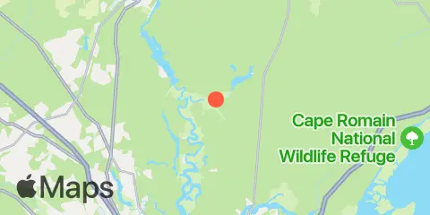
Location & Map
Latitude
33° 3' 18" N (33.055)
Longitude
79° 52' 48" W (-79.88)
State
County
Nearest ZIP
29450
Nearby
Tides
1.2 mi
Bonneau Ferry, East Branch, Cooper River
2.1 mi
Richmond Plantation, East Branch, Cooper River
3.1 mi
Old Rice Mill, West Branch, Cooper River
3.3 mi
Dupont, Dean Hall, Cooper River
4.1 mi
General Dynamics Pier, Cooper River
5.0 mi
Quinby Creek bridge, East Branch, Cooper River
5.1 mi
Pimlico, West Branch, Cooper River
5.3 mi
Back River Reservoir, West Branch, Cooper River
8.0 mi
Snow Point, 0.4 mi. North of, Cooper River
9.3 mi
Cainhoy, Wando River
10.7 mi
Clouter Creek, north entrance, Cooper River
10.8 mi
Nowell Creek, Wando River
10.9 mi
Army Depot, Cooper River
10.9 mi
Yeamans Hall, Goose Creek, Cooper River
11.9 mi
Parker Island, Horlbeck Creek, Wando River
12.2 mi
Hanahan, Turkey Creek, Goose Creek, Cooper River
12.4 mi
Big Paradise Island, Wando River
Currents
1.2 mi
Bonneau Ferry, east of
2.4 mi
Hagan Island, 1 n.mi. below
2.5 mi
East Branch, 0.2 mile above entrance
2.6 mi
The Tee
2.9 mi
The Tee, 0.4 mile southwest of
4.0 mi
Moreland, 0.5 n.mi. below
4.5 mi
Childsbury, S.A.L. RR. bridge
6.7 mi
Back River entrance
7.0 mi
off Amoco Pier
7.7 mi
Snow Point, 0.5 mile north of
9.2 mi
Woods Point
9.4 mi
Woods Point, SE of
9.8 mi
Anneville, marker 36
9.8 mi
Yellow House Landing, 1 mile NW of
10.6 mi
Yellow House Creek
11.1 mi
Ordnance Reach
11.9 mi
Horlbeck Creek, 0.2 mile above entrance
11.9 mi
Filbin Creek Reach, Buoy 58
12.2 mi
Nowell Creek entrance
Note: Tide predictions are an estimate and NOT FOR NAVIGATION.
We also offer free widgets if you want to add tide or solunar tables to your own site.