Roberts Landing Weekly Tide Tables and Charts
Tide Chart for Next 7 Days
Roberts Landing weekly tide chart key:
The tide chart above shows the times and heights of high tide and low tide for Roberts Landing, for the next seven days. The red line highlights the current time and estimated height.The tidal range at Roberts Landing for the next seven days is approximately 7.89 ft with a minimum tide of -0.24 ft and maximum tide of 7.65 ft. You can also check out all the daily details on tides & fishing times on the Day tab for Roberts Landing.
Tide Table for Next 7 Days
▲ Blue = High Tide
▼ Red = Low Tide
| Day | 1st Tide | 2nd Tide | 3rd Tide | 4th Tide | ☀ Sun |
Major Solunars
|
Minor Solunars
|
|
|---|---|---|---|---|---|---|---|---|
| 31 Fri |
|
▲ 7.32 ft |
▼ -0.24 ft |
▲ 6.42 ft |
▼ 2.63 ft |
▲ 6:12 AM ▼ 8:18 PM |
1:36 AM → 3:36 AM 1:52 PM → 3:52 PM |
7:41 AM → 8:41 AM 9:03 PM → 10:03 PM |
| 1 Sat |
|
▲ 7.04 ft |
▼ 0.02 ft |
▲ 6.61 ft |
▼ 2.37 ft |
▲ 6:13 AM ▼ 8:17 PM |
2:19 AM → 4:19 AM 2:35 PM → 4:35 PM |
8:43 AM → 9:43 AM 9:27 PM → 10:27 PM |
| 2 Sun |
|
▲ 6.67 ft |
▼ 0.42 ft |
▲ 6.83 ft |
▼ 2.07 ft |
▲ 6:14 AM ▼ 8:16 PM |
3:02 AM → 5:02 AM 3:18 PM → 5:18 PM |
9:46 AM → 10:46 AM 9:50 PM → 10:50 PM |
| 3 Mon |
|
▲ 6.22 ft |
▼ 0.97 ft |
▲ 7.05 ft |
▼ 1.74 ft |
▲ 6:14 AM ▼ 8:15 PM |
3:45 AM → 5:45 AM 4:03 PM → 6:03 PM |
10:50 AM → 11:50 AM 10:16 PM → 11:16 PM |
| 4 Tue |
|
▲ 5.72 ft |
▼ 1.62 ft |
▲ 7.26 ft |
▲ 6:15 AM ▼ 8:14 PM |
4:31 AM → 6:31 AM 4:50 PM → 6:50 PM |
11:57 AM → 12:57 PM 10:44 PM → 11:44 PM |
|
| 5 Wed |
|
▼ 1.38 ft |
▲ 5.3 ft |
▼ 2.3 ft |
▲ 7.46 ft |
▲ 6:16 AM ▼ 8:13 PM |
5:20 AM → 7:20 AM 5:42 PM → 7:42 PM |
1:06 PM → 2:06 PM 11:18 PM → 12:18 AM |
| 6 Thu |
|
▼ 0.96 ft |
▲ 5.13 ft |
▼ 2.91 ft |
▲ 7.65 ft |
▲ 6:17 AM ▼ 8:12 PM |
6:14 AM → 8:14 AM 6:39 PM → 8:39 PM |
2:19 PM → 3:19 PM |
Buoy Weather
Air Temperature
59° F
Water Temperature
70° F
Wind
10 knots SW (230°)
Wind Gust
12 knots
Atmospheric Pressure
1014 hPa
Note: Observations are from a weather buoy 9.11 miles from the prediction site. Observations are not available at all prediction sites, and observation types vary between sites.
More details: Station aamc1 Buoy Weather
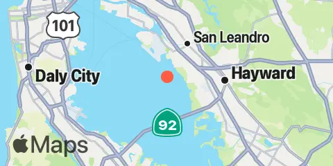
Location & Map
Latitude
37° 40' 0" N (37.66667)
Longitude
122° 12' 0" W (-122.2)
State
County
Nearest ZIP
94579
Nearby
Tides
2.0 mi
San Leandro Marina, San Francisco Bay
4.2 mi
San Mateo Bridge (east end), San Francisco Bay
4.5 mi
Oakland Airport, San Francisco Bay
5.8 mi
Alameda Creek, San Francisco Bay
6.0 mi
San Leandro Channel, San Leandro Bay, San Francisco Bay
6.7 mi
San Mateo Bridge (west end), San Francisco Bay
7.5 mi
Oakland Harbor, Park Street Bridge, San Francisco Bay
8.1 mi
Coyote Point Marina, San Francisco Bay
8.2 mi
Coyote Hills Slough entrance, San Francisco Bay
8.2 mi
South Bay Wreck, San Francisco Bay
8.3 mi
Bay Slough, west end, San Francisco Bay
8.5 mi
Bay Slough, east end, San Francisco Bay
9.1 mi
Alameda, San Francisco Bay
9.2 mi
Redwood Creek Marker 8, San Francisco Bay
9.6 mi
Hunters Point, San Francisco Bay
9.7 mi
Oyster Point Marina, San Francisco Bay
9.8 mi
Point San Bruno, San Francisco Bay
9.9 mi
Oakland Inner Harbor, San Francisco Bay
10.0 mi
Oakland Berth 67, San Francisco Bay
10.2 mi
Seaplane Harbor, San Francisco Bay
10.4 mi
South San Francisco, San Francisco Bay
10.8 mi
Alameda Naval Air Station fuel pier, San Francisco Bay
11.0 mi
Corkscrew Slough, San Francisco Bay
11.1 mi
Redwood City, Wharf 5, San Francisco Bay
11.2 mi
West Point Slough, San Francisco Bay
11.4 mi
Oakland Pier, San Francisco Bay
11.5 mi
Smith Slough, San Francisco Bay
11.8 mi
Potrero Point, San Francisco Bay
11.9 mi
Granite Rock, Redwood Creek, San Francisco Bay
12.0 mi
Dumbarton Highway Bridge, San Francisco Bay
12.1 mi
Oakland, Matson Wharf, San Francisco Bay
12.2 mi
Oakland Middle Harbor, San Francisco Bay
Currents
2.0 mi
Oakland Airport, southwest of
3.4 mi
Little Coyote Pt., 3.4 nmi. NNE of
3.6 mi
Mulford Gardens Channel Approach
4.8 mi
Little Coyote Pt., 3.1 nmi. ENE of
5.2 mi
Sierra Point, 4.4 miles east of
5.9 mi
Little Coyote Pt., 1.2 nmi. NE of
6.0 mi
Coyote Point, 2.3 nmi. NNE of
6.1 mi
San Mateo Bridge
6.5 mi
Sierra Point, 1.2 nmi. east of
6.7 mi
Alameda Estuary, southeast end
6.8 mi
Oyster Point, 2.8 miles east of
7.1 mi
Alameda Radar Tower, 0.9 nmi. SSW of
7.5 mi
Redwood Pt., Blair I., 1.15 nmi. NNE of
7.7 mi
Point Avisadero, 2 miles east of
7.8 mi
Point Avisadero, 0.6 nmi. ESE of
7.8 mi
Hunters Point, 1.6nm SE of
8.7 mi
Point Avisadero, 1.25 nmi. SSE of
8.7 mi
Sierra Point, 1.3 miles ENE of
8.7 mi
Point Avisadero, 1 mile east of
8.8 mi
Brooklyn Basin
9.0 mi
Point San Bruno, 0.51 nmi. east of
9.2 mi
Point Avisadero, 0.3 mile east of
9.3 mi
Potrero Point, 2 miles east of
9.6 mi
Oakland Harbor, Webster Street
9.7 mi
Redwood Point, 1.7nm East of
9.7 mi
Redwood Creek
9.9 mi
Oakland Inner Harbor Reach
10.7 mi
Potrero Point, 1.08 nmi. east of
10.7 mi
Mission Rock, 2.0 miles east of
11.0 mi
Oakland Inner Harbor Channel
11.2 mi
Mission Rock, 1.3 mile east of
11.7 mi
Rincon Point, midbay
11.8 mi
Mission Rock, 0.6 mile east of
11.8 mi
Oakland 7th St. Marine, 0.6 nmi. SSW of
12.1 mi
Oakland Inner Harbor entrance
12.3 mi
Dumbarton Highway Bridge
12.3 mi
Oakland Inner Harbor LB4
12.3 mi
Dumbarton Hwy. Bridge, 0.28 nmi. SE of
Note: Tide predictions are an estimate and NOT FOR NAVIGATION.
We also offer free widgets if you want to add tide or solunar tables to your own site.