Glen Cove Yacht Club Weekly Tide Tables and Charts
Tide Chart for Next 7 Days
Glen Cove Yacht Club weekly tide chart key:
The tide chart above shows the times and heights of high tide and low tide for Glen Cove Yacht Club, for the next seven days. The red line highlights the current time and estimated height.The tidal range at Glen Cove Yacht Club for the next seven days is approximately 8.3 ft with a minimum tide of 0.07 ft and maximum tide of 8.37 ft. You can also check out all the daily details on tides & fishing times on the Day tab for Glen Cove Yacht Club.
Tide Table for Next 7 Days
▲ Blue = High Tide
▼ Red = Low Tide
| Day | 1st Tide | 2nd Tide | 3rd Tide | 4th Tide | ☀ Sun |
Major Solunars
|
Minor Solunars
|
|
|---|---|---|---|---|---|---|---|---|
| 29 Wed |
|
▼ 0.28 ft |
▲ 7.07 ft |
▼ 0.92 ft |
▲ 5:48 AM ▼ 8:13 PM |
11:44 PM → 1:44 AM 12:02 PM → 2:02 PM |
5:03 AM → 6:03 AM 8:02 PM → 9:02 PM |
|
| 30 Thu |
|
▲ 7.7 ft |
▼ 0.23 ft |
▲ 7.32 ft |
▼ 0.74 ft |
▲ 5:49 AM ▼ 8:12 PM |
12:31 AM → 2:31 AM 12:47 PM → 2:47 PM |
6:08 AM → 7:08 AM 8:27 PM → 9:27 PM |
| 31 Fri |
|
▲ 7.79 ft |
▼ 0.16 ft |
▲ 7.62 ft |
▼ 0.53 ft |
▲ 5:50 AM ▼ 8:11 PM |
1:16 AM → 3:16 AM 1:31 PM → 3:31 PM |
7:13 AM → 8:13 AM 8:49 PM → 9:49 PM |
| 1 Sat |
|
▲ 7.85 ft |
▼ 0.1 ft |
▲ 7.92 ft |
▼ 0.34 ft |
▲ 5:51 AM ▼ 8:10 PM |
1:59 AM → 3:59 AM 2:14 PM → 4:14 PM |
8:18 AM → 9:18 AM 9:11 PM → 10:11 PM |
| 2 Sun |
|
▲ 7.85 ft |
▼ 0.07 ft |
▲ 8.17 ft |
▼ 0.22 ft |
▲ 5:52 AM ▼ 8:09 PM |
2:42 AM → 4:42 AM 2:57 PM → 4:57 PM |
9:23 AM → 10:23 AM 9:32 PM → 10:32 PM |
| 3 Mon |
|
▲ 7.76 ft |
▼ 0.13 ft |
▲ 8.33 ft |
▼ 0.19 ft |
▲ 5:53 AM ▼ 8:08 PM |
3:25 AM → 5:25 AM 3:42 PM → 5:42 PM |
10:30 AM → 11:30 AM 9:54 PM → 10:54 PM |
| 4 Tue |
|
▲ 7.58 ft |
▼ 0.27 ft |
▲ 8.37 ft |
▼ 0.25 ft |
▲ 5:54 AM ▼ 8:07 PM |
4:11 AM → 6:11 AM 4:29 PM → 6:29 PM |
11:39 AM → 12:39 PM 10:19 PM → 11:19 PM |
Buoy Weather
Air Temperature
74° F
Wind
3 knots NNE (30°)
Wind Gust
4 knots
Atmospheric Pressure
1003 hPa
Note: Observations are from a weather buoy 6.8 miles from the prediction site. Observations are not available at all prediction sites, and observation types vary between sites.
More details: Station kptn6 Buoy Weather
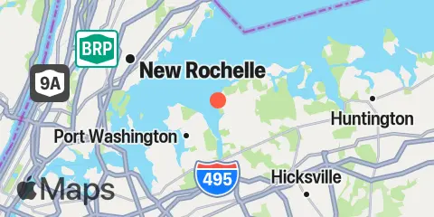
Location & Map
Latitude
40° 51' 48" N (40.8633)
Longitude
73° 39' 18" W (-73.655)
State
County
Nearest ZIP
11542
Nearby
Tides
2.0 mi
Harry Tappen Marina, Hempstead Harbor, Long Island
3.3 mi
Port Washington, Manhasset Bay, Long Island
6.1 mi
Bayville Bridge, Oyster Bay
6.8 mi
Kings Point, Long Island Sound
6.9 mi
Rye Beach (Amusement Park)
6.9 mi
City Island
6.9 mi
New Rochelle
7.2 mi
Oyster Bay Harbor, Oyster Bay
8.2 mi
Willets Point, Little Bay, East River
8.4 mi
Throgs Neck
9.4 mi
Whitestone, East River
9.7 mi
Cold Spring Harbor, Oyster Bay
11.0 mi
Cos Cob Harbor
11.9 mi
College Pt, Ft. of 110th Street, Long Island
12.1 mi
Huntington Harbor Lighthouse, Huntington Bay, Long Island
12.2 mi
Hunts Point, East River
Currents
2.5 mi
Hempstead Harbor, off Glenwood Landing
3.5 mi
Matinecock Point, 0.7 mile NNW of
4.2 mi
Execution Rocks
4.2 mi
Matinecock Point, 1.7 miles northwest of
4.6 mi
Manhasset Bay entrance
4.7 mi
Delancey Point, 1 mile southeast of
4.9 mi
Huckleberry Island, 0.6 mile SE of
5.1 mi
Parsonage Point, 1.3 n.mi. ESE of
5.3 mi
Peningo Neck, 0.6 mi. off Parsonage Pt
5.7 mi
Huckleberry Island, 0.2 mile NW of
5.8 mi
Hart Island, southeast of
6.0 mi
Hart Island, 0.3 n.mi. SSE of
6.3 mi
Oak Neck Point, 0.6 mile north of
6.5 mi
Harbor, west of Soper Point
7.2 mi
City Island Bridge
7.6 mi
Eastchester Bay, near Big Tom
7.7 mi
Harbor ent., south of Plum Point
7.7 mi
Throgs Neck, 0.3 n.mi. NE of
8.3 mi
Greenwich Point, 2.5 miles south of
8.3 mi
Throgs Neck, 0.2 mile S of (Willets Point)
8.4 mi
Throgs Neck Bridge
8.4 mi
Throgs Neck, 0.4 mile south of
8.5 mi
Hutchinson R., Pelham Highway Bridge
8.7 mi
Cryders Point, 0.4 mile NNW of
9.0 mi
Rocky Point, 1 mile east of
9.5 mi
Greenwich Point, 1.1 miles south of
9.6 mi
Captain Hbr. Ent., 0.6 mile southwest of
9.9 mi
Bronx-Whitestone Bridge, East of
11.0 mi
Lloyd Point, 1.3 miles NNW of
11.0 mi
Cos Cob Harbor, off Goose Island
11.3 mi
College Point Reef, 0.25 n.mi. NW of
11.9 mi
Shippan Point, 1.3 miles SSE of
12.0 mi
The Cows, 2 miles SE of
12.2 mi
Stamford Harbor entrance
Note: Tide predictions are an estimate and NOT FOR NAVIGATION.
We also offer free widgets if you want to add tide or solunar tables to your own site.