Dennis Creek Weekly Tide Tables and Charts
Tide Chart for Next 7 Days
Dennis Creek weekly tide chart key:
The tide chart above shows the times and heights of high tide and low tide for Dennis Creek, for the next seven days. The red line highlights the current time and estimated height.The tidal range at Dennis Creek for the next seven days is approximately 5.5 ft with a minimum tide of 0.32 ft and maximum tide of 5.82 ft. You can also check out all the daily details on tides & fishing times on the Day tab for Dennis Creek.
Tide Table for Next 7 Days
▲ Blue = High Tide
▼ Red = Low Tide
| Day | 1st Tide | 2nd Tide | 3rd Tide | 4th Tide | ☀ Sun |
Major Solunars
|
Minor Solunars
|
|
|---|---|---|---|---|---|---|---|---|
| 30 Thu |
|
▼ 0.51 ft |
▲ 4.52 ft |
▼ 0.48 ft |
▲ 5:58 AM ▼ 8:13 PM |
12:36 AM → 2:36 AM 12:53 PM → 2:53 PM |
6:17 AM → 7:17 AM 8:29 PM → 9:29 PM |
|
| 31 Fri |
|
▲ 5.81 ft |
▼ 0.42 ft |
▲ 4.69 ft |
▼ 0.46 ft |
▲ 5:59 AM ▼ 8:12 PM |
1:20 AM → 3:20 AM 1:36 PM → 3:36 PM |
7:21 AM → 8:21 AM 8:52 PM → 9:52 PM |
| 1 Sat |
|
▲ 5.72 ft |
▼ 0.37 ft |
▲ 4.86 ft |
▼ 0.5 ft |
▲ 6:00 AM ▼ 8:11 PM |
2:04 AM → 4:04 AM 2:19 PM → 4:19 PM |
8:24 AM → 9:24 AM 9:15 PM → 10:15 PM |
| 2 Sun |
|
▲ 5.56 ft |
▼ 0.33 ft |
▲ 5.04 ft |
▼ 0.58 ft |
▲ 6:01 AM ▼ 8:10 PM |
2:47 AM → 4:47 AM 3:02 PM → 5:02 PM |
9:28 AM → 10:28 AM 9:37 PM → 10:37 PM |
| 3 Mon |
|
▲ 5.35 ft |
▼ 0.32 ft |
▲ 5.22 ft |
▼ 0.68 ft |
▲ 6:01 AM ▼ 8:09 PM |
3:30 AM → 5:30 AM 3:47 PM → 5:47 PM |
10:33 AM → 11:33 AM 10:01 PM → 11:01 PM |
| 4 Tue |
|
▲ 5.09 ft |
▼ 0.33 ft |
▲ 5.38 ft |
▼ 0.78 ft |
▲ 6:02 AM ▼ 8:08 PM |
4:15 AM → 6:15 AM 4:34 PM → 6:34 PM |
11:41 AM → 12:41 PM 10:28 PM → 11:28 PM |
| 5 Wed |
|
▲ 4.8 ft |
▼ 0.36 ft |
▲ 5.51 ft |
▼ 0.88 ft |
▲ 6:03 AM ▼ 8:07 PM |
5:04 AM → 7:04 AM 5:25 PM → 7:25 PM |
12:51 PM → 1:51 PM 10:59 PM → 11:59 PM |
Buoy Weather
Air Temperature
75° F
Water Temperature
76° F
Wind
5 knots WNW (300°)
Wind Gust
14 knots
Atmospheric Pressure
1007 hPa
Note: Observations are from a weather buoy 16.64 miles from the prediction site. Observations are not available at all prediction sites, and observation types vary between sites.
More details: Station cman4 Buoy Weather
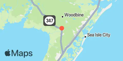
Location & Map
Latitude
39° 10' 60" N (39.1833)
Longitude
74° 49' 18" W (-74.8217)
State
County
Nearest ZIP
08204
Nearby
Tides
1.6 mi
Sluice Creek, Route 47 bridge, Dennis Creek, Delaware Bay
1.6 mi
Dennis Creek, 2.5 n.mi. above entrance, Delaware Bay
4.6 mi
Townsend Sound, Townsends Inlet
4.6 mi
East Creek, Route 47 bridge, Delaware Bay
5.0 mi
West Creek, 0.7 n.mi. above entrance, Delaware Bay
5.1 mi
Bidwell Creek, Route 47 bridge, Delaware Bay
5.3 mi
Bidwell Creek entrance, Delaware Bay
5.7 mi
Stites Sound, Townsends Inlet
6.0 mi
West Creek, Route 47 bridge, Delaware Bay
6.0 mi
Ludlam Bay, west side, Corson Inlet
6.7 mi
Long Reach, Ingram Thorofare, Townsends Inlet
6.8 mi
Ingram Thorofare, Townsends Inlet
7.1 mi
Ocean Drive bridge, Townsends Inlet
7.1 mi
Cedar Swamp Creek, Tuckahoe River, Great Egg Harbor Bay
7.7 mi
Dias Creek, Route 47 bridge, Delaware Bay
8.0 mi
Riggins Ditch, 0.5 n.mi. above entrance, Delaware Bay
8.7 mi
Tuckahoe, Tuckahoe River, Great Egg Harbor Bay
8.8 mi
Riggins Ditch, Heislerville, Delaware Bay
8.9 mi
Strathmere, Strathmere Bay, Corson Inlet
9.3 mi
Stone Harbor, Great Channel, Hereford Inlet
9.5 mi
Middle Thorofare, Ocean Drive bridge, Corson Inlet
10.7 mi
East Point, Maurice River Cove, Delaware Bay
10.8 mi
Nummy Island, Grassy Sound Channel, Hereford Inlet
11.5 mi
Old Turtle Thorofare, RR. bridge, Hereford Inlet
11.5 mi
Mauricetown, Maurice River
11.8 mi
Bivalve, Maurice River, Delaware Bay
12.3 mi
West Wildwood, Grassy Sound, Hereford Inlet
Currents
9.3 mi
Corson's Inlet Entrance
11.2 mi
Bay Shore Channel (north)
11.6 mi
Mauricetown Bridge, Maurice River
12.2 mi
Maurice River entrance
Note: Tide predictions are an estimate and NOT FOR NAVIGATION.
We also offer free widgets if you want to add tide or solunar tables to your own site.