Port Wentworth Weekly Tide Tables and Charts
Tide Chart for Next 7 Days
Port Wentworth weekly tide chart key:
The tide chart above shows the times and heights of high tide and low tide for Port Wentworth, for the next seven days. The red line highlights the current time and estimated height.The tidal range at Port Wentworth for the next seven days is approximately 8.84 ft with a minimum tide of 0.12 ft and maximum tide of 8.96 ft. You can also check out all the daily details on tides & fishing times on the Day tab for Port Wentworth.
Tide Table for Next 7 Days
▲ Blue = High Tide
▼ Red = Low Tide
| Day | 1st Tide | 2nd Tide | 3rd Tide | 4th Tide | ☀ Sun |
Major Solunars
|
Minor Solunars
|
|
|---|---|---|---|---|---|---|---|---|
| 30 Thu |
|
▼ 0.47 ft |
▲ 7.75 ft |
▼ 0.33 ft |
▲ 8.91 ft |
▲ 6:38 AM ▼ 8:23 PM |
1:02 AM → 3:02 AM 1:20 PM → 3:20 PM |
6:57 AM → 7:57 AM 8:43 PM → 9:43 PM |
| 31 Fri |
|
▼ 0.27 ft |
▲ 8.08 ft |
▼ 0.3 ft |
▲ 8.94 ft |
▲ 6:39 AM ▼ 8:22 PM |
1:46 AM → 3:46 AM 2:04 PM → 4:04 PM |
7:56 AM → 8:56 AM 9:12 PM → 10:12 PM |
| 1 Sat |
|
▼ 0.16 ft |
▲ 8.4 ft |
▼ 0.35 ft |
▲ 8.89 ft |
▲ 6:40 AM ▼ 8:22 PM |
2:30 AM → 4:30 AM 2:47 PM → 4:47 PM |
8:55 AM → 9:55 AM 9:39 PM → 10:39 PM |
| 2 Sun |
|
▼ 0.12 ft |
▲ 8.68 ft |
▼ 0.47 ft |
▲ 6:40 AM ▼ 8:21 PM |
3:13 AM → 5:13 AM 3:30 PM → 5:30 PM |
9:54 AM → 10:54 AM 10:06 PM → 11:06 PM |
|
| 3 Mon |
|
▲ 8.74 ft |
▼ 0.16 ft |
▲ 8.87 ft |
▼ 0.65 ft |
▲ 6:41 AM ▼ 8:20 PM |
3:56 AM → 5:56 AM 4:14 PM → 6:14 PM |
10:55 AM → 11:55 AM 10:34 PM → 11:34 PM |
| 4 Tue |
|
▲ 8.49 ft |
▼ 0.24 ft |
▲ 8.96 ft |
▼ 0.85 ft |
▲ 6:42 AM ▼ 8:19 PM |
4:42 AM → 6:42 AM 5:01 PM → 7:01 PM |
11:57 AM → 12:57 PM 11:06 PM → 12:06 AM |
| 5 Wed |
|
▲ 8.15 ft |
▼ 0.33 ft |
▲ 8.94 ft |
▼ 1.02 ft |
▲ 6:42 AM ▼ 8:18 PM |
5:30 AM → 7:30 AM 5:53 PM → 7:53 PM |
1:03 PM → 2:03 PM |
Buoy Weather
Air Temperature
83° F
Water Temperature
87° F
Wind
11 knots NE (50°)
Wind Gust
16 knots
Atmospheric Pressure
1013 hPa
Note: Observations are from a weather buoy 15.86 miles from the prediction site. Observations are not available at all prediction sites, and observation types vary between sites.
More details: Station fpkg1 Buoy Weather
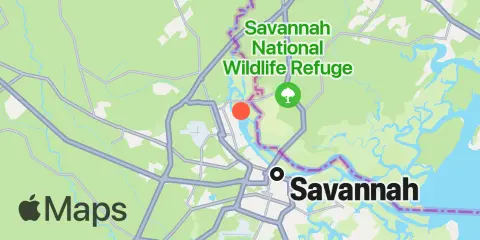
Location & Map
Latitude
32° 8' 36" N (32.1433)
Longitude
81° 8' 30" W (-81.1417)
State
County
Nearest ZIP
31407
Nearby
Tides
1.6 mi
Little Back River, Hwy. 17, Back River, Savannah River
5.2 mi
Savannah (Bull Street)
6.1 mi
S.C.L. RR. bridge, Savannah River
7.5 mi
Fort Jackson, Savannah River
7.7 mi
Turnbridge Landing, Salt Water Creek
9.0 mi
Cook Landing Cemetery, New River
9.3 mi
Thunderbolt, Wilmington River
9.8 mi
North entrance, Wilmington River
10.0 mi
Rt. 170 bridge, New River
10.5 mi
Good Hope Landing, south of, New River
11.1 mi
Purrysburg Landing, Savannah River
12.3 mi
Isle of Hope, Skidaway River
12.3 mi
Doughboy Island, New River
Currents
0.3 mi
Port Wentworth, 0.2 mile above
1.2 mi
Kings Island Channel, Savannah River
1.4 mi
King Island, west of
3.1 mi
Seaboard Coast Line Railroad
4.7 mi
Savannah, southeast of highway bridge
5.4 mi
Savannah
6.7 mi
Fig Island, north of, Back River
7.9 mi
Elba Island, west of, Savannah River
8.3 mi
South Channel, western end
9.1 mi
Oatland Island, north tip
9.4 mi
Wilmington R. ent., south channel
9.4 mi
Elba Island, NE of, Savannah River
10.0 mi
Thunderbolt, SE of, Wilmington River
10.6 mi
McQueen Island Cut
10.8 mi
Fort Pulaski, 4.8 miles above
11.4 mi
Elba Island Cut, NE of, Savannah River
11.9 mi
Skidaway River, north entrance
12.1 mi
Skidaway Island, N End, Wilmington River
12.4 mi
Isle of Hope City, Skidaway River
Note: Tide predictions are an estimate and NOT FOR NAVIGATION.
We also offer free widgets if you want to add tide or solunar tables to your own site.