Coffee Bluff Weekly Tide Tables and Charts
Tide Chart for Next 7 Days
Coffee Bluff weekly tide chart key:
The tide chart above shows the times and heights of high tide and low tide for Coffee Bluff, for the next seven days. The red line highlights the current time and estimated height.The tidal range at Coffee Bluff for the next seven days is approximately 7.95 ft with a minimum tide of 0.13 ft and maximum tide of 8.08 ft. You can also check out all the daily details on tides & fishing times on the Day tab for Coffee Bluff.
Tide Table for Next 7 Days
▲ Blue = High Tide
▼ Red = Low Tide
| Day | 1st Tide | 2nd Tide | 3rd Tide | 4th Tide | ☀ Sun |
Major Solunars
|
Minor Solunars
|
|
|---|---|---|---|---|---|---|---|---|
| 30 Thu |
|
▼ 0.47 ft |
▲ 7.02 ft |
▼ 0.42 ft |
▲ 8.03 ft |
▲ 6:39 AM ▼ 8:23 PM |
1:02 AM → 3:02 AM 1:20 PM → 3:20 PM |
6:58 AM → 7:58 AM 8:43 PM → 9:43 PM |
| 31 Fri |
|
▼ 0.34 ft |
▲ 7.13 ft |
▼ 0.44 ft |
▲ 7.93 ft |
▲ 6:39 AM ▼ 8:22 PM |
1:46 AM → 3:46 AM 2:04 PM → 4:04 PM |
7:57 AM → 8:57 AM 9:11 PM → 10:11 PM |
| 1 Sat |
|
▼ 0.24 ft |
▲ 7.26 ft |
▼ 0.51 ft |
▲ 7.78 ft |
▲ 6:40 AM ▼ 8:21 PM |
2:30 AM → 4:30 AM 2:47 PM → 4:47 PM |
8:55 AM → 9:55 AM 9:39 PM → 10:39 PM |
| 2 Sun |
|
▼ 0.16 ft |
▲ 7.42 ft |
▼ 0.64 ft |
▲ 6:41 AM ▼ 8:21 PM |
3:13 AM → 5:13 AM 3:30 PM → 5:30 PM |
9:54 AM → 10:54 AM 10:06 PM → 11:06 PM |
|
| 3 Mon |
|
▲ 7.59 ft |
▼ 0.13 ft |
▲ 7.6 ft |
▼ 0.82 ft |
▲ 6:41 AM ▼ 8:20 PM |
3:56 AM → 5:56 AM 4:14 PM → 6:14 PM |
10:54 AM → 11:54 AM 10:35 PM → 11:35 PM |
| 4 Tue |
|
▲ 7.37 ft |
▼ 0.14 ft |
▲ 7.79 ft |
▼ 1.02 ft |
▲ 6:42 AM ▼ 8:19 PM |
4:42 AM → 6:42 AM 5:01 PM → 7:01 PM |
11:57 AM → 12:57 PM 11:06 PM → 12:06 AM |
| 5 Wed |
|
▲ 7.17 ft |
▼ 0.18 ft |
▲ 7.99 ft |
▼ 1.18 ft |
▲ 6:43 AM ▼ 8:18 PM |
5:30 AM → 7:30 AM 5:52 PM → 7:52 PM |
1:02 PM → 2:02 PM |
Buoy Weather
Air Temperature
83° F
Water Temperature
87° F
Wind
11 knots NE (50°)
Wind Gust
16 knots
Atmospheric Pressure
1013 hPa
Note: Observations are from a weather buoy 16.1 miles from the prediction site. Observations are not available at all prediction sites, and observation types vary between sites.
More details: Station fpkg1 Buoy Weather
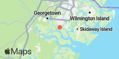
Location & Map
Latitude
31° 55' 60" N (31.93333)
Longitude
81° 9' 0" W (-81.15)
State
County
Nearest ZIP
31419
Nearby
Tides
3.1 mi
Vernon View, Burnside River
5.2 mi
Fort McAllister, Ogeechee River
5.5 mi
Florida Passage, Ogeechee River
6.0 mi
Little Wassaw Island, Green Island Sound
6.8 mi
Isle of Hope, Skidaway River
7.9 mi
Egg Islands
8.1 mi
Cane Patch Creek entrance
8.1 mi
Florida Passage, Bear River
8.2 mi
Richmond Hill, Ogeechee River
8.4 mi
Priest Landing, Wilmington River
8.4 mi
Skidaway Institute, Skidaway River
8.6 mi
Highway bridge, Ogeechee River
8.8 mi
Romerly Marsh Creek
9.1 mi
Thunderbolt, Wilmington River
9.7 mi
Bradley Point, Bradley River
9.9 mi
Bear River, (Range 'A' Light)
9.9 mi
Savannah Sheraton Resort Hotel, Wilmington River
10.5 mi
Kilkenny Club, Kilkenny Creek
10.8 mi
Savannah (Bull Street)
11.6 mi
Belfast, Belfast River
12.2 mi
Fort Jackson, Savannah River
12.3 mi
Halfmoon Reef, Halfmoon River
Currents
1.3 mi
Montgomery, Vernon River
3.9 mi
Vernon R., 1.2 miles S of Possum Point
4.1 mi
Little Ogeechee River Entrance, north of
4.2 mi
Burnside Island, SE of, Burnside River
4.3 mi
Pigeon Island, SSE of, Skidaway River
4.3 mi
Little Ogeechee River Entrance
4.6 mi
Long Island, south of, Skidaway River
5.2 mi
Skidaway Narrows
5.3 mi
Florida Passage, N of, Ogeechee River
5.5 mi
Long Island, NNE of, Skidaway River
6.2 mi
Burntpot Island, west of, Skidaway River
6.3 mi
Little Don Island, east of, Vernon River
6.4 mi
Isle of Hope City, Skidaway River
6.8 mi
Isle of Hope City, SE of, Skidaway River
7.2 mi
Florida Passage (south)
7.3 mi
Little Wassaw Island, SW of
7.5 mi
Raccoon Key
7.9 mi
Raccoon Key & Egg Island Shoal, between
8.6 mi
Dutch Island, SE of, Skidaway River
8.6 mi
610 Statute Mile Mark
8.8 mi
Thunderbolt, SE of, Wilmington River
9.4 mi
Skidaway River, north entrance
9.6 mi
Bradley Point, NNE of
9.7 mi
Joe's Cut, Wilmington River
9.9 mi
Skidaway Island, N End, Wilmington River
9.9 mi
Wassaw Island, SSW of
9.9 mi
Odingsell River Entrance
9.9 mi
Wilmington R., 0.5 mi. S of Turners Creek
10.2 mi
Wilmington River ent. off Cabbage Island
10.4 mi
North of Big Tom Creek Entrance
11.1 mi
Savannah, southeast of highway bridge
11.1 mi
Savannah
11.9 mi
Seaboard Coast Line Railroad
12.0 mi
Entrance, off Wassaw Island
12.0 mi
Fig Island, north of, Back River
12.2 mi
South of Kilkenny Creek Entrance
Note: Tide predictions are an estimate and NOT FOR NAVIGATION.
We also offer free widgets if you want to add tide or solunar tables to your own site.