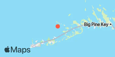
Waltz Key Map
Latitude
24° 38' 48" N (24.6467)
Longitude
81° 39' 12" W (-81.6533)
State
County
Nearest ZIP
33040
Nearby
Tides
2.0 mi
Snipe Keys, Middle Narrows
2.1 mi
O'Hara Key, North End, Waltz Key Basin
2.6 mi
Duck Key Point, Duck Key, Waltz Key Basin
2.9 mi
Snipe Keys, Southeast End, Inner Narrows
3.0 mi
Shark Key, southeast end, Similar Sound
3.1 mi
Saddlebunch Keys, Channel No. 5
3.1 mi
Big Coppitt Key, Northeast Side, Waltz Key Basin
3.2 mi
Saddlebunch Keys, Channel No. 4
3.4 mi
Snipe Keys, Snipe Point
3.5 mi
Saddlebunch Keys, Channel No. 3
3.8 mi
Saddlebunch Keys, Similar Sound
3.9 mi
Rockland Key, Rockland Channel Bridge
4.1 mi
Boca Chica Key, Long Point
4.1 mi
Bird Key, Similar Sound
5.2 mi
Perky, Upper Sugarloaf Sound
5.4 mi
Channel Key, west side
5.8 mi
Johnston Key, southwest end, Turkey Basin
6.0 mi
Boca Chica Marina
6.3 mi
North Harris Channel, Upper Sugarloaf Sound
6.5 mi
Boca Chica Channel Bridge
6.9 mi
Boca Chica Key, Southwest end
7.0 mi
Sugarloaf Key, North End, Bow Channel
7.1 mi
Key Haven - Stock Island Channel
7.1 mi
Park Channel Bridge, Upper Sugarloaf Sound
7.5 mi
Pumpkin Key, Bow Channel
7.7 mi
Sugarloaf Key, Northeast Side, Bow Channel
8.1 mi
Cow Key Channel
8.4 mi
Riviera Canal, Key West
8.7 mi
Tarpon Creek, Upper Sugarloaf Sound
8.7 mi
Sugarloaf Key, Pirates Cove
8.8 mi
Cudjoe Key, Pirates Cove
8.8 mi
Sigsbee Park, Garrison Bight Channel
9.1 mi
Sugarloaf Key, East Side, Tarpon Creek
9.6 mi
Sawyer Key, Inside, Cudjoe Channel
9.7 mi
Fleming Key, North End
10.0 mi
Cudjoe Key, North End, Kemp Channel
10.2 mi
Cudjoe Key, Cudjoe Bay
10.6 mi
Gopher Key, Cudjoe Bay
10.8 mi
Key West, South Side, White Street Pier
11.6 mi
Key West
11.7 mi
Kemp Channel Viaduct, Florida Keys
11.9 mi
Key Lois, southeast end
12.0 mi
Knockemdown Key, North End
Currents
9.8 mi
Fleming Key, North of
10.5 mi
Man of War Harbor
10.8 mi
Fleming Key Cut
11.2 mi
Turning Basin
11.4 mi
Key West Harbor Range channel
11.6 mi
Ft. Taylor, 0.6 mile N of
12.3 mi
Key West, 0.3 mi. W of Ft. Taylor