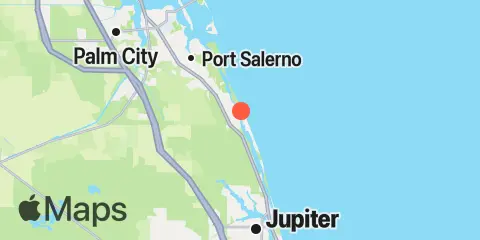
Latitude
27° 3' 54" N (27.065)
Longitude
80° 7' 24" W (-80.1233)
State
County
Nearest ZIP
33455
Nearby
Tides
2.1 mi
Gomez, South Jupiter Narrows
2.2 mi
Hobe Sound, Jupiter Island
3.6 mi
Peck Lake, ICWW
5.5 mi
Boy Scout Dock, Loxahatchee River
5.6 mi
Conch Bar, Jupiter Sound
6.3 mi
North Fork, 2 miles above entrance, Loxahatchee River
6.6 mi
3 miles above A1A highway bridge, Loxahatchee River
6.8 mi
South Point, St. Lucie Inlet, St. Lucie River
6.9 mi
Great Pocket
7.3 mi
Tequesta, North Fork, Loxahatchee River
7.4 mi
Port Salerno, Manatee Pocket, St. Lucie River
7.9 mi
Tequesta, North Fork entrance, Loxahatchee River
8.1 mi
Tequesta, Loxahatchee River
8.3 mi
Jupiter Sound, South End
8.4 mi
Jupiter Inlet, U.S. Highway 1 Bridge
8.4 mi
Southwest Fork, 0.5 mile above entrance, Loxahatchee River
8.4 mi
A1A highway bridge, Loxahatchee River
8.5 mi
Seminole Shores
8.6 mi
Sewall Point, St. Lucie River
9.0 mi
Jupiter Inlet, south jetty
9.1 mi
Southwest Fork (spillway), Loxahatchee River
9.3 mi
Jupiter, Lake Worth Creek, ICWW
10.7 mi
South Fork, St. Lucie River
10.9 mi
Lake Worth Creek, Day Beacon 19, ICWW
