Bakers Haulover Inlet (Inside) Weekly Tide Tables and Charts
Tide Chart for Next 7 Days
Bakers Haulover Inlet (Inside) weekly tide chart key:
The tide chart above shows the times and heights of high tide and low tide for Bakers Haulover Inlet (Inside), for the next seven days. The red line highlights the current time and estimated height.The tidal range at Bakers Haulover Inlet (Inside) for the next seven days is approximately 2.16 ft with a minimum tide of 0.01 ft and maximum tide of 2.17 ft. You can also check out all the daily details on tides & fishing times on the Day tab for Bakers Haulover Inlet (Inside).
Tide Table for Next 7 Days
▲ Blue = High Tide
▼ Red = Low Tide
| Day | 1st Tide | 2nd Tide | 3rd Tide | 4th Tide | ☀ Sun |
Major Solunars
|
Minor Solunars
|
|
|---|---|---|---|---|---|---|---|---|
| 30 Thu |
|
▼ 0.27 ft |
▲ 2.01 ft |
▼ 0.01 ft |
▲ 2.17 ft |
▲ 6:46 AM ▼ 8:08 PM |
12:58 AM → 2:58 AM 1:17 PM → 3:17 PM |
7:03 AM → 8:03 AM 8:31 PM → 9:31 PM |
| 31 Fri |
|
▼ 0.2 ft |
▲ 2.06 ft |
▼ 0.03 ft |
▲ 2.17 ft |
▲ 6:46 AM ▼ 8:07 PM |
1:42 AM → 3:42 AM 2:00 PM → 4:00 PM |
7:59 AM → 8:59 AM 9:02 PM → 10:02 PM |
| 1 Sat |
|
▼ 0.14 ft |
▲ 2.09 ft |
▼ 0.08 ft |
▲ 6:47 AM ▼ 8:07 PM |
2:26 AM → 4:26 AM 2:43 PM → 4:43 PM |
8:54 AM → 9:54 AM 9:33 PM → 10:33 PM |
|
| 2 Sun |
|
▲ 2.15 ft |
▼ 0.08 ft |
▲ 2.1 ft |
▼ 0.16 ft |
▲ 6:47 AM ▼ 8:06 PM |
3:08 AM → 5:08 AM 3:27 PM → 5:27 PM |
9:50 AM → 10:50 AM 10:04 PM → 11:04 PM |
| 3 Mon |
|
▲ 2.11 ft |
▼ 0.04 ft |
▲ 2.1 ft |
▼ 0.25 ft |
▲ 6:48 AM ▼ 8:05 PM |
3:52 AM → 5:52 AM 4:11 PM → 6:11 PM |
10:46 AM → 11:46 AM 10:36 PM → 11:36 PM |
| 4 Tue |
|
▲ 2.06 ft |
▼ 0.02 ft |
▲ 2.08 ft |
▼ 0.35 ft |
▲ 6:48 AM ▼ 8:05 PM |
4:37 AM → 6:37 AM 4:58 PM → 6:58 PM |
11:45 AM → 12:45 PM 11:12 PM → 12:12 AM |
| 5 Wed |
|
▲ 2.01 ft |
▼ 0.01 ft |
▲ 2.06 ft |
▼ 0.45 ft |
▲ 6:49 AM ▼ 8:04 PM |
5:26 AM → 7:26 AM 5:49 PM → 7:49 PM |
12:47 PM → 1:47 PM |
Buoy Weather
Air Temperature
85° F
Water Temperature
86° F
Waves
0.7 ft
Note: Observations are from a weather buoy 6.99 miles from the prediction site. Observations are not available at all prediction sites, and observation types vary between sites.
More details: Station 41122 Buoy Weather
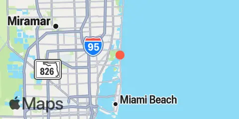
Location & Map
Latitude
25° 54' 12" N (25.9033)
Longitude
80° 7' 30" W (-80.125)
State
County
Nearest ZIP
33154
Nearby
Tides
0.3 mi
Haulover Pier, N. Miami Beach
1.8 mi
Sunny Isles, Biscayne Creek
1.9 mi
North Miami Beach, Newport Fishing Pier
2.3 mi
Indian Creek Golf Club, ICWW
2.7 mi
Dumfoundling Bay
2.9 mi
Biscayne Creek, ICWW
4.4 mi
Golden Beach, ICWW
8.0 mi
San Marino Island, Biscayne Bay
9.0 mi
Hollywood Beach, West Lake, South End
9.3 mi
Miami Beach (city pier)
9.4 mi
Miami, Miamarina, Biscayne Bay
9.5 mi
Hollywood Beach
9.6 mi
Dodge Island, Fishermans Channel, Biscayne Bay
9.7 mi
Hollywood Beach, West Lake, North End
9.7 mi
Government Cut, Miami Harbor Entrance
10.5 mi
Whiskey Creek, South Entrance, ICWW
10.8 mi
Port Laudania, Dania cut-off Canal
12.1 mi
Virginia Key, Bear Cut, Biscayne Bay
12.2 mi
Whiskey Creek, North End
12.3 mi
South Port Everglades, ICWW
Currents
0.3 mi
Bakers Haulover Cut
8.9 mi
Dodge Island, NW Turning Basin
9.1 mi
Dodge Island, SE Turning Basin
9.2 mi
Main Ship Channel
9.4 mi
Fisher Island Turning Basin
9.6 mi
Pilot House
9.6 mi
Dodge Island Cut, west end
9.6 mi
West entrance, south side
9.6 mi
Miami Harbor Entrance
9.7 mi
Norris Cut
9.8 mi
Lummus Island Turning Basin
9.8 mi
Lummus Island, SW corner
9.9 mi
South Jetty
10.0 mi
Miami River Entrance
11.9 mi
South Port, at the terminals
Note: Tide predictions are an estimate and NOT FOR NAVIGATION.
We also offer free widgets if you want to add tide or solunar tables to your own site.