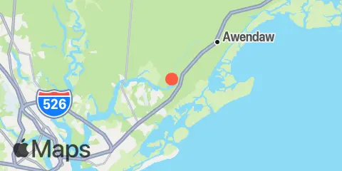
TidesPro
  • Recents
    • Woodville, Wando River
  • Tides
    United States
    Alabama Alaska California Connecticut Delaware District of Columbia Florida Georgia Hawaii
    Louisiana Maine Maryland Massachusetts Mississippi New Hampshire New Jersey New York North Carolina
    Oregon Pennsylvania Rhode Island South Carolina Texas US Outlying Islands Virginia Washington Puerto Rico
    Caribbean
    The Bahamas Cayman Islands Cuba Dominican Republic Haiti Jamaica Virgin Islands (US)
  • Fishing  Coordinates
    Alabama - Alabama Inshore Public Reefs Alabama - Alabama Nearshore Public Reefs Alabama - Alabama Offshore Public Reefs California - California Artificial Reefs Delaware - Delaware Artificial Reefs Florida - Bay County Florida - Brevard County Florida - Broward County Florida - Charlote and Lee Counties Florida - Citrus County Florida - Collier County Florida - Dixie County Florida - Duval County Florida - Escambia County Florida - Flagler County Florida - Florida Keys Florida - Franklin County Florida - Gulf County Florida - Hernando County
    Florida - Indian River County Florida - Levy County Florida - Manatee County Florida - Martin County Florida - Miami-Dade County Florida - Monroe County Florida - Nassau County Florida - Okaloosa County Florida - Palm Beach County Florida - Pasco County Florida - Santa Rosa County Florida - Sarasota County Florida - St. Johns County Florida - St. Lucie County Florida - Tampa Bay Florida - Taylor County Florida - Volusia County Florida - Wakulla County Florida - Walton County
    Georgia - Georgia Reefs Hawaii - Hawaii Artificial Reefs Louisiana - Louisiana Artificial Reefs Maryland - Maryland Artificial Reefs Massachusetts - Massachusetts Artificial Reefs Mississippi - Mississippi Inshore Artificial Reefs Mississippi - Mississippi Offshore Artificial Reefs New Jersey - New Jersey Artificial Reefs New York - New York Artificial Reefs North Carolina - Estuarine North Carolina - Long Bay North Carolina - Onslow Bay North Carolina - Outer Banks North Carolina - Raleigh Bay Puerto Rico - Puerto Rico Artificial Reefs Rhode Island - Rhode Island Artificial Reefs South Carolina - South Carolina Reefs Texas - Texas Artificial Reefs Virginia - Virginia Artificial Reefs
  • Solunar Tables
Woodville Location
  1. United States
  2. South Carolina
  3. Woodville, Wando River

Woodville Map

Day Week Month Table Month Chart Map
Latitude
32° 55' 12" N (32.92)
Longitude
79° 43' 60" W (-79.7333)
State
South Carolina
County
Charleston County
Nearest ZIP
29429
Nearby
Tides 0.9 mi Big Paradise Island, Wando River 4.4 mi Old Capers Landing, Santee Pass, Capers Island 4.6 mi Capers Creek, South Capers Island 4.7 mi Moores Landing, ICWW, Sewee Bay 5.1 mi Price Creek, North Capers Island 5.1 mi North Dewees Island, Capers Inlet 5.6 mi Cainhoy, Wando River 6.0 mi South Dewees Island, Dewees Inlet 6.8 mi Wharf Creek entrance, Bulls Bay 6.9 mi Parker Island, Horlbeck Creek, Wando River 7.2 mi Hamlin Sound 8.8 mi Jack Creek entrance, Bulls Bay 9.8 mi Nowell Creek, Wando River 9.8 mi Hamlin Creek, Isle of Palms 9.9 mi Isle of Palms Pier 10.9 mi Breach Inlet, Isle of Palms 11.7 mi Snow Point, 0.4 mi. North of, Cooper River 11.7 mi Clouter Creek, north entrance, Cooper River 11.8 mi Hobcaw Point, Wando River 11.9 mi Ben Sawyer Bridge, ICWW 12.1 mi Sullivans Island (outer coast) 12.3 mi Shem Creek Currents 6.1 mi Anneville, marker 36 6.9 mi Horlbeck Creek, 0.2 mile above entrance 8.4 mi Nowell Creek, Southeast of 8.7 mi Nowell Creek entrance 10.3 mi Rathall Creek entrance 11.1 mi off Amoco Pier 11.2 mi Wando River Upper Reach, Turning Basin 11.4 mi Moreland, 0.5 n.mi. below 11.4 mi Yellow House Landing, 1 mile NW of 11.6 mi Woods Point, SE of 11.6 mi Snow Point, 0.5 mile north of 11.8 mi Yellow House Creek 11.9 mi Woods Point 12.1 mi Back River entrance 12.4 mi Daniel Island Bend

About

TidesPro was created as an easy-to-use tides and solunar site. It provides tide predictions and marine weather for many types of people, whether you’re fishing, going to the beach, boating, kayaking, surfing, or planning a trip. With anglers in mind, it also provides an accessible way to find fishing spots and the best times to fish in those locations.

More About TidesPro

App

Apple App Store
[More Info]
Quick Links
  • When to Fish
  • Solunar Theory
  • Tide & Solunar Widgets for Your Site
  • Tide & Solunar Predictions in Google Earth
  • Things to Do
  • About

© Copyright 2017 - 2025 ASR Concepts LLC. All rights reserved.

  • Privacy Policy
  • •
  • Terms of Use
  • •
  • Contact
  • •
  • Bluesky
  • •
  • Mastodon