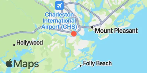
Wappoo Creek Fishing Times
Check tides for fishing in Wappoo Creek, alongside major and minor solunar periods and a seven-day fishing outlook.
Major solunar periods
Low tide · 1:04 PM · 0.16 ft
Low tide · 1:03 AM · -0.41 ft
Based on solunar timing. Consider weather and water conditions.
Tides & fishing windows
Full tide details →Shaded bands show major fishing periods. Fish markers show all major and minor periods.
Fishing times
Major Fishing Times
10:06 AM 12:06 PM
10:36 PM 12:36 AM
Minor Fishing Times
5:20 AM 6:20 AM
3:46 PM 4:46 PM
About Solunar Theory →Tide Times & Heights
| Tide | Time | Height |
|---|---|---|
| Low tide | -0.18′ | |
| High tide | 6.41′ | |
| Low tide | 0.16′ | |
| High tide | 5.30′ |
Weather & marine conditions
Monday, November 23, 2026
- Air temperature
-
56–72 °FClear / Mainly Clear / Overcast / Partly Cloudy
- Wind
-
2–6 mphGusts to 11 mph
- Open-water waves
-
1.2–2.2 ft7.6–8.4 sec
- Water temperature
-
64–65 °FEstimated
| Date | Mon, Nov 23 | |||||||||||||||||||||||
|---|---|---|---|---|---|---|---|---|---|---|---|---|---|---|---|---|---|---|---|---|---|---|---|---|
| Forecast | ||||||||||||||||||||||||
| Weather °F Precip |
61°
2%
|
60°
1%
|
59°
1%
|
59°
1%
|
58°
1%
|
57°
1%
|
57°
1%
|
56°
1%
|
58°
1%
|
63°
1%
|
66°
1%
|
68°
1%
|
69°
1%
|
70°
1%
|
71°
|
72°
|
70°
|
67°
|
65°
|
65°
|
64°
|
63°
|
62°
|
64°
|
| Wind mph | 4 Gust 11 | 4 Gust 10 | 4 Gust 7 | 4 Gust 7 | 3 Gust 7 | 4 Gust 8 | 3 Gust 8 | 4 Gust 7 | 2 Gust 8 | 4 Gust 8 | 3 Gust 6 | 3 Gust 6 | 3 Gust 6 | 2 Gust 4 | 2 Gust 3 | 2 Gust 4 | 6 Gust 7 | 5 Gust 7 | 4 Gust 9 | 4 Gust 11 | 4 Gust 9 | 4 Gust 10 | 4 Gust 8 | 3 Gust 6 |
| Waves | 2.2′ 7.6 sec | 2.2′ 7.6 sec | 2.1′ 7.6 sec | 2.1′ 7.6 sec | 2′ 7.6 sec | 2′ 7.6 sec | 1.9′ 7.6 sec | 1.8′ 7.7 sec | 1.8′ 7.7 sec | 1.7′ 7.8 sec | 1.6′ 7.9 sec | 1.6′ 8 sec | 1.6′ 8.1 sec | 1.5′ 8.2 sec | 1.4′ 8.2 sec | 1.4′ 8.3 sec | 1.4′ 8.3 sec | 1.4′ 8.3 sec | 1.3′ 8.3 sec | 1.3′ 8.3 sec | 1.3′ 8.3 sec | 1.2′ 8.3 sec | 1.2′ 8.3 sec | 1.2′ 8.4 sec |
| Pressure hPa | 1014 | 1014 | 1014 | 1014 | 1015 | 1015 | 1015 | 1016 | 1016 | 1016 | 1017 | 1017 | 1017 | 1016 | 1016 | 1016 | 1016 | 1016 | 1017 | 1017 | 1018 | 1018 | 1018 | 1018 |
| Water °F | 64° | 64° | 64° | 64° | 64° | 64° | 64° | 64° | 64° | 65° | 65° | 65° | 65° | 65° | 65° | 65° | 65° | 65° | 65° | 65° | 65° | 65° | 65° | 65° |
Wave fill scale: 0–3 ft
About this forecast
Wave forecasts represent open-water conditions; conditions in rivers, harbors, and sheltered waters may differ. Forecast wave heights represent significant wave height, roughly the average height of the highest third of waves. Individual waves can be twice this height or more, so the forecast does not represent the maximum wave height.
Atmospheric pressure
Forecast · 12:00 PM
Over the next 3 hours
Based on pressure level only. Separate from the solunar fishing rating.
About the pressure outlook
A general guide based on atmospheric pressure, not a guarantee of fish activity or catches. Local weather, water conditions, species, and fishing reports are not included in this outlook.
The trend compares forecast pressure at the time shown and three hours later. Other dates use a forecast near midday.
Sun & moon
Moon phase
 Waxing Gibbous
99% illuminated
Sun & moon
- Sunrise
- Sunset
- Moonset
- Moonrise
7-day fishing planner
Daily ratings, all major and minor fishing periods, and tide times and heights.
About the fishing rating
The rating provides a general outlook for potential fish activity based on solunar conditions. It does not include weather, water conditions, species, or local fishing reports. A higher rating is not a guarantee of a catch.
About Solunar TheoryLocation & Map
Nearby
About these predictions
Tide heights are predictions, not measurements. Wind, air pressure, storms, and river flow can cause actual water levels to differ. Not for navigation.
Tide prediction source:
Tide predictions: NOAA Center for Operational Oceanographic Products and Services (CO-OPS). Official source
Vertical datum:
MLLW — Mean Lower Low Water
Weather Data: Open-Meteo