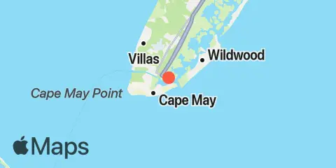
TidesPro
  • Recents
    • Cape May Harbor, Cape May Inlet
  • Tides
    United States
    Alabama Alaska California Connecticut Delaware District of Columbia Florida Georgia Hawaii
    Louisiana Maine Maryland Massachusetts Mississippi New Hampshire New Jersey New York North Carolina
    Oregon Pennsylvania Rhode Island South Carolina Texas US Outlying Islands Virginia Washington Puerto Rico
    Caribbean
    The Bahamas Cayman Islands Cuba Dominican Republic Haiti Jamaica Virgin Islands (US)
  • Fishing  Coordinates
    Alabama - Alabama Inshore Public Reefs Alabama - Alabama Nearshore Public Reefs Alabama - Alabama Offshore Public Reefs California - California Artificial Reefs Delaware - Delaware Artificial Reefs Florida - Bay County Florida - Brevard County Florida - Broward County Florida - Charlote and Lee Counties Florida - Citrus County Florida - Collier County Florida - Dixie County Florida - Duval County Florida - Escambia County Florida - Flagler County Florida - Florida Keys Florida - Franklin County Florida - Gulf County Florida - Hernando County
    Florida - Indian River County Florida - Levy County Florida - Manatee County Florida - Martin County Florida - Miami-Dade County Florida - Monroe County Florida - Nassau County Florida - Okaloosa County Florida - Palm Beach County Florida - Pasco County Florida - Santa Rosa County Florida - Sarasota County Florida - St. Johns County Florida - St. Lucie County Florida - Tampa Bay Florida - Taylor County Florida - Volusia County Florida - Wakulla County Florida - Walton County
    Georgia - Georgia Reefs Hawaii - Hawaii Artificial Reefs Louisiana - Louisiana Artificial Reefs Maryland - Maryland Artificial Reefs Massachusetts - Massachusetts Artificial Reefs Mississippi - Mississippi Inshore Artificial Reefs Mississippi - Mississippi Offshore Artificial Reefs New Jersey - New Jersey Artificial Reefs New York - New York Artificial Reefs North Carolina - Estuarine North Carolina - Long Bay North Carolina - Onslow Bay North Carolina - Outer Banks North Carolina - Raleigh Bay Puerto Rico - Puerto Rico Artificial Reefs Rhode Island - Rhode Island Artificial Reefs South Carolina - South Carolina Reefs Texas - Texas Artificial Reefs Virginia - Virginia Artificial Reefs
  • Solunar Tables
Cape May Harbor Location
  1. United States
  2. New Jersey
  3. Cape May Harbor, Cape May Inlet

Cape May Harbor Map

Day Week Month Table Month Chart Map
Latitude
38° 56' 54" N (38.9483)
Longitude
74° 53' 30" W (-74.8917)
State
New Jersey
County
Cape May County
Nearest ZIP
08204
Nearby
Tides 1.2 mi Cape Island Creek, Cape May 2.7 mi Cape May (Ocean) 2.7 mi Swain Channel, Taylor Sound, Cape May Inlet 3.6 mi Wildwood Crest, Sunset Lake, Cape May Inlet 3.9 mi Cape May Canal, Cape May, Delaware Bay 4.1 mi Wildwood Crest, Ocean Pier 4.3 mi Cape May Point, Sunset Beach, Delaware Bay 5.3 mi West Wildwood, Grassy Sound, Hereford Inlet 5.5 mi Old Turtle Thorofare, RR. bridge, Hereford Inlet 5.9 mi North Highlands Beach, Delaware Bay 7.3 mi Nummy Island, Grassy Sound Channel, Hereford Inlet 9.3 mi Dias Creek, Route 47 bridge, Delaware Bay 10.1 mi Stone Harbor, Great Channel, Hereford Inlet 11.8 mi Bidwell Creek, Route 47 bridge, Delaware Bay 12.2 mi Brandywine Shoal Light, Delaware Bay Currents 0.5 mi Cape May Canal, east end 1.0 mi Cape May Harbor entrance 4.6 mi Cape May Canal, West End 5.2 mi Cape May Channel 5.5 mi Cape May Point, 1.4 n.mi. SSW of 6.5 mi Cape May Point, 2.7 n.mi. SSW of 7.2 mi McCrie Shoal 9.4 mi Cape Henlopen, 4.8 n.mi. northeast of 10.2 mi Bay Shore Channel (north) 11.2 mi Cape Henlopen, 5 mi north of 11.5 mi Delaware Bay Channel LB 10 11.9 mi Delaware Bay Entrance 12.4 mi Cape Henlopen, 2 mi NE of

About

TidesPro was created as an easy-to-use tides and solunar site. It provides tide predictions and marine weather for many types of people, whether you’re fishing, going to the beach, boating, kayaking, surfing, or planning a trip. With anglers in mind, it also provides an accessible way to find fishing spots and the best times to fish in those locations.

More About TidesPro

App

Apple App Store
[More Info]
Quick Links
  • When to Fish
  • Solunar Theory
  • Tide & Solunar Widgets for Your Site
  • Tide & Solunar Predictions in Google Earth
  • Things to Do
  • About

© Copyright 2017 - 2025 ASR Concepts LLC. All rights reserved.

  • Privacy Policy
  • •
  • Terms of Use
  • •
  • Contact
  • •
  • Bluesky
  • •
  • Mastodon