Mullet Key Channel (Skyway) Weekly Tide Tables and Charts
Tide Chart for Next 7 Days
Mullet Key Channel (Skyway) weekly tide chart key:
The tide chart above shows the times and heights of high tide and low tide for Mullet Key Channel (Skyway), for the next seven days. The red line highlights the current time and estimated height.The tidal range at Mullet Key Channel (Skyway) for the next seven days is approximately 2.51 ft with a minimum tide of -0.19 ft and maximum tide of 2.32 ft. You can also check out all the daily details on tides & fishing times on the Day tab for Mullet Key Channel (Skyway).
Tide Table for Next 7 Days
▲ Blue = High Tide
▼ Red = Low Tide
| Day | 1st Tide | 2nd Tide | 3rd Tide | 4th Tide | ☀ Sun |
Major Solunars
|
Minor Solunars
|
|
|---|---|---|---|---|---|---|---|---|
| 30 Thu |
|
▲ 1.24 ft |
▼ 0.92 ft |
▲ 2.32 ft |
▼ -0.12 ft |
▲ 6:53 AM ▼ 8:21 PM |
1:08 AM → 3:08 AM 1:27 PM → 3:27 PM |
7:11 AM → 8:11 AM 8:44 PM → 9:44 PM |
| 31 Fri |
|
▲ 1.32 ft |
▼ 0.82 ft |
▲ 2.23 ft |
▼ 0 ft |
▲ 6:54 AM ▼ 8:21 PM |
1:53 AM → 3:53 AM 2:11 PM → 4:11 PM |
8:08 AM → 9:08 AM 9:14 PM → 10:14 PM |
| 1 Sat |
|
▲ 1.41 ft |
▼ 0.73 ft |
▲ 2.07 ft |
▼ 0.16 ft |
▲ 6:54 AM ▼ 8:20 PM |
2:36 AM → 4:36 AM 2:54 PM → 4:54 PM |
9:04 AM → 10:04 AM 9:44 PM → 10:44 PM |
| 2 Sun |
|
▲ 1.51 ft |
▼ 0.64 ft |
▲ 1.86 ft |
▼ 0.36 ft |
▲ 6:55 AM ▼ 8:19 PM |
3:19 AM → 5:19 AM 3:37 PM → 5:37 PM |
10:01 AM → 11:01 AM 10:14 PM → 11:14 PM |
| 3 Mon |
|
▲ 1.63 ft |
▼ 0.55 ft |
▲ 1.59 ft |
▼ 0.58 ft |
▲ 6:55 AM ▼ 8:19 PM |
4:03 AM → 6:03 AM 4:21 PM → 6:21 PM |
10:58 AM → 11:58 AM 10:45 PM → 11:45 PM |
| 4 Tue |
|
▲ 1.76 ft |
▼ 0.45 ft |
▲ 1.3 ft |
▼ 0.77 ft |
▲ 6:56 AM ▼ 8:18 PM |
4:48 AM → 6:48 AM 5:09 PM → 7:09 PM |
11:58 AM → 12:58 PM 11:20 PM → 12:20 AM |
| 5 Wed |
|
▲ 1.91 ft |
▼ 0.32 ft |
▲ 1.04 ft |
▼ 0.92 ft |
▲ 6:56 AM ▼ 8:17 PM |
5:37 AM → 7:37 AM 6:00 PM → 8:00 PM |
1:01 PM → 2:01 PM |
Buoy Weather
Air Temperature
84° F
Wind
12 knots WNW (290°)
Wind Gust
14 knots
Atmospheric Pressure
1015 hPa
Note: Observations are from a weather buoy 8.73 miles from the prediction site. Observations are not available at all prediction sites, and observation types vary between sites.
More details: Station mtbf1 Buoy Weather
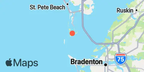
Location & Map
Latitude
27° 36' 54" N (27.615)
Longitude
82° 43' 36" W (-82.7267)
State
County
Nearest ZIP
33715
Nearby
Tides
2.2 mi
Egmont Key, Egmont Channel, Tampa Bay
4.7 mi
Pass-a-Grille Beach, Boca Ciega Bay
5.7 mi
Anna Maria Key, city pier
8.0 mi
Point Pinellas
8.2 mi
Anna Maria Key, Bradenton Beach
8.5 mi
Gulfport, Boca Ciega Bay
9.6 mi
Long Key, 0.5mi N. of Corey Causeway, Boca Ciega Bay
10.2 mi
Port Manatee, Tampa Bay
10.5 mi
Cortez, Sarasota Bay
11.8 mi
St. Petersburg, Tampa Bay
12.2 mi
Johns Pass, Boca Ciega Bay
12.3 mi
Bradenton, Manatee River
Currents
0.7 mi
Mullet Key Channel entrance
2.1 mi
Mullet Key Channel, marker '24'
2.2 mi
Tampa Bay Entrance (Egmont Channel)
2.3 mi
Bunces Pass (West of Bayway bridge)
4.4 mi
Sunshine Skyway Bridge
4.4 mi
Southwest Channel (S of Egmont Key)
4.9 mi
Pass-a-Grille Channel
4.9 mi
Rattlesnake Key, 3.1 miles west of
5.4 mi
Passage Key Inlet (off Bean Pt.)
5.4 mi
Pine Key (Pinellas Bayway bridge)
5.6 mi
Egmont Channel (3 mi. W of Egmont Key Lt.)
5.9 mi
Rattlesnake Key, 1.1 miles northwest of
6.1 mi
Pinellas Point, 2.6 miles south of
6.1 mi
Bridge, 0.8 mi. south of Maximo Pt.
6.2 mi
Joe Island, 1.8 miles northwest of
6.4 mi
Cut A & B, Channel Junction
6.5 mi
Cats Point (bridge west of)
8.1 mi
Pinellas Point, 0.5 mile southeast of
8.1 mi
Harbor Key, 1.3 miles west of
8.5 mi
Port Manatee Channel Entrance
8.6 mi
Pinellas Point, 1.9 miles SE of
8.7 mi
Egmont Channel, marker '10'
8.8 mi
Port Manatee Channel, marker '4'
10.0 mi
Blind Pass (north end)
10.2 mi
Cortez, north of bridge
10.4 mi
Lewis Island, 0.9 mile east of
10.4 mi
Piney Point, 0.6 mile NNW of
11.9 mi
Johns Pass Entrance
12.1 mi
Johns Pass Bridge, north span
12.2 mi
Longboat Pass
12.2 mi
Johns Pass Bridge, 0.3nm north of
Note: Tide predictions are an estimate and NOT FOR NAVIGATION.
We also offer free widgets if you want to add tide or solunar tables to your own site.