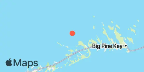
Johnston Key Map
Latitude
24° 42' 36" N (24.71)
Longitude
81° 35' 36" W (-81.5933)
State
County
Nearest ZIP
33042
Nearby
Tides
2.0 mi
Pumpkin Key, Bow Channel
2.7 mi
Sugarloaf Key, North End, Bow Channel
3.7 mi
Snipe Keys, Southeast End, Inner Narrows
3.8 mi
Snipe Keys, Middle Narrows
3.9 mi
Sawyer Key, Inside, Cudjoe Channel
4.5 mi
Perky, Upper Sugarloaf Sound
4.6 mi
Sugarloaf Key, Northeast Side, Bow Channel
4.7 mi
North Harris Channel, Upper Sugarloaf Sound
5.1 mi
Park Channel Bridge, Upper Sugarloaf Sound
5.2 mi
Snipe Keys, Snipe Point
5.6 mi
Cudjoe Key, North End, Kemp Channel
5.8 mi
Waltz Key, Waltz Key Basin
5.9 mi
Cudjoe Key, Pirates Cove
6.0 mi
Saddlebunch Keys, Channel No. 3
6.3 mi
Sugarloaf Key, Pirates Cove
6.7 mi
Saddlebunch Keys, Channel No. 4
7.1 mi
Saddlebunch Keys, Channel No. 5
7.2 mi
O'Hara Key, North End, Waltz Key Basin
7.2 mi
Knockemdown Key, North End
7.2 mi
Raccoon Key, East Side
7.3 mi
Cudjoe Key, Cudjoe Bay
7.3 mi
Tarpon Creek, Upper Sugarloaf Sound
7.7 mi
Sugarloaf Key, East Side, Tarpon Creek
7.8 mi
Saddlebunch Keys, Similar Sound
8.1 mi
Shark Key, southeast end, Similar Sound
8.3 mi
Gopher Key, Cudjoe Bay
8.3 mi
Duck Key Point, Duck Key, Waltz Key Basin
8.4 mi
Big Coppitt Key, Northeast Side, Waltz Key Basin
8.5 mi
Kemp Channel Viaduct, Florida Keys
8.9 mi
Content Keys, Content Passage
8.9 mi
Bird Key, Similar Sound
9.4 mi
Water Keys, South End, Harbor Channel
9.5 mi
Rockland Key, Rockland Channel Bridge
9.6 mi
Big Torch Key, Harbor Channel
9.9 mi
Boca Chica Key, Long Point
10.1 mi
Big Torch Key, Niles Channel
10.1 mi
Summerland Key, southwest side, Kemp Channel
10.4 mi
Summerland Key, Niles Channel Bridge
10.5 mi
Key Lois, southeast end
10.7 mi
Summerland Key, Niles Channel South
10.9 mi
Howe Key, northwest end
11.1 mi
Channel Key, west side
11.2 mi
Ramrod Key, Niles Channel Bridge
11.8 mi
Howe Key, South End, Harbor Channel
11.8 mi
Boca Chica Marina
12.3 mi
Boca Chica Channel Bridge
Currents
10.9 mi
Loggerhead Key, East of