Big Torch Key Tides & Fishing Times
Tides
Big Torch Key tide chart key:
The tide chart above shows the times and heights of high tide and low tide for Big Torch Key, as well as solunar period times (represented by fish icons). The red line highlights the current time and estimated height.| Day | Time | Tide | Height | |
|---|---|---|---|---|
| 29 Wed | ▼ Low | -0.03 ft | ||
| 30 Thu | ▲ High | 0.73 ft | ||
| 30 Thu | ▼ Low | 0.39 ft | ||
| 30 Thu | ▲ High | 1.21 ft | ||
| 30 Thu | ▼ Low | 0 ft | ||
| 31 Fri | ▲ High | 0.8 ft |
Thursday, July 30, 2026 2:38 PM: The tide is currently falling at Big Torch Key with a current estimated height of 1.2 ft. The last tide was High at 2:14 PM and the next tide is a Low of 0 ft at 7:35 PM. The tidal range today is approximately 1.21 ft with a minimum tide of 0 ft and maximum tide of 1.21 ft.
Next 7 Days
▲ Blue = High Tide
▼ Red = Low Tide
| Day | 1st Tide | 2nd Tide | 3rd Tide | 4th Tide | ☀ Sun |
Major Solunars
|
Minor Solunars
|
|
|---|---|---|---|---|---|---|---|---|
| 30 Thu |
|
▲ 0.73 ft |
▼ 0.39 ft |
▲ 1.21 ft |
▼ 0 ft |
▲ 6:53 AM ▼ 8:11 PM |
1:03 AM → 3:03 AM 1:23 PM → 3:23 PM |
7:11 AM → 8:11 AM 8:35 PM → 9:35 PM |
| 31 Fri |
|
▲ 0.8 ft |
▼ 0.36 ft |
▲ 1.2 ft |
▼ 0.05 ft |
▲ 6:53 AM ▼ 8:11 PM |
1:48 AM → 3:48 AM 2:06 PM → 4:06 PM |
8:06 AM → 9:06 AM 9:07 PM → 10:07 PM |
| 1 Sat |
|
▲ 0.87 ft |
▼ 0.33 ft |
▲ 1.15 ft |
▼ 0.12 ft |
▲ 6:54 AM ▼ 8:10 PM |
2:31 AM → 4:31 AM 2:49 PM → 4:49 PM |
9:00 AM → 10:00 AM 9:38 PM → 10:38 PM |
| 2 Sun |
|
▲ 0.93 ft |
▼ 0.29 ft |
▲ 1.06 ft |
▼ 0.19 ft |
▲ 6:54 AM ▼ 8:09 PM |
3:14 AM → 5:14 AM 3:32 PM → 5:32 PM |
9:55 AM → 10:55 AM 10:10 PM → 11:10 PM |
| 3 Mon |
|
▲ 0.99 ft |
▼ 0.24 ft |
▲ 0.95 ft |
▼ 0.27 ft |
▲ 6:55 AM ▼ 8:09 PM |
3:57 AM → 5:57 AM 4:17 PM → 6:17 PM |
10:51 AM → 11:51 AM 10:43 PM → 11:43 PM |
| 4 Tue |
|
▲ 1.04 ft |
▼ 0.2 ft |
▲ 0.81 ft |
▼ 0.34 ft |
▲ 6:55 AM ▼ 8:08 PM |
4:43 AM → 6:43 AM 5:04 PM → 7:04 PM |
11:49 AM → 12:49 PM 11:19 PM → 12:19 AM |
| 5 Wed |
|
▲ 1.08 ft |
▼ 0.15 ft |
▲ 0.67 ft |
▼ 0.4 ft |
▲ 6:56 AM ▼ 8:07 PM |
5:32 AM → 7:32 AM 5:55 PM → 7:55 PM |
12:50 PM → 1:50 PM |
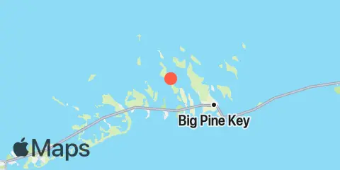
Location & Map
Latitude
24° 42' 18" N (24.705)
Longitude
81° 25' 60" W (-81.4333)
State
County
Nearest ZIP
33042
Nearby
Tides
2.2 mi
Howe Key, South End, Harbor Channel
2.3 mi
Big Torch Key, Harbor Channel
2.9 mi
Knockemdown Key, North End
3.1 mi
Water Keys, South End, Harbor Channel
3.1 mi
Summerland Key, Niles Channel Bridge
3.2 mi
Ramrod Key, Niles Channel Bridge
3.3 mi
Big Pine Key, West Side, Pine Channel
3.3 mi
Big Pine Key, Northeast Shore
3.6 mi
Middle Torch Key, Torch Ramrod Channel
3.7 mi
Big Pine Key, North End
3.7 mi
Little Torch Key, Torch Channel
3.7 mi
Summerland Key, Niles Channel South
3.7 mi
Howe Key, northwest end
3.7 mi
Kemp Channel Viaduct, Florida Keys
3.9 mi
Summerland Key, southwest side, Kemp Channel
4.0 mi
Little Torch Key, Pine Channel Bridge, South Side
4.0 mi
Raccoon Key, East Side
4.2 mi
Ramrod Key, Newfound Harbor
4.5 mi
Cudjoe Key, North End, Kemp Channel
4.6 mi
Annette Key, North End, Big Spanish Channel
4.6 mi
Big Pine Key, Pine Channel Bridge, South Side
4.7 mi
Big Pine Key, Pine Channel Bridge, North Side
4.8 mi
Cudjoe Key, Cudjoe Bay
4.9 mi
Mayo Key, Big Spanish Channel
4.9 mi
Big Pine Key, Doctors Arm, Bogie Channel
5.2 mi
Big Pine Key, Newfound Harbor Channel
5.2 mi
Porpoise Key, Big Spanish Channel
5.4 mi
Big Pine Key, Bogie Channel Bridge
5.5 mi
Gopher Key, Cudjoe Bay
5.9 mi
Crawl Key, Big Spanish Channel
5.9 mi
Big Spanish Key
5.9 mi
Cudjoe Key, Pirates Cove
6.0 mi
Munson Island, Newfound Harbor Channel
6.2 mi
Water Key, west end, Big Spanish Channel
6.2 mi
Little Spanish Key, Spanish Banks
6.3 mi
Sugarloaf Key, Pirates Cove
6.4 mi
Big Pine Key, Coupon Bight
6.7 mi
Content Keys, Content Passage
6.7 mi
Sugarloaf Key, Northeast Side, Bow Channel
7.2 mi
Sugarloaf Key, East Side, Tarpon Creek
7.2 mi
Key Lois, southeast end
7.2 mi
No Name Key, East Side, Bahia Honda Channel
7.3 mi
Little Pine Key, North End
7.4 mi
Tarpon Creek, Upper Sugarloaf Sound
7.5 mi
Park Channel Bridge, Upper Sugarloaf Sound
7.6 mi
Big Pine Key, Spanish Harbor
7.7 mi
Sugarloaf Key, North End, Bow Channel
8.1 mi
Pumpkin Key, Bow Channel
8.1 mi
Johnson Keys, North End
8.2 mi
Little Pine Key, South End
8.3 mi
North Harris Channel, Upper Sugarloaf Sound
8.8 mi
Johnson Keys, South End
8.9 mi
Sawyer Key, Inside, Cudjoe Channel
9.4 mi
Perky, Upper Sugarloaf Sound
10.1 mi
Johnston Key, southwest end, Turkey Basin
10.1 mi
Bahia Honda Key, Bahia Honda Channel
10.3 mi
Horseshoe Keys, South End
11.4 mi
West Bahia Honda Key
11.5 mi
Snipe Keys, Southeast End, Inner Narrows
11.7 mi
Ohio Key-Bahia Honda Key Channel, west side
12.1 mi
Saddlebunch Keys, Channel No. 3
12.1 mi
Missouri Key-Ohio Key Channel, west side
Currents
6.3 mi
Loggerhead Key, East of
7.5 mi
No Name Key, northeast of
9.7 mi
Bahia Honda Harbor
Note: Tide predictions are an estimate and NOT FOR NAVIGATION.
We also offer free widgets if you want to add tide or solunar tables to your own site.