Indian Rocks Beach (Inside) Weekly Tide Tables and Charts
Tide Chart for Next 7 Days
Indian Rocks Beach (Inside) weekly tide chart key:
The tide chart above shows the times and heights of high tide and low tide for Indian Rocks Beach (Inside), for the next seven days. The red line highlights the current time and estimated height.The tidal range at Indian Rocks Beach (Inside) for the next seven days is approximately 2.58 ft with a minimum tide of 0.1 ft and maximum tide of 2.68 ft. You can also check out all the daily details on tides & fishing times on the Day tab for Indian Rocks Beach (Inside).
Tide Table for Next 7 Days
▲ Blue = High Tide
▼ Red = Low Tide
| Day | 1st Tide | 2nd Tide | 3rd Tide | 4th Tide | ☀ Sun |
Major Solunars
|
Minor Solunars
|
|
|---|---|---|---|---|---|---|---|---|
| 30 Thu |
|
▲ 2.16 ft |
▼ 1.08 ft |
▲ 2.68 ft |
▼ 0.14 ft |
▲ 6:53 AM ▼ 8:22 PM |
1:09 AM → 3:09 AM 1:28 PM → 3:28 PM |
7:12 AM → 8:12 AM 8:44 PM → 9:44 PM |
| 31 Fri |
|
▲ 2.21 ft |
▼ 0.97 ft |
▲ 2.66 ft |
▼ 0.19 ft |
▲ 6:54 AM ▼ 8:22 PM |
1:53 AM → 3:53 AM 2:11 PM → 4:11 PM |
8:08 AM → 9:08 AM 9:15 PM → 10:15 PM |
| 1 Sat |
|
▲ 2.29 ft |
▼ 0.84 ft |
▲ 2.61 ft |
▼ 0.28 ft |
▲ 6:54 AM ▼ 8:21 PM |
2:37 AM → 4:37 AM 2:55 PM → 4:55 PM |
9:05 AM → 10:05 AM 9:45 PM → 10:45 PM |
| 2 Sun |
|
▲ 2.38 ft |
▼ 0.71 ft |
▲ 2.53 ft |
▼ 0.4 ft |
▲ 6:55 AM ▼ 8:20 PM |
3:20 AM → 5:20 AM 3:37 PM → 5:37 PM |
10:01 AM → 11:01 AM 10:14 PM → 11:14 PM |
| 3 Mon |
|
▲ 2.49 ft |
▼ 0.59 ft |
▲ 2.39 ft |
▼ 0.57 ft |
▲ 6:55 AM ▼ 8:19 PM |
4:03 AM → 6:03 AM 4:22 PM → 6:22 PM |
10:59 AM → 11:59 AM 10:45 PM → 11:45 PM |
| 4 Tue |
|
▲ 2.6 ft |
▼ 0.48 ft |
▲ 2.21 ft |
▼ 0.78 ft |
▲ 6:56 AM ▼ 8:19 PM |
4:49 AM → 6:49 AM 5:09 PM → 7:09 PM |
11:59 AM → 12:59 PM 11:20 PM → 12:20 AM |
| 5 Wed |
|
▲ 2.68 ft |
▼ 0.4 ft |
▲ 2.02 ft |
▲ 6:56 AM ▼ 8:18 PM |
5:37 AM → 7:37 AM 6:00 PM → 8:00 PM |
1:02 PM → 2:02 PM |
Buoy Weather
Air Temperature
85° F
Water Temperature
85° F
Wind
14 knots W (270°)
Wind Gust
17 knots
Atmospheric Pressure
1015 hPa
Note: Observations are from a weather buoy 7.09 miles from the prediction site. Observations are not available at all prediction sites, and observation types vary between sites.
More details: Station cwbf1 Buoy Weather
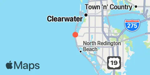
Location & Map
Latitude
27° 52' 36" N (27.8767)
Longitude
82° 51' 0" W (-82.85)
State
County
Nearest ZIP
33785
Nearby
Tides
5.8 mi
Madeira Beach Causeway, Boca Ciega Bay
6.0 mi
Clearwater
7.1 mi
Clearwater Beach, Gulf Of Mexico
7.6 mi
Johns Pass, Boca Ciega Bay
9.1 mi
Bay Aristocrat Village, Old Tampa Bay
10.1 mi
Dunedin, St. Joseph Sound
10.5 mi
Long Key, 0.5mi N. of Corey Causeway, Boca Ciega Bay
Currents
0.0 mi
The Narrows (Indian Rocks Beach Bridge)
5.8 mi
Clearwater Pass, 0.2 mi. NE of Sand Key
7.7 mi
Johns Pass Bridge, 0.3nm north of
7.7 mi
Johns Pass Bridge, north span
7.8 mi
Johns Pass Entrance
9.9 mi
Blind Pass (north end)
Note: Tide predictions are an estimate and NOT FOR NAVIGATION.
We also offer free widgets if you want to add tide or solunar tables to your own site.