Boca Chica Key Weekly Tide Tables and Charts
Tide Chart for Next 7 Days
Boca Chica Key weekly tide chart key:
The tide chart above shows the times and heights of high tide and low tide for Boca Chica Key, for the next seven days. The red line highlights the current time and estimated height.The tidal range at Boca Chica Key for the next seven days is approximately 1.31 ft with a minimum tide of 0 ft and maximum tide of 1.31 ft. You can also check out all the daily details on tides & fishing times on the Day tab for Boca Chica Key.
Tide Table for Next 7 Days
▲ Blue = High Tide
▼ Red = Low Tide
| Day | 1st Tide | 2nd Tide | 3rd Tide | 4th Tide | ☀ Sun |
Major Solunars
|
Minor Solunars
|
|
|---|---|---|---|---|---|---|---|---|
| 30 Thu |
|
▼ 0.35 ft |
▲ 1.31 ft |
▼ 0 ft |
▲ 0.87 ft |
▲ 6:54 AM ▼ 8:12 PM |
1:04 AM → 3:04 AM 1:24 PM → 3:24 PM |
7:12 AM → 8:12 AM 8:36 PM → 9:36 PM |
| 31 Fri |
|
▼ 0.32 ft |
▲ 1.29 ft |
▼ 0.05 ft |
▲ 6:55 AM ▼ 8:11 PM |
1:49 AM → 3:49 AM 2:07 PM → 4:07 PM |
8:07 AM → 9:07 AM 9:08 PM → 10:08 PM |
|
| 1 Sat |
|
▲ 0.94 ft |
▼ 0.29 ft |
▲ 1.24 ft |
▼ 0.1 ft |
▲ 6:55 AM ▼ 8:11 PM |
2:32 AM → 4:32 AM 2:50 PM → 4:50 PM |
9:02 AM → 10:02 AM 9:39 PM → 10:39 PM |
| 2 Sun |
|
▲ 1.01 ft |
▼ 0.26 ft |
▲ 1.15 ft |
▼ 0.17 ft |
▲ 6:56 AM ▼ 8:10 PM |
3:15 AM → 5:15 AM 3:33 PM → 5:33 PM |
9:56 AM → 10:56 AM 10:11 PM → 11:11 PM |
| 3 Mon |
|
▲ 1.07 ft |
▼ 0.22 ft |
▲ 1.02 ft |
▼ 0.24 ft |
▲ 6:56 AM ▼ 8:10 PM |
3:58 AM → 5:58 AM 4:18 PM → 6:18 PM |
10:52 AM → 11:52 AM 10:44 PM → 11:44 PM |
| 4 Tue |
|
▲ 1.13 ft |
▼ 0.18 ft |
▲ 0.88 ft |
▼ 0.3 ft |
▲ 6:57 AM ▼ 8:09 PM |
4:44 AM → 6:44 AM 5:05 PM → 7:05 PM |
11:50 AM → 12:50 PM 11:20 PM → 12:20 AM |
| 5 Wed |
|
▲ 1.17 ft |
▼ 0.13 ft |
▲ 0.73 ft |
▼ 0.36 ft |
▲ 6:57 AM ▼ 8:08 PM |
5:33 AM → 7:33 AM 5:56 PM → 7:56 PM |
12:51 PM → 1:51 PM |
Buoy Weather
Air Temperature
89° F
Water Temperature
89° F
Wind
3 knots S (190°)
Wind Gust
6 knots
Atmospheric Pressure
1018 hPa
Note: Observations are from a weather buoy 5.98 miles from the prediction site. Observations are not available at all prediction sites, and observation types vary between sites.
More details: Station kywf1 Buoy Weather
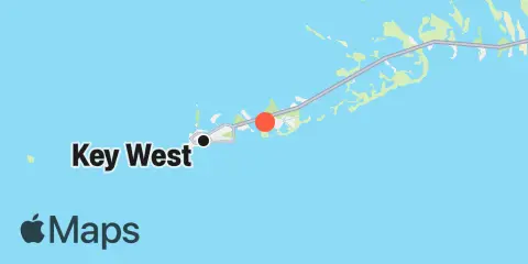
Location & Map
Latitude
24° 33' 48" N (24.5633)
Longitude
81° 42' 48" W (-81.7133)
State
County
Nearest ZIP
33040
Nearby
Tides
0.9 mi
Boca Chica Marina
1.1 mi
Boca Chica Channel Bridge
2.0 mi
Key Haven - Stock Island Channel
2.4 mi
Cow Key Channel
2.4 mi
Riviera Canal, Key West
2.9 mi
Channel Key, west side
2.9 mi
Boca Chica Key, Long Point
3.4 mi
Rockland Key, Rockland Channel Bridge
4.2 mi
Sigsbee Park, Garrison Bight Channel
4.5 mi
Duck Key Point, Duck Key, Waltz Key Basin
4.5 mi
Big Coppitt Key, Northeast Side, Waltz Key Basin
4.6 mi
Key West, South Side, White Street Pier
5.0 mi
Bird Key, Similar Sound
5.1 mi
Shark Key, southeast end, Similar Sound
5.5 mi
Fleming Key, North End
5.7 mi
O'Hara Key, North End, Waltz Key Basin
6.0 mi
Key West
6.3 mi
Saddlebunch Keys, Similar Sound
6.6 mi
Saddlebunch Keys, Channel No. 5
6.9 mi
Waltz Key, Waltz Key Basin
7.0 mi
Saddlebunch Keys, Channel No. 4
8.1 mi
Saddlebunch Keys, Channel No. 3
8.9 mi
Snipe Keys, Middle Narrows
9.2 mi
Snipe Keys, Snipe Point
9.3 mi
Snipe Keys, Southeast End, Inner Narrows
10.8 mi
Perky, Upper Sugarloaf Sound
11.8 mi
North Harris Channel, Upper Sugarloaf Sound
Currents
5.6 mi
Fleming Key Cut
5.8 mi
Fleming Key, North of
5.8 mi
Turning Basin
6.0 mi
Key West Harbor Range channel
6.1 mi
Man of War Harbor
6.1 mi
Ft. Taylor, 0.6 mile N of
6.6 mi
Key West, 0.3 mi. W of Ft. Taylor
7.1 mi
Key West Channel, Cut-A Cut-B Turn
7.7 mi
Northwest Channel, W of Middle Ground
7.7 mi
Southwest channel
8.9 mi
Main Ship Channel Entrance
10.6 mi
Northwest Channel, W of Calda Bank
Note: Tide predictions are an estimate and NOT FOR NAVIGATION.
We also offer free widgets if you want to add tide or solunar tables to your own site.