Wilmington Marine Terminal Weekly Tide Tables and Charts
Tide Chart for Next 7 Days
Wilmington Marine Terminal weekly tide chart key:
The tide chart above shows the times and heights of high tide and low tide for Wilmington Marine Terminal, for the next seven days. The red line highlights the current time and estimated height.The tidal range at Wilmington Marine Terminal for the next seven days is approximately 5.52 ft with a minimum tide of 0.5 ft and maximum tide of 6.02 ft. You can also check out all the daily details on tides & fishing times on the Day tab for Wilmington Marine Terminal.
Tide Table for Next 7 Days
▲ Blue = High Tide
▼ Red = Low Tide
| Day | 1st Tide | 2nd Tide | 3rd Tide | 4th Tide | ☀ Sun |
Major Solunars
|
Minor Solunars
|
|
|---|---|---|---|---|---|---|---|---|
| 30 Thu |
|
▲ 6.02 ft |
▼ 0.5 ft |
▲ 5.11 ft |
▼ 0.68 ft |
▲ 5:59 AM ▼ 8:17 PM |
12:39 AM → 2:39 AM 12:55 PM → 2:55 PM |
6:19 AM → 7:19 AM 8:32 PM → 9:32 PM |
| 31 Fri |
|
▲ 6 ft |
▼ 0.51 ft |
▲ 5.2 ft |
▼ 0.7 ft |
▲ 6:00 AM ▼ 8:16 PM |
1:23 AM → 3:23 AM 1:39 PM → 3:39 PM |
7:23 AM → 8:23 AM 8:56 PM → 9:56 PM |
| 1 Sat |
|
▲ 5.97 ft |
▼ 0.52 ft |
▲ 5.35 ft |
▼ 0.75 ft |
▲ 6:01 AM ▼ 8:15 PM |
2:07 AM → 4:07 AM 2:22 PM → 4:22 PM |
8:27 AM → 9:27 AM 9:18 PM → 10:18 PM |
| 2 Sun |
|
▲ 5.93 ft |
▼ 0.52 ft |
▲ 5.53 ft |
▼ 0.83 ft |
▲ 6:02 AM ▼ 8:14 PM |
2:49 AM → 4:49 AM 3:05 PM → 5:05 PM |
9:31 AM → 10:31 AM 9:40 PM → 10:40 PM |
| 3 Mon |
|
▲ 5.84 ft |
▼ 0.53 ft |
▲ 5.72 ft |
▼ 0.95 ft |
▲ 6:03 AM ▼ 8:13 PM |
3:33 AM → 5:33 AM 3:50 PM → 5:50 PM |
10:37 AM → 11:37 AM 10:03 PM → 11:03 PM |
| 4 Tue |
|
▲ 5.7 ft |
▼ 0.55 ft |
▲ 5.87 ft |
▼ 1.1 ft |
▲ 6:04 AM ▼ 8:12 PM |
4:18 AM → 6:18 AM 4:37 PM → 6:37 PM |
11:45 AM → 12:45 PM 10:29 PM → 11:29 PM |
| 5 Wed |
|
▲ 5.5 ft |
▼ 0.62 ft |
▲ 5.95 ft |
▲ 6:05 AM ▼ 8:11 PM |
5:07 AM → 7:07 AM 5:28 PM → 7:28 PM |
12:56 PM → 1:56 PM 11:01 PM → 12:01 AM |
Buoy Weather
Air Temperature
72° F
Water Temperature
80° F
Atmospheric Pressure
1006 hPa
Note: Observations are from a weather buoy 8.4 miles from the prediction site. Observations are not available at all prediction sites, and observation types vary between sites.
More details: Station mrcp1 Buoy Weather
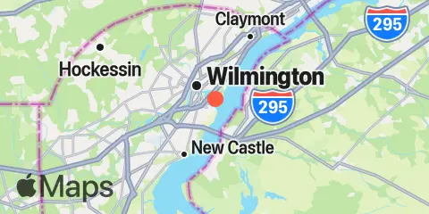
Location & Map
Latitude
39° 43' 6" N (39.7183)
Longitude
75° 31' 12" W (-75.52)
State
County
Nearest ZIP
19801
Nearby
Tides
2.2 mi
Millside, RR. bridge, Christina River
2.5 mi
Salem Canal entrance, Delaware River
2.6 mi
Edgemoor, Delaware River
4.8 mi
New Castle, Delaware River
6.9 mi
Pedricktown, Oldmans Creek, Delaware River
8.5 mi
Auburn, Oldmans Creek, Delaware River
8.7 mi
Marcus Hook
9.8 mi
Pea Patch Island, Bulkhead Shoal Channel, Delaware River
10.1 mi
Salem, Salem River
10.1 mi
Delaware City, Delaware River
10.3 mi
Sinnickson Landing, Salem River
10.7 mi
Bridgeport, Raccoon Creek
10.9 mi
Delaware City Branch Channel bridge, Delaware River
11.4 mi
Reedy Point, C&D Canal
Currents
0.6 mi
Christina River, 0.9 n.mi. above ent
1.3 mi
Deepwater Point, 0.5 nm NW of
2.5 mi
Edgemoor
4.4 mi
Kelly Point, 0.7nm N of
6.9 mi
Marcus Hook Bar (north)
7.6 mi
Penns Neck, 0.3 mile west of
7.7 mi
Penns Neck, 0.6 mile west of
8.3 mi
Finns Point, 0.60 n.mi. Northwest of
9.0 mi
Pea Patch Island
10.0 mi
Bulkhead Shoal Channel, off Del. City
10.2 mi
Salem River Entrance, east of marker 11
10.3 mi
Bulkhead Shoal Channel, SE, Del. City
10.3 mi
Salem River entrance
10.8 mi
Chesapeake and Delaware Canal Entrance
11.2 mi
Reedy Point
11.2 mi
Reedy Point Radio Tower, south of
Note: Tide predictions are an estimate and NOT FOR NAVIGATION.
We also offer free widgets if you want to add tide or solunar tables to your own site.