Greys Island Tides & Fishing Times
Tides
Greys Island tide chart key:
The tide chart above shows the times and heights of high tide and low tide for Greys Island, as well as solunar period times (represented by fish icons). The red line highlights the current time and estimated height.| Day | Time | Tide | Height | |
|---|---|---|---|---|
| 1 Sat | ▼ Low | 1.57 ft | ||
| 2 Sun | ▲ High | 15.22 ft | ||
| 2 Sun | ▼ Low | -0.67 ft | ||
| 2 Sun | ▲ High | 15.22 ft | ||
| 2 Sun | ▼ Low | 1.39 ft | ||
| 3 Mon | ▲ High | 14.4 ft |
Sunday, August 2, 2026 7:45 AM: The tide is currently falling at Greys Island with a current estimated height of 3.2 ft. The last tide was High at 3:37 AM and the next tide is a Low of -0.67 ft at 9:42 AM. The tidal range today is approximately 15.89 ft with a minimum tide of -0.67 ft and maximum tide of 15.22 ft.
Next 7 Days
▲ Blue = High Tide
▼ Red = Low Tide
| Day | 1st Tide | 2nd Tide | 3rd Tide | 4th Tide | ☀ Sun |
Major Solunars
|
Minor Solunars
|
|
|---|---|---|---|---|---|---|---|---|
| 2 Sun |
|
▲ 15.22 ft |
▼ -0.67 ft |
▲ 15.22 ft |
▼ 1.39 ft |
▲ 4:54 AM ▼ 8:58 PM |
2:44 AM → 4:44 AM 2:55 PM → 4:55 PM |
9:33 AM → 10:33 AM 9:18 PM → 10:18 PM |
| 3 Mon |
|
▲ 14.4 ft |
▼ 0.24 ft |
▲ 15.26 ft |
▼ 1.37 ft |
▲ 4:56 AM ▼ 8:55 PM |
3:28 AM → 5:28 AM 3:40 PM → 5:40 PM |
10:57 AM → 11:57 AM 9:24 PM → 10:24 PM |
| 4 Tue |
|
▲ 13.33 ft |
▼ 1.41 ft |
▲ 15.15 ft |
▼ 1.51 ft |
▲ 4:58 AM ▼ 8:53 PM |
4:14 AM → 6:14 AM 4:28 PM → 6:28 PM |
12:24 PM → 1:24 PM 9:32 PM → 10:32 PM |
| 5 Wed |
|
▲ 12.13 ft |
▼ 2.74 ft |
▲ 14.89 ft |
▲ 5:00 AM ▼ 8:51 PM |
5:03 AM → 7:03 AM 5:19 PM → 7:19 PM |
1:55 PM → 2:55 PM 9:44 PM → 10:44 PM |
|
| 6 Thu |
|
▼ 1.66 ft |
▲ 11.05 ft |
▼ 4.07 ft |
▲ 14.59 ft |
▲ 5:02 AM ▼ 8:49 PM |
5:57 AM → 7:57 AM 6:22 PM → 8:22 PM |
3:28 PM → 4:28 PM 10:03 PM → 11:03 PM |
| 7 Fri |
|
▼ 1.56 ft |
▲ 10.56 ft |
▼ 5.09 ft |
▲ 14.52 ft |
▲ 5:04 AM ▼ 8:47 PM |
6:56 AM → 8:56 AM 7:26 PM → 9:26 PM |
5:15 PM → 6:15 PM 10:38 PM → 11:38 PM |
| 8 Sat |
|
▼ 0.93 ft |
▲ 11.01 ft |
▼ 5.34 ft |
▲ 14.98 ft |
▲ 5:06 AM ▼ 8:44 PM |
7:59 AM → 9:59 AM 8:33 PM → 10:33 PM |
6:29 PM → 7:29 PM |
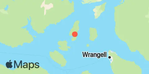
Location & Map
Latitude
56° 31' 18" N (56.5217)
Longitude
132° 32' 31" W (-132.542)
State
County
Nearest ZIP
99833
Nearby
Tides
6.6 mi
Dry Strait, Frederick Sound
6.9 mi
Wrangell, Wrangell Island
10.2 mi
Cosmos Point, Frederick Sound
10.6 mi
Ideal Cove, Mitkof Island, Frederick Sound
11.7 mi
Reef Point, Stikine Strait
Currents
2.2 mi
Blaquiere Point, 1 mile SSW of
5.2 mi
Wrangell Harbor, 1.6 miles west of
5.8 mi
Vank Island, off Neal Point
6.2 mi
Point Highfield
9.8 mi
South Craig Point
10.3 mi
Cosmos Point, 0.5 mile east of
11.0 mi
East Point, east of
Note: Tide predictions are an estimate and NOT FOR NAVIGATION.
We also offer free widgets if you want to add tide or solunar tables to your own site.