Arletta Weekly Tide Tables and Charts
Tide Chart for Next 7 Days
Arletta weekly tide chart key:
The tide chart above shows the times and heights of high tide and low tide for Arletta, for the next seven days. The red line highlights the current time and estimated height.The tidal range at Arletta for the next seven days is approximately 15.19 ft with a minimum tide of -1.33 ft and maximum tide of 13.86 ft. You can also check out all the daily details on tides & fishing times on the Day tab for Arletta.
Tide Table for Next 7 Days
▲ Blue = High Tide
▼ Red = Low Tide
| Day | 1st Tide | 2nd Tide | 3rd Tide | 4th Tide | ☀ Sun |
Major Solunars
|
Minor Solunars
|
|
|---|---|---|---|---|---|---|---|---|
| 30 Thu |
|
▼ 6.87 ft |
▲ 11.41 ft |
▼ -1.33 ft |
▲ 13.45 ft |
▲ 5:47 AM ▼ 8:46 PM |
12:53 AM → 2:53 AM 1:07 PM → 3:07 PM |
6:17 AM → 7:17 AM 8:58 PM → 9:58 PM |
| 31 Fri |
|
▼ 6.24 ft |
▲ 11.32 ft |
▼ -0.97 ft |
▲ 13.63 ft |
▲ 5:48 AM ▼ 8:45 PM |
1:37 AM → 3:37 AM 1:51 PM → 3:51 PM |
7:28 AM → 8:28 AM 9:15 PM → 10:15 PM |
| 1 Sat |
|
▼ 5.42 ft |
▲ 11.12 ft |
▼ -0.25 ft |
▲ 13.79 ft |
▲ 5:49 AM ▼ 8:44 PM |
2:21 AM → 4:21 AM 2:35 PM → 4:35 PM |
8:39 AM → 9:39 AM 9:31 PM → 10:31 PM |
| 2 Sun |
|
▼ 4.44 ft |
▲ 10.82 ft |
▼ 0.84 ft |
▲ 13.86 ft |
▲ 5:51 AM ▼ 8:42 PM |
3:03 AM → 5:03 AM 3:18 PM → 5:18 PM |
9:49 AM → 10:49 AM 9:47 PM → 10:47 PM |
| 3 Mon |
|
▼ 3.36 ft |
▲ 10.46 ft |
▼ 2.28 ft |
▲ 13.81 ft |
▲ 5:52 AM ▼ 8:41 PM |
3:47 AM → 5:47 AM 4:03 PM → 6:03 PM |
11:02 AM → 12:02 PM 10:04 PM → 11:04 PM |
| 4 Tue |
|
▼ 2.26 ft |
▲ 10.12 ft |
▼ 3.97 ft |
▲ 13.62 ft |
▲ 5:53 AM ▼ 8:39 PM |
4:33 AM → 6:33 AM 4:50 PM → 6:50 PM |
12:17 PM → 1:17 PM 10:24 PM → 11:24 PM |
| 5 Wed |
|
▼ 1.21 ft |
▲ 9.92 ft |
▼ 5.72 ft |
▲ 13.34 ft |
▲ 5:54 AM ▼ 8:38 PM |
5:22 AM → 7:22 AM 5:42 PM → 7:42 PM |
1:35 PM → 2:35 PM 10:49 PM → 11:49 PM |
Buoy Weather
Air Temperature
57° F
Wind
3 knots SW (220°)
Wind Gust
4 knots
Note: Observations are from a weather buoy 10.98 miles from the prediction site. Observations are not available at all prediction sites, and observation types vary between sites.
More details: Station tcmw1 Buoy Weather
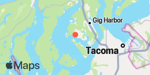
Location & Map
Latitude
47° 16' 48" N (47.28)
Longitude
122° 39' 7" W (-122.652)
State
County
Nearest ZIP
98335
Nearby
Tides
2.1 mi
Horsehead Bay, Carr Inlet, Puget Sound
4.7 mi
Tacoma Narrows Bridge, Puget Sound
5.0 mi
Home, Von Geldern Cove, Carr Inlet, Puget Sound
5.1 mi
Gig Harbor, Puget Sound
6.8 mi
Longbranch, Filucy Bay, Puget Sound
6.8 mi
Wauna, Carr Inlet, Puget Sound
7.0 mi
Yoman Point, Anderson Island, Balch Passage, Puget Sound
7.2 mi
Vaughn, Case Inlet, Puget Sound
7.7 mi
Steilacoom, Cormorant Passage, Puget Sound
7.7 mi
Tahlequah, Neil Pt., Dalco Passage, Vashon I., Puget Sound
8.8 mi
Sandy Point, Anderson Island, Puget Sound
9.4 mi
Devils Head, Drayton Passage, Puget Sound
10.1 mi
McMicken Island, Case Inlet, Puget Sound
10.7 mi
Allyn, Case Inlet, Puget Sound
11.2 mi
Dupont Wharf, Nisqually Reach, Puget Sound
11.2 mi
Tacoma, Commencement Bay, Sitcum Waterway, Puget Sound
11.9 mi
Burton, Quartermaster Hbr. (Inside), Vashon I., Puget Sound
12.3 mi
Henderson Inlet, Puget Sound
Currents
0.5 mi
Hale Passage, West end
3.5 mi
Hale Passage, East end
4.6 mi
The Narrows, South end (midstream)
4.8 mi
The Narrows, North End (west side)
4.8 mi
Pitt Passage, NE of Pitt Island
4.8 mi
Gig Harbor Entrance
5.0 mi
The Narrows, 0.3 miles North of Bridge
5.1 mi
The Narrows, North end - midstream
5.2 mi
Gibson Point, 0.8 miles East of
6.5 mi
Balch Passage, NE of Eagle Island
6.7 mi
Dalco Passage
7.1 mi
Steilacoom, 0.8 miles North of
8.5 mi
Drayton Passage
8.8 mi
Point Richmond, East of, Colvos Passage
9.1 mi
Ketron Island, West of
9.5 mi
Pickering Passage, North end
9.9 mi
Browns Point, 1.6 miles North of
10.5 mi
Devils Head, West of
11.5 mi
Nisqually Reach, 0.5 miles South of Lyle Point
Note: Tide predictions are an estimate and NOT FOR NAVIGATION.
We also offer free widgets if you want to add tide or solunar tables to your own site.