Mcmicken Island Tides & Fishing Times
Tides
Mcmicken Island tide chart key:
The tide chart above shows the times and heights of high tide and low tide for Mcmicken Island, as well as solunar period times (represented by fish icons). The red line highlights the current time and estimated height.| Day | Time | Tide | Height | |
|---|---|---|---|---|
| 30 Thu | ▲ High | 14.13 ft | ||
| 31 Fri | ▼ Low | 6.36 ft | ||
| 31 Fri | ▲ High | 11.9 ft | ||
| 31 Fri | ▼ Low | -0.99 ft | ||
| 31 Fri | ▲ High | 14.33 ft | ||
| 1 Sat | ▼ Low | 5.52 ft |
Friday, July 31, 2026 2:17 PM: The tide is currently rising at Mcmicken Island with a current estimated height of -0.5 ft. The last tide was Low at 1:35 PM and the next tide is a High of 14.33 ft at 8:30 PM. The tidal range today is approximately 15.32 ft with a minimum tide of -0.99 ft and maximum tide of 14.33 ft.
Next 7 Days
▲ Blue = High Tide
▼ Red = Low Tide
| Day | 1st Tide | 2nd Tide | 3rd Tide | 4th Tide | ☀ Sun |
Major Solunars
|
Minor Solunars
|
|
|---|---|---|---|---|---|---|---|---|
| 31 Fri |
|
▼ 6.36 ft |
▲ 11.9 ft |
▼ -0.99 ft |
▲ 14.33 ft |
▲ 5:49 AM ▼ 8:46 PM |
1:38 AM → 3:38 AM 1:52 PM → 3:52 PM |
7:29 AM → 8:29 AM 9:16 PM → 10:16 PM |
| 1 Sat |
|
▼ 5.52 ft |
▲ 11.68 ft |
▼ -0.26 ft |
▲ 14.5 ft |
▲ 5:50 AM ▼ 8:44 PM |
2:21 AM → 4:21 AM 2:35 PM → 4:35 PM |
8:39 AM → 9:39 AM 9:32 PM → 10:32 PM |
| 2 Sun |
|
▼ 4.53 ft |
▲ 11.37 ft |
▼ 0.86 ft |
▲ 14.57 ft |
▲ 5:52 AM ▼ 8:43 PM |
3:04 AM → 5:04 AM 3:18 PM → 5:18 PM |
9:50 AM → 10:50 AM 9:47 PM → 10:47 PM |
| 3 Mon |
|
▼ 3.43 ft |
▲ 11 ft |
▼ 2.33 ft |
▲ 14.51 ft |
▲ 5:53 AM ▼ 8:42 PM |
3:48 AM → 5:48 AM 4:04 PM → 6:04 PM |
11:03 AM → 12:03 PM 10:05 PM → 11:05 PM |
| 4 Tue |
|
▼ 2.3 ft |
▲ 10.64 ft |
▼ 4.04 ft |
▲ 14.32 ft |
▲ 5:54 AM ▼ 8:40 PM |
4:34 AM → 6:34 AM 4:51 PM → 6:51 PM |
12:18 PM → 1:18 PM 10:25 PM → 11:25 PM |
| 5 Wed |
|
▼ 1.23 ft |
▲ 10.43 ft |
▼ 5.83 ft |
▲ 14.02 ft |
▲ 5:55 AM ▼ 8:39 PM |
5:23 AM → 7:23 AM 5:43 PM → 7:43 PM |
1:36 PM → 2:36 PM 10:50 PM → 11:50 PM |
| 6 Thu |
|
▼ 0.28 ft |
▲ 10.6 ft |
▼ 7.46 ft |
▲ 13.66 ft |
▲ 5:57 AM ▼ 8:37 PM |
6:17 AM → 8:17 AM 6:40 PM → 8:40 PM |
2:56 PM → 3:56 PM 11:24 PM → 12:24 AM |
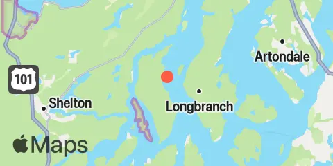
Location & Map
Latitude
47° 14' 48" N (47.2467)
Longitude
122° 51' 43" W (-122.862)
State
County
Nearest ZIP
98584
Nearby
Tides
3.7 mi
Walkers Landing, Pickering Passage, Puget Sound
5.0 mi
Arcadia, Totten Inlet, Puget Sound
5.3 mi
Home, Von Geldern Cove, Carr Inlet, Puget Sound
5.7 mi
Longbranch, Filucy Bay, Puget Sound
6.4 mi
Henderson Inlet, Puget Sound
7.2 mi
Devils Head, Drayton Passage, Puget Sound
7.5 mi
Dofflemeyer Point, Boston Hbr., Budd Inlet, Puget Sound
7.7 mi
Vaughn, Case Inlet, Puget Sound
9.3 mi
Barron Point, Little Snookum Inlet Entrance, Puget Sound
9.3 mi
Horsehead Bay, Carr Inlet, Puget Sound
9.6 mi
Allyn, Case Inlet, Puget Sound
9.9 mi
Yoman Point, Anderson Island, Balch Passage, Puget Sound
10.1 mi
Arletta, Hale Passage, Puget Sound
10.4 mi
Budd Inlet, south of Gull Harbor
10.6 mi
Shelton, Oakland Bay, Puget Sound
10.9 mi
Sandy Point, Anderson Island, Puget Sound
12.0 mi
Lynch Cove Dock
Currents
3.0 mi
Pickering Passage, off Graham Point
3.2 mi
Peale Passage, North end
3.9 mi
Pickering Passage, West of Squaxin Island
4.1 mi
Pickering Passage, North end
5.1 mi
Peale Passage, South end
5.6 mi
Squaxin Passage, North of Hunter Point
5.6 mi
Totten Inlet Entrance
5.8 mi
Dana Passage
6.8 mi
Libby Point, Hammersley Inlet
6.9 mi
Devils Head, West of
7.2 mi
Pitt Passage, NE of Pitt Island
7.6 mi
Drayton Passage
7.7 mi
Eld Inlet entrance
7.9 mi
Budd Inlet Entrance
8.8 mi
Hammersley Inlet, west of Skookum Point
8.9 mi
Balch Passage, NE of Eagle Island
9.6 mi
Hale Passage, West end
11.7 mi
Ketron Island, West of
11.8 mi
Nisqually Reach, 0.5 miles South of Lyle Point
Note: Tide predictions are an estimate and NOT FOR NAVIGATION.
We also offer free widgets if you want to add tide or solunar tables to your own site.