Beach Haven Coast Guard Station Weekly Tide Tables and Charts
Tide Chart for Next 7 Days
Beach Haven Coast Guard Station weekly tide chart key:
The tide chart above shows the times and heights of high tide and low tide for Beach Haven Coast Guard Station, for the next seven days. The red line highlights the current time and estimated height.The tidal range at Beach Haven Coast Guard Station for the next seven days is approximately 2.41 ft with a minimum tide of 0.08 ft and maximum tide of 2.49 ft. You can also check out all the daily details on tides & fishing times on the Day tab for Beach Haven Coast Guard Station.
Tide Table for Next 7 Days
▲ Blue = High Tide
▼ Red = Low Tide
| Day | 1st Tide | 2nd Tide | 3rd Tide | 4th Tide | ☀ Sun |
Major Solunars
|
Minor Solunars
|
|
|---|---|---|---|---|---|---|---|---|
| 30 Thu |
|
▼ 0.13 ft |
▲ 2.1 ft |
▼ 0.4 ft |
▲ 2.48 ft |
▲ 5:55 AM ▼ 8:12 PM |
12:33 AM → 2:33 AM 12:50 PM → 2:50 PM |
6:14 AM → 7:14 AM 8:27 PM → 9:27 PM |
| 31 Fri |
|
▼ 0.09 ft |
▲ 2.14 ft |
▼ 0.38 ft |
▲ 2.44 ft |
▲ 5:56 AM ▼ 8:11 PM |
1:18 AM → 3:18 AM 1:34 PM → 3:34 PM |
7:18 AM → 8:18 AM 8:50 PM → 9:50 PM |
| 1 Sat |
|
▼ 0.08 ft |
▲ 2.18 ft |
▼ 0.39 ft |
▲ 2.38 ft |
▲ 5:57 AM ▼ 8:10 PM |
2:01 AM → 4:01 AM 2:17 PM → 4:17 PM |
8:22 AM → 9:22 AM 9:13 PM → 10:13 PM |
| 2 Sun |
|
▼ 0.09 ft |
▲ 2.23 ft |
▼ 0.41 ft |
▲ 5:57 AM ▼ 8:09 PM |
2:44 AM → 4:44 AM 3:00 PM → 5:00 PM |
9:26 AM → 10:26 AM 9:35 PM → 10:35 PM |
|
| 3 Mon |
|
▲ 2.3 ft |
▼ 0.13 ft |
▲ 2.29 ft |
▼ 0.47 ft |
▲ 5:58 AM ▼ 8:07 PM |
3:28 AM → 5:28 AM 3:44 PM → 5:44 PM |
10:31 AM → 11:31 AM 9:58 PM → 10:58 PM |
| 4 Tue |
|
▲ 2.2 ft |
▼ 0.19 ft |
▲ 2.35 ft |
▼ 0.54 ft |
▲ 5:59 AM ▼ 8:06 PM |
4:13 AM → 6:13 AM 4:32 PM → 6:32 PM |
11:39 AM → 12:39 PM 10:25 PM → 11:25 PM |
| 5 Wed |
|
▲ 2.11 ft |
▼ 0.26 ft |
▲ 2.41 ft |
▼ 0.6 ft |
▲ 6:00 AM ▼ 8:05 PM |
5:02 AM → 7:02 AM 5:23 PM → 7:23 PM |
12:50 PM → 1:50 PM 10:56 PM → 11:56 PM |
Buoy Weather
Air Temperature
71° F
Wind
3 knots WSW (240°)
Atmospheric Pressure
1006 hPa
Note: Observations are from a weather buoy 11.09 miles from the prediction site. Observations are not available at all prediction sites, and observation types vary between sites.
More details: Station jcrn4 Buoy Weather
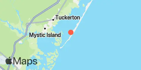
Location & Map
Latitude
39° 32' 54" N (39.5483)
Longitude
74° 15' 24" W (-74.2567)
State
County
Nearest ZIP
08008
Nearby
Tides
3.8 mi
Little Sheepshead Creek, Great Bay
4.5 mi
Tuckerton Creek entrance, Little Egg Harbor
4.5 mi
Westecunk Creek entrance, Little Egg Harbor
4.6 mi
Shooting Thorofare, Little Egg Inlet, Great Bay
4.8 mi
Seven Island, Newmans Thorofare, Great Bay
5.1 mi
Beach Haven Crest, Little Egg Harbor
5.5 mi
Parker Run, upper end, Little Egg Harbor
5.8 mi
Tuckerton, Tuckerton Creek, Little Egg Harbor
6.1 mi
West Creek, Westecunk Creek, Little Egg Harbor
7.0 mi
Graveling Point, Great Bay
7.3 mi
Cedar Run, Little Egg Harbor
7.5 mi
Dinner Point Creek, upper end, Little Egg Harbor
8.2 mi
Mill Creek, 1 n.mi. above entrance, Little Egg Harbor
8.2 mi
Manahawkin Drawbridge, Manahawkin Bay
8.3 mi
Main Marsh Thorofare
8.5 mi
Manahawkin Creek, Manahawkin Bay
9.7 mi
Brigantine Channel @ Hoffman Thorofare
10.2 mi
North Beach, Manahawkin Bay
10.3 mi
New Gretna, Bass River, Mullica River
10.9 mi
Chestnut Neck Boatyard, Mullica River
11.1 mi
Nacote Creek, U.S. Highway 9 bridge, Mullica River
11.5 mi
Flat Creek, Manahawkin Bay
Currents
8.0 mi
Manahawkin Drawbridge
Note: Tide predictions are an estimate and NOT FOR NAVIGATION.
We also offer free widgets if you want to add tide or solunar tables to your own site.