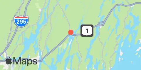
TidesPro
  • Recents
    • Wiscasset, Sheepscot River
  • Tides
    United States
    Alabama Alaska California Connecticut Delaware District of Columbia Florida Georgia Hawaii
    Louisiana Maine Maryland Massachusetts Mississippi New Hampshire New Jersey New York North Carolina
    Oregon Pennsylvania Rhode Island South Carolina Texas US Outlying Islands Virginia Washington Puerto Rico
    Caribbean
    The Bahamas Cayman Islands Cuba Dominican Republic Haiti Jamaica Virgin Islands (US)
  • Fishing  Coordinates
    Alabama - Alabama Inshore Public Reefs Alabama - Alabama Nearshore Public Reefs Alabama - Alabama Offshore Public Reefs California - California Artificial Reefs Delaware - Delaware Artificial Reefs Florida - Bay County Florida - Brevard County Florida - Broward County Florida - Charlote and Lee Counties Florida - Citrus County Florida - Collier County Florida - Dixie County Florida - Duval County Florida - Escambia County Florida - Flagler County Florida - Florida Keys Florida - Franklin County Florida - Gulf County Florida - Hernando County
    Florida - Indian River County Florida - Levy County Florida - Manatee County Florida - Martin County Florida - Miami-Dade County Florida - Monroe County Florida - Nassau County Florida - Okaloosa County Florida - Palm Beach County Florida - Pasco County Florida - Santa Rosa County Florida - Sarasota County Florida - St. Johns County Florida - St. Lucie County Florida - Tampa Bay Florida - Taylor County Florida - Volusia County Florida - Wakulla County Florida - Walton County
    Georgia - Georgia Reefs Hawaii - Hawaii Artificial Reefs Louisiana - Louisiana Artificial Reefs Maryland - Maryland Artificial Reefs Massachusetts - Massachusetts Artificial Reefs Mississippi - Mississippi Inshore Artificial Reefs Mississippi - Mississippi Offshore Artificial Reefs New Jersey - New Jersey Artificial Reefs New York - New York Artificial Reefs North Carolina - Estuarine North Carolina - Long Bay North Carolina - Onslow Bay North Carolina - Outer Banks North Carolina - Raleigh Bay Puerto Rico - Puerto Rico Artificial Reefs Rhode Island - Rhode Island Artificial Reefs South Carolina - South Carolina Reefs Texas - Texas Artificial Reefs Virginia - Virginia Artificial Reefs
  • Solunar Tables
Wiscasset Location
  1. United States
  2. Maine
  3. Wiscasset, Sheepscot River

Wiscasset Map

Day Week Month Table Month Chart Map
Latitude
44° 0' 0" N (44)
Longitude
69° 40' 0" W (-69.6667)
State
Maine
County
Lincoln County
Nearest ZIP
04578
Nearby
Tides 3.0 mi Back River, Sheepscot River 4.2 mi Sheepscot (below rapids), Sheepscot River 5.2 mi Cross River entrance, Sheepscot River 6.3 mi Walpole, Damariscotta River 6.9 mi Newcastle, Damariscotta River 8.5 mi Sturgeon Island, Merrymeeting Bay, Kennebec River 8.9 mi Richmond, Kennebec River 9.0 mi Bath, Kennebec River 9.2 mi Mill Point, Sasanoa River, Sheepscot River 9.7 mi Isle of Springs, Sheepscot River 10.2 mi East Boothbay, Damariscotta River 10.5 mi Boothbay Harbor 10.6 mi Southport, Townsend Gut 10.7 mi Robinhood, Sasanoa River, Sheepscot River 11.1 mi Pemaquid Harbor, Johns Bay 11.4 mi Bowdoinham, Cathance River, Kennebec River 11.4 mi Muscongus Harbor, Muscongus Sound 11.6 mi Androscoggin River entrance, Kennebec River 12.3 mi New Harbor, Muscongus Bay Currents 7.0 mi Sheepscot River, off Barter Island 8.1 mi Goose Cove, south of Chops Passage, Kennebec River 8.5 mi Maine Kennebec Bridge, 0.2 n.mi. SW of 8.5 mi Merrymeeting Bay, N of Chops Pass., Kennebec River 8.9 mi Upper Hell Gate, Sasanoa River 9.1 mi Lower Hell Gate, Knubble Bay 9.6 mi Damariscotta River, off Cavis Point 9.7 mi Bath Iron Works, Kennebec River 10.1 mi Lincoln Ledge, east of 10.5 mi Fiddler Ledge, north of 10.6 mi Lowe Point, NE of, Sasanoa River 10.8 mi Doubling Point, south of 11.9 mi Bluff Head, west of

About

TidesPro was created as an easy-to-use tides and solunar site. It provides tide predictions and marine weather for many types of people, whether you’re fishing, going to the beach, boating, kayaking, surfing, or planning a trip. With anglers in mind, it also provides an accessible way to find fishing spots and the best times to fish in those locations.

More About TidesPro

App

Apple App Store
[More Info]
Quick Links
  • When to Fish
  • Solunar Theory
  • Tide & Solunar Widgets for Your Site
  • Tide & Solunar Predictions in Google Earth
  • Things to Do
  • About

© Copyright 2017 - 2025 ASR Concepts LLC. All rights reserved.

  • Privacy Policy
  • •
  • Terms of Use
  • •
  • Contact
  • •
  • Bluesky
  • •
  • Mastodon