Phipps Point Tides
Unfortunately, this tide station is no longer active, and predictions are no longer accurate.
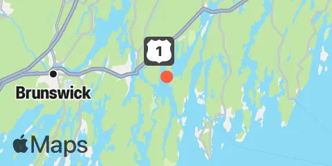
You can check out the map below -- any nearby locations will be displayed on the map and list below. Alternatively, you can browse the site for other active locations.
Location & Map
Latitude
43° 53' 54" N (43.8983)
Longitude
69° 44' 36" W (-69.7433)
State
County
Nearest ZIP
04578
Nearby
Tides
1.3 mi
Mill Point, Sasanoa River, Sheepscot River
3.2 mi
Robinhood, Sasanoa River, Sheepscot River
3.9 mi
Isle of Springs, Sheepscot River
4.0 mi
Bath, Kennebec River
4.1 mi
Cross River entrance, Sheepscot River
5.1 mi
Back River, Sheepscot River
5.4 mi
Southport, Townsend Gut
6.5 mi
Phippsburg, Kennebec River
6.6 mi
Boothbay Harbor
7.0 mi
Howard Point, New Meadows River, Casco Bay
7.4 mi
Sturgeon Island, Merrymeeting Bay, Kennebec River
8.0 mi
Wiscasset, Sheepscot River
8.1 mi
Androscoggin River entrance, Kennebec River
8.3 mi
East Boothbay, Damariscotta River
8.5 mi
Walpole, Damariscotta River
10.1 mi
Fort Popham, Hunniwell Point, Kennebec River
10.7 mi
Cundy Harbor, New Meadows River, Casco Bay
10.7 mi
Bowdoinham, Cathance River, Kennebec River
11.0 mi
Pemaquid Harbor, Johns Bay
11.1 mi
Brunswick, Androscoggin River, Kennebec River
11.6 mi
Damariscove Harbor, Damariscove Island
12.2 mi
Sheepscot (below rapids), Sheepscot River
Currents
1.4 mi
Upper Hell Gate, Sasanoa River
1.6 mi
Lower Hell Gate, Knubble Bay
2.6 mi
Sheepscot River, off Barter Island
2.9 mi
Fiddler Ledge, north of
3.3 mi
Bath Iron Works, Kennebec River
3.3 mi
Lincoln Ledge, east of
3.4 mi
Lowe Point, NE of, Sasanoa River
3.4 mi
Doubling Point, south of
4.0 mi
Bluff Head, west of
6.7 mi
Goose Cove, south of Chops Passage, Kennebec River
7.1 mi
Bald Head, 0.3 mile southwest of
7.5 mi
Merrymeeting Bay, N of Chops Pass., Kennebec River
8.1 mi
Damariscotta River, off Cavis Point
10.0 mi
Hunniwell Point, northeast of