Sawyer Key Tides
Unfortunately, this tide station is no longer active, and predictions are no longer accurate.
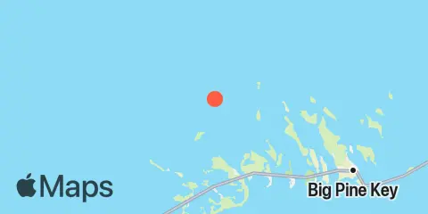
You can check out the map below -- any nearby locations will be displayed on the map and list below. Alternatively, you can browse the site for other active locations.
Location & Map
Latitude
24° 45' 30" N (24.7583)
Longitude
81° 33' 42" W (-81.5617)
State
County
Nearby
Tides
2.9 mi
Pumpkin Key, Bow Channel
3.9 mi
Johnston Key, southwest end, Turkey Basin
4.5 mi
Sugarloaf Key, North End, Bow Channel
5.1 mi
Raccoon Key, East Side
5.4 mi
Cudjoe Key, North End, Kemp Channel
5.4 mi
Content Keys, Content Passage
6.0 mi
Knockemdown Key, North End
6.2 mi
Sugarloaf Key, Northeast Side, Bow Channel
7.1 mi
Water Keys, South End, Harbor Channel
7.3 mi
Park Channel Bridge, Upper Sugarloaf Sound
7.3 mi
North Harris Channel, Upper Sugarloaf Sound
7.3 mi
Cudjoe Key, Pirates Cove
7.5 mi
Snipe Keys, Southeast End, Inner Narrows
7.6 mi
Big Torch Key, Harbor Channel
7.6 mi
Perky, Upper Sugarloaf Sound
7.7 mi
Snipe Keys, Middle Narrows
7.8 mi
Sugarloaf Key, Pirates Cove
8.1 mi
Cudjoe Key, Cudjoe Bay
8.4 mi
Howe Key, northwest end
8.4 mi
Snipe Keys, Snipe Point
8.9 mi
Big Torch Key, Niles Channel
8.9 mi
Kemp Channel Viaduct, Florida Keys
9.3 mi
Tarpon Creek, Upper Sugarloaf Sound
9.4 mi
Gopher Key, Cudjoe Bay
9.6 mi
Sugarloaf Key, East Side, Tarpon Creek
9.6 mi
Waltz Key, Waltz Key Basin
9.6 mi
Big Spanish Key
9.7 mi
Saddlebunch Keys, Channel No. 3
10.0 mi
Howe Key, South End, Harbor Channel
10.4 mi
Summerland Key, Niles Channel Bridge
10.4 mi
Summerland Key, southwest side, Kemp Channel
10.5 mi
Saddlebunch Keys, Channel No. 4
10.5 mi
Big Pine Key, North End
10.8 mi
Annette Key, North End, Big Spanish Channel
10.8 mi
Summerland Key, Niles Channel South
10.9 mi
Saddlebunch Keys, Channel No. 5
11.0 mi
Ramrod Key, Niles Channel Bridge
11.1 mi
O'Hara Key, North End, Waltz Key Basin
11.2 mi
Big Pine Key, Northeast Shore
11.6 mi
Saddlebunch Keys, Similar Sound
11.9 mi
Shark Key, southeast end, Similar Sound
12.0 mi
Key Lois, southeast end
12.1 mi
Middle Torch Key, Torch Ramrod Channel
12.1 mi
Duck Key Point, Duck Key, Waltz Key Basin
12.2 mi
Big Pine Key, West Side, Pine Channel
12.2 mi
Little Spanish Key, Spanish Banks
12.3 mi
Little Torch Key, Torch Channel
12.3 mi
Big Coppitt Key, Northeast Side, Waltz Key Basin
Currents
12.0 mi
Loggerhead Key, East of