Cedar Heights Weekly Tide Tables and Charts
Tide Chart for Next 7 Days
Cedar Heights weekly tide chart key:
The tide chart above shows the times and heights of high tide and low tide for Cedar Heights, for the next seven days. The red line highlights the current time and estimated height.The tidal range at Cedar Heights for the next seven days is approximately 3.22 ft with a minimum tide of 0.05 ft and maximum tide of 3.27 ft. You can also check out all the daily details on tides & fishing times on the Day tab for Cedar Heights.
Tide Table for Next 7 Days
▲ Blue = High Tide
▼ Red = Low Tide
| Day | 1st Tide | 2nd Tide | 3rd Tide | 4th Tide | ☀ Sun |
Major Solunars
|
Minor Solunars
|
|
|---|---|---|---|---|---|---|---|---|
| 30 Thu |
|
▼ 0.23 ft |
▲ 2.69 ft |
▼ 0.05 ft |
▲ 3.08 ft |
▲ 6:44 AM ▼ 8:22 PM |
1:04 AM → 3:04 AM 1:22 PM → 3:22 PM |
7:02 AM → 8:02 AM 8:43 PM → 9:43 PM |
| 31 Fri |
|
▼ 0.2 ft |
▲ 2.8 ft |
▼ 0.08 ft |
▲ 3.14 ft |
▲ 6:44 AM ▼ 8:21 PM |
1:48 AM → 3:48 AM 2:06 PM → 4:06 PM |
8:00 AM → 9:00 AM 9:12 PM → 10:12 PM |
| 1 Sat |
|
▼ 0.19 ft |
▲ 2.93 ft |
▼ 0.15 ft |
▲ 6:45 AM ▼ 8:21 PM |
2:32 AM → 4:32 AM 2:49 PM → 4:49 PM |
8:58 AM → 9:58 AM 9:40 PM → 10:40 PM |
|
| 2 Sun |
|
▲ 3.19 ft |
▼ 0.2 ft |
▲ 3.06 ft |
▼ 0.25 ft |
▲ 6:46 AM ▼ 8:20 PM |
3:15 AM → 5:15 AM 3:32 PM → 5:32 PM |
9:56 AM → 10:56 AM 10:08 PM → 11:08 PM |
| 3 Mon |
|
▲ 3.21 ft |
▼ 0.22 ft |
▲ 3.17 ft |
▼ 0.37 ft |
▲ 6:46 AM ▼ 8:19 PM |
3:58 AM → 5:58 AM 4:16 PM → 6:16 PM |
10:55 AM → 11:55 AM 10:38 PM → 11:38 PM |
| 4 Tue |
|
▲ 3.19 ft |
▼ 0.24 ft |
▲ 3.24 ft |
▼ 0.48 ft |
▲ 6:47 AM ▼ 8:18 PM |
4:44 AM → 6:44 AM 5:04 PM → 7:04 PM |
11:57 AM → 12:57 PM 11:11 PM → 12:11 AM |
| 5 Wed |
|
▲ 3.12 ft |
▼ 0.25 ft |
▲ 3.27 ft |
▼ 0.56 ft |
▲ 6:47 AM ▼ 8:17 PM |
5:32 AM → 7:32 AM 5:55 PM → 7:55 PM |
1:02 PM → 2:02 PM |
Buoy Weather
Water Temperature
87° F
Note: Observations are from a weather buoy 5.99 miles from the prediction site. Observations are not available at all prediction sites, and observation types vary between sites.
More details: Station jxuf1 Buoy Weather
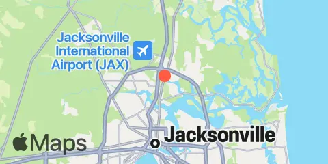
Location & Map
Latitude
30° 26' 12" N (30.4367)
Longitude
81° 38' 30" W (-81.6417)
State
County
Nearest ZIP
32218
Nearby
Tides
2.7 mi
Jacksonville, Navy Fuel Depot
3.3 mi
Moncrief Creek entrance, Trout River
3.7 mi
Phoenix Park
4.3 mi
Lake Forest, Ribault River, Trout River
5.3 mi
Sherwood Forest, Trout River
5.5 mi
Jacksonville, Long Branch
6.0 mi
Blount Island Bridge
6.1 mi
Dame Point, St. Johns River
7.5 mi
Edwards Creek, Nassau River
7.8 mi
Mink Creek entrance, Nassau River
8.1 mi
Clapboard Creek, Pelotes Island
8.1 mi
Main Street Bridge, St. Johns River
8.7 mi
Fulton
9.0 mi
Little Pottsburg Creek
9.8 mi
Tiger Point, Pumpkin Hill Creek, Nassau River
9.9 mi
Halfmoon Island, highway bridge, Nassau River
10.5 mi
Cuno, Lofton Creek, Nassau River
10.6 mi
Boggy Creek, 2 mi. above entrance, Nassau River
11.1 mi
Sawpit Creek, 1 mi. above entrance
11.3 mi
Sisters Creek
11.6 mi
Ortega River entrance
11.8 mi
Nassauville, Nassau River East
12.1 mi
Fort George Island, Fort George River
12.2 mi
Sawpit Creek entrance, bridge
12.3 mi
Pablo Creek entrance
Currents
3.0 mi
Drummond Point, channel south of
3.3 mi
Reddie Point
3.8 mi
Trout River Cut
4.1 mi
Chaseville Turn
5.7 mi
Terminal Channel (north end)
6.1 mi
Dames Point Bridge
6.3 mi
Dames Point, 0.23 n.mi. ESE of
8.0 mi
Jacksonville, off Washington St
8.0 mi
Acosta Bridge
8.3 mi
Commodore Point, terminal channel
8.5 mi
Blount Island, East of
9.1 mi
Winter Point
9.2 mi
St. Johns Bluff
11.2 mi
Sisters Creek entrance (bridge)
11.4 mi
Ft. George River
11.7 mi
ICW Intersection
11.7 mi
Nassau River, SW of Mesa Marsh
Note: Tide predictions are an estimate and NOT FOR NAVIGATION.
We also offer free widgets if you want to add tide or solunar tables to your own site.