Sisters Creek Tides & Fishing Times
Tides
Sisters Creek tide chart key:
The tide chart above shows the times and heights of high tide and low tide for Sisters Creek, as well as solunar period times (represented by fish icons). The red line highlights the current time and estimated height.| Day | Time | Tide | Height | |
|---|---|---|---|---|
| 1 Sat | ▲ High | 4.65 ft | ||
| 2 Sun | ▼ Low | 0.09 ft | ||
| 2 Sun | ▲ High | 4.34 ft | ||
| 2 Sun | ▼ Low | 0.17 ft | ||
| 3 Mon | ▲ High | 4.57 ft |
Sunday, August 2, 2026 11:44 AM: The tide is currently rising at Sisters Creek with a current estimated height of 4.2 ft. The last tide was Low at 6:23 AM and the next tide is a High of 4.34 ft at 12:17 PM. The tidal range today is approximately 4.25 ft with a minimum tide of 0.09 ft and maximum tide of 4.34 ft.
Next 7 Days
▲ Blue = High Tide
▼ Red = Low Tide
| Day | 1st Tide | 2nd Tide | 3rd Tide | 4th Tide | ☀ Sun |
Major Solunars
|
Minor Solunars
|
|
|---|---|---|---|---|---|---|---|---|
| 2 Sun |
|
▼ 0.09 ft |
▲ 4.34 ft |
▼ 0.17 ft |
▲ 6:45 AM ▼ 8:19 PM |
3:14 AM → 5:14 AM 3:31 PM → 5:31 PM |
9:55 AM → 10:55 AM 10:08 PM → 11:08 PM |
|
| 3 Mon |
|
▲ 4.57 ft |
▼ 0.07 ft |
▲ 4.46 ft |
▼ 0.31 ft |
▲ 6:45 AM ▼ 8:18 PM |
3:57 AM → 5:57 AM 4:16 PM → 6:16 PM |
10:55 AM → 11:55 AM 10:37 PM → 11:37 PM |
| 4 Tue |
|
▲ 4.44 ft |
▼ 0.07 ft |
▲ 4.54 ft |
▼ 0.45 ft |
▲ 6:46 AM ▼ 8:17 PM |
4:43 AM → 6:43 AM 5:03 PM → 7:03 PM |
11:56 AM → 12:56 PM 11:10 PM → 12:10 AM |
| 5 Wed |
|
▲ 4.27 ft |
▼ 0.06 ft |
▲ 4.58 ft |
▼ 0.56 ft |
▲ 6:47 AM ▼ 8:17 PM |
5:32 AM → 7:32 AM 5:54 PM → 7:54 PM |
1:01 PM → 2:01 PM |
| 6 Thu |
|
▲ 4.08 ft |
▼ 0.05 ft |
▲ 4.62 ft |
▼ 0.63 ft |
▲ 6:47 AM ▼ 8:16 PM |
6:25 AM → 8:25 AM 6:50 PM → 8:50 PM |
11:48 PM → 12:48 AM 2:08 PM → 3:08 PM |
| 7 Fri |
|
▲ 3.91 ft |
▼ 0.02 ft |
▲ 4.72 ft |
▼ 0.62 ft |
▲ 6:48 AM ▼ 8:15 PM |
7:23 AM → 9:23 AM 7:52 PM → 9:52 PM |
12:33 AM → 1:33 AM 3:18 PM → 4:18 PM |
| 8 Sat |
|
▲ 3.85 ft |
▼ -0.02 ft |
▲ 4.89 ft |
▲ 6:48 AM ▼ 8:14 PM |
8:26 AM → 10:26 AM 8:58 PM → 10:58 PM |
1:27 AM → 2:27 AM 4:26 PM → 5:26 PM |
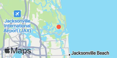
Location & Map
Latitude
30° 25' 0" N (30.4167)
Longitude
81° 27' 12" W (-81.4533)
State
County
Nearest ZIP
32226
Nearby
Tides
1.8 mi
Fort George Island, Fort George River
2.0 mi
Bar Pilot Dock, St. Johns River
2.1 mi
Mayport (Ferry Depot)
2.7 mi
Water Treatment Dock, Mayport Naval Station, St Johns River
2.8 mi
Pablo Creek entrance
3.0 mi
Little Talbot Island, Ocean
3.5 mi
Clapboard Creek, Pelotes Island
3.6 mi
Simpson Creek, A1A highway bridge
3.7 mi
Fulton
3.7 mi
Degaussing structure, Mayport Naval Station
5.5 mi
Blount Island Bridge
6.1 mi
Sawpit Creek, 1 mi. above entrance
6.4 mi
Tiger Point, Pumpkin Hill Creek, Nassau River
6.5 mi
Pablo Creek, ICWW bridge
6.6 mi
Dame Point, St. Johns River
6.6 mi
Atlantic Beach
6.7 mi
Sawpit Creek entrance, bridge
7.0 mi
Nassau River entrance
7.9 mi
Edwards Creek, Nassau River
10.0 mi
Jacksonville Beach
10.4 mi
Jacksonville, Navy Fuel Depot
10.7 mi
Jacksonville, Long Branch
11.1 mi
Nassauville, Nassau River East
11.2 mi
Phoenix Park
11.3 mi
Mink Creek entrance, Nassau River
11.3 mi
Cedar Heights, Broward River
11.4 mi
Oak Landing, ICWW
11.8 mi
Amelia City, South Amelia River
11.9 mi
Little Pottsburg Creek
Currents
1.9 mi
Sisters Creek entrance (bridge)
2.0 mi
Mayport
2.3 mi
Mile Point LB 20
2.4 mi
ICW Intersection
2.8 mi
Ft. George River
3.2 mi
St. Johns Bluff
3.6 mi
St. Johns Bar Cut, 0.7 n.mi. east of jetties
3.7 mi
Mayport Basin Entrance
3.7 mi
Blount Island, East of
4.2 mi
St. Johns River Ent. (between jetties)
4.9 mi
Bar Cut, 0.6 n.mi. ENE of St. John's Point
6.3 mi
Dames Point, 0.23 n.mi. ESE of
6.5 mi
Pablo Creek bascule bridge
6.6 mi
Dames Point Bridge
7.4 mi
Midsound, 1 mi. N of Sawpit Creek entrance
8.2 mi
Nassau River, SW of Mesa Marsh
8.3 mi
South Amelia River, off Walker Creek
8.9 mi
Drummond Point, channel south of
10.5 mi
Reddie Point
10.7 mi
Terminal Channel (north end)
10.7 mi
Trout River Cut
10.8 mi
Chaseville Turn
12.4 mi
Commodore Point, terminal channel
Note: Tide predictions are an estimate and NOT FOR NAVIGATION.
We also offer free widgets if you want to add tide or solunar tables to your own site.