Bahia Mar Yacht Club Tides & Fishing Times
Tides
Bahia Mar Yacht Club tide chart key:
The tide chart above shows the times and heights of high tide and low tide for Bahia Mar Yacht Club, as well as solunar period times (represented by fish icons). The red line highlights the current time and estimated height.| Day | Time | Tide | Height | |
|---|---|---|---|---|
| 1 Sat | ▲ High | 2.59 ft | ||
| 2 Sun | ▼ Low | 0.11 ft | ||
| 2 Sun | ▲ High | 2.54 ft | ||
| 2 Sun | ▼ Low | 0.21 ft | ||
| 3 Mon | ▲ High | 2.55 ft |
Sunday, August 2, 2026 11:50 AM: The tide is currently rising at Bahia Mar Yacht Club with a current estimated height of 2.5 ft. The last tide was Low at 5:48 AM and the next tide is a High of 2.54 ft at 11:51 AM. The tidal range today is approximately 2.43 ft with a minimum tide of 0.11 ft and maximum tide of 2.54 ft.
Next 7 Days
▲ Blue = High Tide
▼ Red = Low Tide
| Day | 1st Tide | 2nd Tide | 3rd Tide | 4th Tide | ☀ Sun |
Major Solunars
|
Minor Solunars
|
|
|---|---|---|---|---|---|---|---|---|
| 2 Sun |
|
▼ 0.11 ft |
▲ 2.54 ft |
▼ 0.21 ft |
▲ 6:47 AM ▼ 8:06 PM |
3:08 AM → 5:08 AM 3:27 PM → 5:27 PM |
9:50 AM → 10:50 AM 10:04 PM → 11:04 PM |
|
| 3 Mon |
|
▲ 2.55 ft |
▼ 0.05 ft |
▲ 2.53 ft |
▼ 0.33 ft |
▲ 6:47 AM ▼ 8:06 PM |
3:52 AM → 5:52 AM 4:11 PM → 6:11 PM |
10:46 AM → 11:46 AM 10:36 PM → 11:36 PM |
| 4 Tue |
|
▲ 2.49 ft |
▼ 0.02 ft |
▲ 2.51 ft |
▼ 0.46 ft |
▲ 6:48 AM ▼ 8:05 PM |
4:37 AM → 6:37 AM 4:58 PM → 6:58 PM |
11:45 AM → 12:45 PM 11:11 PM → 12:11 AM |
| 5 Wed |
|
▲ 2.43 ft |
▼ 0.02 ft |
▲ 2.48 ft |
▼ 0.59 ft |
▲ 6:48 AM ▼ 8:04 PM |
5:26 AM → 7:26 AM 5:49 PM → 7:49 PM |
12:47 PM → 1:47 PM |
| 6 Thu |
|
▲ 2.38 ft |
▼ 0.02 ft |
▲ 2.47 ft |
▼ 0.67 ft |
▲ 6:49 AM ▼ 8:04 PM |
6:19 AM → 8:19 AM 6:45 PM → 8:45 PM |
11:51 PM → 12:51 AM 1:53 PM → 2:53 PM |
| 7 Fri |
|
▲ 2.36 ft |
▼ -0.01 ft |
▲ 2.49 ft |
▼ 0.67 ft |
▲ 6:49 AM ▼ 8:03 PM |
7:17 AM → 9:17 AM 7:47 PM → 9:47 PM |
12:38 AM → 1:38 AM 3:00 PM → 4:00 PM |
| 8 Sat |
|
▲ 2.4 ft |
▼ -0.08 ft |
▲ 2.58 ft |
▼ 0.58 ft |
▲ 6:50 AM ▼ 8:02 PM |
8:20 AM → 10:20 AM 8:52 PM → 10:52 PM |
1:34 AM → 2:34 AM 4:08 PM → 5:08 PM |
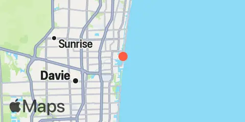
Location & Map
Latitude
26° 6' 48" N (26.1133)
Longitude
80° 6' 30" W (-80.1083)
State
County
Nearest ZIP
33316
Nearby
Tides
0.9 mi
Mayan Lake
1.8 mi
Port Everglades, Turning Basin
2.2 mi
South Port Everglades, ICWW
2.3 mi
Andrews Avenue bridge, New River, Fort Lauderdale
2.3 mi
Whiskey Creek, North End
3.9 mi
Port Laudania, Dania cut-off Canal
4.0 mi
Whiskey Creek, South Entrance, ICWW
5.0 mi
Hollywood Beach, West Lake, North End
5.1 mi
Hollywood Beach
5.3 mi
Lauderdale-by-the-Sea, Anglin Fishing Pier
5.6 mi
Hollywood Beach, West Lake, South End
10.1 mi
Hillsboro Inlet (Ocean)
10.2 mi
Hillsboro Inlet, Coast Guard Light Station
10.2 mi
Golden Beach, ICWW
10.2 mi
Hillsboro Inlet Marina
11.2 mi
Hillsboro Beach, ICWW
11.9 mi
Dumfoundling Bay
Currents
0.7 mi
Fort Lauderdale, New River
1.2 mi
17th Street Bridge
1.4 mi
Turning Basin
1.4 mi
Port Everglades Entrance
1.8 mi
South Entrance (ICW)
2.7 mi
South Port, at the terminals
Note: Tide predictions are an estimate and NOT FOR NAVIGATION.
We also offer free widgets if you want to add tide or solunar tables to your own site.