Bolinas Weekly Tide Tables and Charts
Tide Chart for Next 7 Days
Bolinas weekly tide chart key:
The tide chart above shows the times and heights of high tide and low tide for Bolinas, for the next seven days. The red line highlights the current time and estimated height.The tidal range at Bolinas for the next seven days is approximately 4.51 ft with a minimum tide of 0.08 ft and maximum tide of 4.59 ft. You can also check out all the daily details on tides & fishing times on the Day tab for Bolinas.
Tide Table for Next 7 Days
▲ Blue = High Tide
▼ Red = Low Tide
| Day | 1st Tide | 2nd Tide | 3rd Tide | 4th Tide | ☀ Sun |
Major Solunars
|
Minor Solunars
|
|
|---|---|---|---|---|---|---|---|---|
| 31 Fri |
|
▲ 4.32 ft |
▼ 0.08 ft |
▲ 3.41 ft |
▼ 1.79 ft |
▲ 6:13 AM ▼ 8:20 PM |
1:37 AM → 3:37 AM 1:54 PM → 3:54 PM |
7:42 AM → 8:42 AM 9:06 PM → 10:06 PM |
| 1 Sat |
|
▲ 4.17 ft |
▼ 0.24 ft |
▲ 3.6 ft |
▼ 1.68 ft |
▲ 6:14 AM ▼ 8:19 PM |
2:21 AM → 4:21 AM 2:37 PM → 4:37 PM |
8:45 AM → 9:45 AM 9:29 PM → 10:29 PM |
| 2 Sun |
|
▲ 3.89 ft |
▼ 0.43 ft |
▲ 3.83 ft |
▼ 1.59 ft |
▲ 6:15 AM ▼ 8:18 PM |
3:04 AM → 5:04 AM 3:20 PM → 5:20 PM |
9:48 AM → 10:48 AM 9:52 PM → 10:52 PM |
| 3 Mon |
|
▲ 3.5 ft |
▼ 0.66 ft |
▲ 4.07 ft |
▼ 1.49 ft |
▲ 6:16 AM ▼ 8:17 PM |
3:47 AM → 5:47 AM 4:04 PM → 6:04 PM |
10:52 AM → 11:52 AM 10:17 PM → 11:17 PM |
| 4 Tue |
|
▲ 3.02 ft |
▼ 0.93 ft |
▲ 4.29 ft |
▲ 6:17 AM ▼ 8:16 PM |
4:33 AM → 6:33 AM 4:52 PM → 6:52 PM |
11:59 AM → 12:59 PM 10:46 PM → 11:46 PM |
|
| 5 Wed |
|
▼ 1.32 ft |
▲ 2.57 ft |
▼ 1.22 ft |
▲ 4.46 ft |
▲ 6:18 AM ▼ 8:15 PM |
5:22 AM → 7:22 AM 5:44 PM → 7:44 PM |
1:09 PM → 2:09 PM 11:19 PM → 12:19 AM |
| 6 Thu |
|
▼ 1.02 ft |
▲ 2.3 ft |
▼ 1.52 ft |
▲ 4.59 ft |
▲ 6:18 AM ▼ 8:14 PM |
6:16 AM → 8:16 AM 6:41 PM → 8:41 PM |
2:21 PM → 3:21 PM |
Buoy Weather
Air Temperature
56° F
Water Temperature
59° F
Waves
5.6 ft
WSW (240°)
Average Wave Period
7.4 sec
Dominant Wave Period
17 sec
Note: Observations are from a weather buoy 8.63 miles from the prediction site. Observations are not available at all prediction sites, and observation types vary between sites.
More details: Station 46237 Buoy Weather
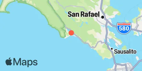
Location & Map
Latitude
37° 54' 28" N (37.90778)
Longitude
122° 40' 43" W (-122.67861)
State
County
Nearest ZIP
94970
Nearby
Tides
9.4 mi
Corte Madera Creek, San Francisco Bay
10.3 mi
Point Bonita, Bonita Cove, San Francisco Bay
10.6 mi
Sausalito, Corps of Engineers Dock, San Francisco Bay
11.4 mi
Point San Quentin, San Francisco Bay
11.8 mi
Sausalito, San Francisco Bay
12.1 mi
Gallinas, Gallinas Creek, San Pablo Bay
Currents
7.5 mi
Point Bonita Lt., 5.27 nmi. WSW of
9.2 mi
San Francisco Bar, north of ship channel
9.7 mi
Point Lobos, 3.73 nmi. W of
10.7 mi
Point Bonita, 0.8 nmi. NE of
10.9 mi
Point Bonita Lt., 0.4 nmi. SSE of
10.9 mi
San Francisco traffic separation zone buoy
11.4 mi
Point Bonita, 0.95 nm SSE of
11.7 mi
Point Diablo, 0.2 mile SE of
11.8 mi
San Francisco Bay Entrance (Outside)
12.0 mi
Mile Rock Lt., 0.2 nmi. NW of
12.0 mi
Point Chauncey, 0.75 nmi. NW of
12.1 mi
Point San Quentin, 0.82 nmi. east of
12.2 mi
Point Lobos, 1.3 nmi. SW of
Note: Tide predictions are an estimate and NOT FOR NAVIGATION.
We also offer free widgets if you want to add tide or solunar tables to your own site.