Wares Wharf Weekly Tide Tables and Charts
Tide Chart for Next 7 Days
Wares Wharf weekly tide chart key:
The tide chart above shows the times and heights of high tide and low tide for Wares Wharf, for the next seven days. The red line highlights the current time and estimated height.The tidal range at Wares Wharf for the next seven days is approximately 1.96 ft with a minimum tide of 0.27 ft and maximum tide of 2.23 ft. You can also check out all the daily details on tides & fishing times on the Day tab for Wares Wharf.
Tide Table for Next 7 Days
▲ Blue = High Tide
▼ Red = Low Tide
| Day | 1st Tide | 2nd Tide | 3rd Tide | 4th Tide | ☀ Sun |
Major Solunars
|
Minor Solunars
|
|
|---|---|---|---|---|---|---|---|---|
| 29 Wed |
|
▲ 2.16 ft |
▼ 0.33 ft |
▲ 1.88 ft |
▼ 0.42 ft |
▲ 6:08 AM ▼ 8:19 PM |
11:57 PM → 1:57 AM 12:16 PM → 2:16 PM |
5:25 AM → 6:25 AM 8:07 PM → 9:07 PM |
| 30 Thu |
|
▲ 2.16 ft |
▼ 0.3 ft |
▲ 1.94 ft |
▼ 0.4 ft |
▲ 6:09 AM ▼ 8:18 PM |
12:44 AM → 2:44 AM 1:01 PM → 3:01 PM |
6:28 AM → 7:28 AM 8:34 PM → 9:34 PM |
| 31 Fri |
|
▲ 2.14 ft |
▼ 0.28 ft |
▲ 1.99 ft |
▼ 0.4 ft |
▲ 6:10 AM ▼ 8:17 PM |
1:28 AM → 3:28 AM 1:45 PM → 3:45 PM |
7:31 AM → 8:31 AM 8:59 PM → 9:59 PM |
| 1 Sat |
|
▲ 2.11 ft |
▼ 0.27 ft |
▲ 2.06 ft |
▼ 0.42 ft |
▲ 6:11 AM ▼ 8:16 PM |
2:12 AM → 4:12 AM 2:27 PM → 4:27 PM |
8:33 AM → 9:33 AM 9:22 PM → 10:22 PM |
| 2 Sun |
|
▲ 2.08 ft |
▼ 0.27 ft |
▲ 2.12 ft |
▼ 0.44 ft |
▲ 6:11 AM ▼ 8:15 PM |
2:55 AM → 4:55 AM 3:11 PM → 5:11 PM |
9:36 AM → 10:36 AM 9:46 PM → 10:46 PM |
| 3 Mon |
|
▲ 2.03 ft |
▼ 0.28 ft |
▲ 2.19 ft |
▼ 0.47 ft |
▲ 6:12 AM ▼ 8:14 PM |
3:38 AM → 5:38 AM 3:55 PM → 5:55 PM |
10:41 AM → 11:41 AM 10:10 PM → 11:10 PM |
| 4 Tue |
|
▲ 1.97 ft |
▼ 0.31 ft |
▲ 2.23 ft |
▲ 6:13 AM ▼ 8:13 PM |
4:24 AM → 6:24 AM 4:42 PM → 6:42 PM |
11:47 AM → 12:47 PM 10:38 PM → 11:38 PM |
Buoy Weather
Air Temperature
82° F
Water Temperature
83° F
Wind
12 knots NNW (340°)
Wind Gust
19 knots
Atmospheric Pressure
1006 hPa
Note: Observations are from a weather buoy 19.29 miles from the prediction site. Observations are not available at all prediction sites, and observation types vary between sites.
More details: Station lwtv2 Buoy Weather
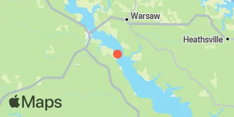
Location & Map
Latitude
37° 52' 24" N (37.8733)
Longitude
76° 46' 60" W (-76.7833)
State
County
Nearest ZIP
22454
Nearby
Tides
5.6 mi
Tappahannock, Rappahannock River
10.2 mi
Bayport, Rappahannock River
Currents
0.6 mi
Accaceek Point, 0.3 mile southwest of
3.7 mi
Tappahannock Bridge, 1.8 miles SE of
4.2 mi
Bowlers Rock, 0.2 mile north of
6.7 mi
Sharps, 1.2 miles south of
7.0 mi
Jones Point, 1.4 miles NNW of
10.2 mi
Tarpley Point, 1.5 miles south of
Note: Tide predictions are an estimate and NOT FOR NAVIGATION.
We also offer free widgets if you want to add tide or solunar tables to your own site.