Galveston Railroad Bridge Weekly Tide Tables and Charts
Tide Chart for Next 7 Days
Galveston Railroad Bridge weekly tide chart key:
The tide chart above shows the times and heights of high tide and low tide for Galveston Railroad Bridge, for the next seven days. The red line highlights the current time and estimated height.The tidal range at Galveston Railroad Bridge for the next seven days is approximately 1.64 ft with a minimum tide of -0.19 ft and maximum tide of 1.45 ft. You can also check out all the daily details on tides & fishing times on the Day tab for Galveston Railroad Bridge.
Tide Table for Next 7 Days
▲ Blue = High Tide
▼ Red = Low Tide
| Day | 1st Tide | 2nd Tide | 3rd Tide | 4th Tide | ☀ Sun |
Major Solunars
|
Minor Solunars
|
|
|---|---|---|---|---|---|---|---|---|
| 31 Fri |
|
▼ -0.19 ft |
▲ 0.99 ft |
▼ 0.93 ft |
▲ 0.97 ft |
▲ 6:39 AM ▼ 8:12 PM |
1:43 AM → 3:43 AM 2:01 PM → 4:01 PM |
7:57 AM → 8:57 AM 9:05 PM → 10:05 PM |
| 1 Sat |
|
▼ -0.01 ft |
▲ 0.98 ft |
▼ 0.79 ft |
▲ 0.87 ft |
▲ 6:40 AM ▼ 8:12 PM |
2:26 AM → 4:26 AM 2:44 PM → 4:44 PM |
8:54 AM → 9:54 AM 9:34 PM → 10:34 PM |
| 2 Sun |
|
▼ 0.22 ft |
▲ 0.97 ft |
▼ 0.61 ft |
▲ 0.79 ft |
▲ 6:41 AM ▼ 8:11 PM |
3:09 AM → 5:09 AM 3:27 PM → 5:27 PM |
9:51 AM → 10:51 AM 10:03 PM → 11:03 PM |
| 3 Mon |
|
▼ 0.49 ft |
▲ 0.98 ft |
▼ 0.4 ft |
▲ 0.82 ft |
▲ 6:41 AM ▼ 8:10 PM |
3:53 AM → 5:53 AM 4:11 PM → 6:11 PM |
10:50 AM → 11:50 AM 10:33 PM → 11:33 PM |
| 4 Tue |
|
▼ 0.76 ft |
▲ 1.03 ft |
▼ 0.19 ft |
▲ 6:42 AM ▼ 8:09 PM |
4:38 AM → 6:38 AM 4:59 PM → 6:59 PM |
11:51 AM → 12:51 PM 11:07 PM → 12:07 AM |
|
| 5 Wed |
|
▲ 1.12 ft |
▼ -0.01 ft |
▲ 6:42 AM ▼ 8:08 PM |
5:27 AM → 7:27 AM 5:50 PM → 7:50 PM |
12:55 PM → 1:55 PM | ||
| 6 Thu |
|
▲ 1.29 ft |
▼ -0.17 ft |
▲ 6:43 AM ▼ 8:08 PM |
6:21 AM → 8:21 AM 6:47 PM → 8:47 PM |
11:46 PM → 12:46 AM 2:02 PM → 3:02 PM |
Buoy Weather
Air Temperature
84° F
Water Temperature
86° F
Wind
4 knots W (260°)
Wind Gust
5 knots
Atmospheric Pressure
1015 hPa
Note: Observations are from a weather buoy 0.08 miles from the prediction site. Observations are not available at all prediction sites, and observation types vary between sites.
More details: Station grrt2 Buoy Weather
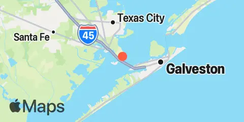
Location & Map
Latitude
29° 18' 9" N (29.3026)
Longitude
94° 53' 50" W (-94.8971)
State
County
Nearest ZIP
77554
Nearby
Tides
5.6 mi
Texas City, Turning Basin, Galveston Bay
6.1 mi
Texas City, Galveston Bay
6.3 mi
Galveston Pier 21, Galveston Channel
6.6 mi
Galveston Pleasure Pier, Gulf Of Mexico
8.3 mi
Port Bolivar, Galveston Bay
8.9 mi
Jamaica Beach, West Bay, Galveston Bay
9.1 mi
Jamaica Beach
11.1 mi
Galveston Bay Entrance, North Jetty
12.3 mi
Eagle Point, Galveston Bay
12.4 mi
Galveston Bay entrance, south jetty
Currents
0.8 mi
Galveston Causeway RR. bridge
4.6 mi
Galveston Channel, west end
7.1 mi
Galveston Channel, East End
7.4 mi
Houston Channel, W of Port Bolivar
7.5 mi
Bolivar Roads
9.8 mi
Galveston Bay Entrance Channel, LB 11
11.5 mi
Galveston Bay Ent. (between jetties)
Note: Tide predictions are an estimate and NOT FOR NAVIGATION.
We also offer free widgets if you want to add tide or solunar tables to your own site.