Bristol Ferry Tides & Fishing Times
Tides
Bristol Ferry tide chart key:
The tide chart above shows the times and heights of high tide and low tide for Bristol Ferry, as well as solunar period times (represented by fish icons). The red line highlights the current time and estimated height.| Day | Time | Tide | Height | |
|---|---|---|---|---|
| 1 Sat | ▲ High | 4.49 ft | ||
| 2 Sun | ▼ Low | -0.26 ft | ||
| 2 Sun | ▲ High | 4.17 ft | ||
| 2 Sun | ▼ Low | -0.03 ft | ||
| 2 Sun | ▲ High | 4.35 ft | ||
| 3 Mon | ▼ Low | -0.32 ft |
Sunday, August 2, 2026 11:49 AM: The tide is currently falling at Bristol Ferry with a current estimated height of 4.1 ft. The last tide was High at 11:22 AM and the next tide is a Low of -0.03 ft at 4:40 PM. The tidal range today is approximately 4.61 ft with a minimum tide of -0.26 ft and maximum tide of 4.35 ft.
Next 7 Days
▲ Blue = High Tide
▼ Red = Low Tide
| Day | 1st Tide | 2nd Tide | 3rd Tide | 4th Tide | ☀ Sun |
Major Solunars
|
Minor Solunars
|
|
|---|---|---|---|---|---|---|---|---|
| 2 Sun |
|
▼ -0.26 ft |
▲ 4.17 ft |
▼ -0.03 ft |
▲ 4.35 ft |
▲ 5:40 AM ▼ 8:01 PM |
2:32 AM → 4:32 AM 2:47 PM → 4:47 PM |
9:13 AM → 10:13 AM 9:22 PM → 10:22 PM |
| 3 Mon |
|
▼ -0.32 ft |
▲ 4.26 ft |
▼ 0.02 ft |
▲ 5:41 AM ▼ 8:00 PM |
3:15 AM → 5:15 AM 3:32 PM → 5:32 PM |
10:21 AM → 11:21 AM 9:43 PM → 10:43 PM |
|
| 4 Tue |
|
▲ 4.18 ft |
▼ -0.24 ft |
▲ 4.35 ft |
▼ 0.21 ft |
▲ 5:42 AM ▼ --:-- |
4:01 AM → 6:01 AM 4:19 PM → 6:19 PM |
11:30 AM → 12:30 PM 10:08 PM → 11:08 PM |
| 5 Wed |
|
▲ 3.99 ft |
▼ -0.05 ft |
▲ 4.42 ft |
▼ 0.45 ft |
▲ 5:43 AM ▼ 7:58 PM |
4:49 AM → 6:49 AM 5:10 PM → 7:10 PM |
12:43 PM → 1:43 PM 10:38 PM → 11:38 PM |
| 6 Thu |
|
▲ 3.82 ft |
▼ 0.18 ft |
▲ 4.48 ft |
▼ 0.59 ft |
▲ 5:44 AM ▼ 7:57 PM |
5:42 AM → 7:42 AM 6:06 PM → 8:06 PM |
1:58 PM → 2:58 PM 11:15 PM → 12:15 AM |
| 7 Fri |
|
▲ 3.66 ft |
▼ 0.3 ft |
▲ 4.54 ft |
▼ 0.56 ft |
▲ 5:45 AM ▼ 7:55 PM |
6:41 AM → 8:41 AM 7:08 PM → 9:08 PM |
3:13 PM → 4:13 PM |
| 8 Sat |
|
▲ 3.6 ft |
▼ 0.3 ft |
▲ 4.68 ft |
▼ 0.44 ft |
▲ 5:47 AM ▼ 7:54 PM |
7:43 AM → 9:43 AM 8:14 PM → 10:14 PM |
12:04 AM → 1:04 AM 4:23 PM → 5:23 PM |
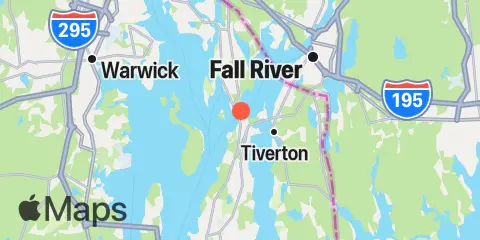
Location & Map
Latitude
41° 38' 12" N (41.6367)
Longitude
71° 15' 18" W (-71.255)
State
County
Nearest ZIP
02809
Nearby
Tides
2.2 mi
Anthony Point, Sakonnet River
2.5 mi
Bristol, Bristol Harbor, Narragansett Bay
2.5 mi
North End, Bay Oil pier, Sakonnet River
3.0 mi
Nannaquaket Neck, Sakonnet River
4.6 mi
Bristol Highlands, Narragansett Bay
5.0 mi
Kickamuit River, Narragansett Bay
5.2 mi
Prudence Island, (South End), Narragansett Bay
5.5 mi
The Glen, Sakonnet River
6.6 mi
Fall River, Narragansett Bay
7.2 mi
Conimicut Light, Narragansett Bay
7.5 mi
Conanicut Point, Conanicut Island
8.8 mi
Quonset Point
9.4 mi
Bay Spring, Bullock Cove, Narragansett Bay
9.6 mi
Steep Brook, Taunton River, Narragansett Bay
9.8 mi
Newport, Narragansett Bay
10.0 mi
East Greenwich, Narragansett Bay
10.4 mi
Sachuest, Flint Point, Sakonnet River
10.5 mi
Hix Bridge, East Branch, Westport River
10.8 mi
Wickford, Narragansett Bay
11.0 mi
Pawtuxet, Pawtuxet Cove, Narragansett Bay
11.8 mi
West Jamestown, Dutch Island Harbor, Conanicut Island
12.2 mi
Westport Harbor, Westport River
12.3 mi
Sakonnet, Sakonnet River
Currents
0.3 mi
Mount Hope Bridge
1.1 mi
Common Fence Point, west of
2.1 mi
Almy Point Bridge, south of, Sakonnet River
2.2 mi
Hog Island, northwest of
3.7 mi
Mount Hope Point, northeast of
4.4 mi
Dyer Island, west of
4.8 mi
Dyer Island-Carrs Point (between)
5.3 mi
Patience Island, narrows east of
5.9 mi
Fall River entrance
6.2 mi
Conanicut Point, ENE of
6.4 mi
Patience I. and Warwick Neck, between
6.6 mi
Warren, Warren River
8.2 mi
Quonset Point
8.3 mi
Nayatt Point, WNW of
8.8 mi
Gould Island, southeast of
9.0 mi
Gould Island, west of
9.2 mi
Black Point, SW of, Sakonnet River
10.0 mi
Rose Island, northeast of
10.3 mi
Rose Island, northwest of
10.9 mi
Rose Island, west of
11.9 mi
Bull Point, east of
12.1 mi
Dutch Island, west of
12.4 mi
Dutch Island and Beaver Head, between
12.4 mi
Westport River entrance
Note: Tide predictions are an estimate and NOT FOR NAVIGATION.
We also offer free widgets if you want to add tide or solunar tables to your own site.