Block Island (SW End) Weekly Tide Tables and Charts
Tide Chart for Next 7 Days
Block Island (SW End) weekly tide chart key:
The tide chart above shows the times and heights of high tide and low tide for Block Island (SW End), for the next seven days. The red line highlights the current time and estimated height.The tidal range at Block Island (SW End) for the next seven days is approximately 2.98 ft with a minimum tide of 0.1 ft and maximum tide of 3.08 ft. You can also check out all the daily details on tides & fishing times on the Day tab for Block Island (SW End).
Tide Table for Next 7 Days
▲ Blue = High Tide
▼ Red = Low Tide
| Day | 1st Tide | 2nd Tide | 3rd Tide | 4th Tide | ☀ Sun |
Major Solunars
|
Minor Solunars
|
|
|---|---|---|---|---|---|---|---|---|
| 30 Thu |
|
▼ 0.16 ft |
▲ 2.67 ft |
▼ 0.34 ft |
▲ 3.03 ft |
▲ 5:40 AM ▼ 8:05 PM |
12:23 AM → 2:23 AM 12:39 PM → 2:39 PM |
5:59 AM → 6:59 AM 8:19 PM → 9:19 PM |
| 31 Fri |
|
▼ 0.11 ft |
▲ 2.76 ft |
▼ 0.34 ft |
▲ 3 ft |
▲ 5:41 AM ▼ 8:04 PM |
1:07 AM → 3:07 AM 1:22 PM → 3:22 PM |
7:04 AM → 8:04 AM 8:41 PM → 9:41 PM |
| 1 Sat |
|
▼ 0.1 ft |
▲ 2.83 ft |
▼ 0.35 ft |
▲ 2.93 ft |
▲ 5:42 AM ▼ 8:03 PM |
1:50 AM → 3:50 AM 2:06 PM → 4:06 PM |
8:10 AM → 9:10 AM 9:02 PM → 10:02 PM |
| 2 Sun |
|
▼ 0.12 ft |
▲ 2.9 ft |
▼ 0.38 ft |
▲ 2.82 ft |
▲ 5:43 AM ▼ 8:02 PM |
2:33 AM → 4:33 AM 2:49 PM → 4:49 PM |
9:15 AM → 10:15 AM 9:23 PM → 10:23 PM |
| 3 Mon |
|
▼ 0.15 ft |
▲ 2.97 ft |
▼ 0.42 ft |
▲ 2.68 ft |
▲ 5:44 AM ▼ 8:01 PM |
3:17 AM → 5:17 AM 3:33 PM → 5:33 PM |
10:22 AM → 11:22 AM 9:45 PM → 10:45 PM |
| 4 Tue |
|
▼ 0.18 ft |
▲ 3.03 ft |
▼ 0.48 ft |
▲ 5:45 AM ▼ --:-- |
4:02 AM → 6:02 AM 4:21 PM → 6:21 PM |
11:31 AM → 12:31 PM 10:11 PM → 11:11 PM |
|
| 5 Wed |
|
▲ 2.53 ft |
▼ 0.22 ft |
▲ 3.08 ft |
▼ 0.53 ft |
▲ 5:46 AM ▼ 7:58 PM |
4:51 AM → 6:51 AM 5:12 PM → 7:12 PM |
12:43 PM → 1:43 PM 10:41 PM → 11:41 PM |
Buoy Weather
Air Temperature
68° F
Water Temperature
68° F
Atmospheric Pressure
1005 hPa
Note: Observations are from a weather buoy 19.86 miles from the prediction site. Observations are not available at all prediction sites, and observation types vary between sites.
More details: Station mtkn6 Buoy Weather
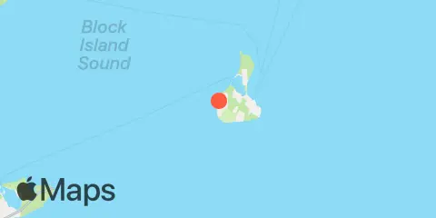
Location & Map
Latitude
41° 9' 48" N (41.1633)
Longitude
71° 36' 36" W (-71.61)
State
County
Nearest ZIP
02807
Nearby
Tides
2.9 mi
Block Island (Old Harbor)
Currents
1.5 mi
Lewis Pt., 1.5 miles west of
1.9 mi
Lewis Pt., 1.0 mile southwest of
2.6 mi
Great Salt Pond ent., 1 mile NW of
2.7 mi
Great Salt Pond entrance
4.1 mi
Old Harbor Pt., 0.5 mile southeast of
5.7 mi
Southwest Ledge
5.8 mi
Clay Head, 1.2 miles ENE of
6.4 mi
Sandy Pt., 1.5 miles north of
6.5 mi
Southwest Ledge, 2.0 miles west of
6.9 mi
Lewis Point, 6.0 miles WNW of
7.3 mi
Sandy Point, 2.1 miles NNE of
9.1 mi
Sandy Point, 4.1 miles northwest of
9.4 mi
Quonochontaug Beach, 3.8 miles S of
10.2 mi
Watch Hill Point, 5.3 n.mi. SE of
10.3 mi
4 miles north of
11.2 mi
Montauk Point, 5.4 miles NNE of
11.4 mi
Watch Hill Point, 5.2 miles SSE of
11.7 mi
Quonochontaug Beach, 1.1 miles S of
Note: Tide predictions are an estimate and NOT FOR NAVIGATION.
We also offer free widgets if you want to add tide or solunar tables to your own site.