Jones Inlet (Point Lookout) Weekly Tide Tables and Charts
Tide Chart for Next 7 Days
Jones Inlet (Point Lookout) weekly tide chart key:
The tide chart above shows the times and heights of high tide and low tide for Jones Inlet (Point Lookout), for the next seven days. The red line highlights the current time and estimated height.The tidal range at Jones Inlet (Point Lookout) for the next seven days is approximately 4.07 ft with a minimum tide of 0.1 ft and maximum tide of 4.17 ft. You can also check out all the daily details on tides & fishing times on the Day tab for Jones Inlet (Point Lookout).
Tide Table for Next 7 Days
▲ Blue = High Tide
▼ Red = Low Tide
| Day | 1st Tide | 2nd Tide | 3rd Tide | 4th Tide | ☀ Sun |
Major Solunars
|
Minor Solunars
|
|
|---|---|---|---|---|---|---|---|---|
| 29 Wed |
|
▼ 0.26 ft |
▲ 3.43 ft |
▼ 0.55 ft |
▲ 4.17 ft |
▲ 5:49 AM ▼ 8:12 PM |
11:44 PM → 1:44 AM 12:02 PM → 2:02 PM |
5:03 AM → 6:03 AM 8:01 PM → 9:01 PM |
| 30 Thu |
|
▼ 0.17 ft |
▲ 3.51 ft |
▼ 0.51 ft |
▲ 4.15 ft |
▲ 5:49 AM ▼ 8:11 PM |
12:31 AM → 2:31 AM 12:47 PM → 2:47 PM |
6:08 AM → 7:08 AM 8:26 PM → 9:26 PM |
| 31 Fri |
|
▼ 0.12 ft |
▲ 3.58 ft |
▼ 0.49 ft |
▲ 4.09 ft |
▲ 5:50 AM ▼ 8:10 PM |
1:15 AM → 3:15 AM 1:31 PM → 3:31 PM |
7:13 AM → 8:13 AM 8:49 PM → 9:49 PM |
| 1 Sat |
|
▼ 0.1 ft |
▲ 3.65 ft |
▼ 0.5 ft |
▲ 3.98 ft |
▲ 5:51 AM ▼ 8:09 PM |
1:59 AM → 3:59 AM 2:14 PM → 4:14 PM |
8:18 AM → 9:18 AM 9:10 PM → 10:10 PM |
| 2 Sun |
|
▼ 0.12 ft |
▲ 3.74 ft |
▼ 0.54 ft |
▲ 3.84 ft |
▲ 5:52 AM ▼ 8:08 PM |
2:41 AM → 4:41 AM 2:57 PM → 4:57 PM |
9:23 AM → 10:23 AM 9:31 PM → 10:31 PM |
| 3 Mon |
|
▼ 0.17 ft |
▲ 3.84 ft |
▼ 0.61 ft |
▲ 3.69 ft |
▲ 5:53 AM ▼ 8:07 PM |
3:25 AM → 5:25 AM 3:41 PM → 5:41 PM |
10:29 AM → 11:29 AM 9:54 PM → 10:54 PM |
| 4 Tue |
|
▼ 0.24 ft |
▲ 3.94 ft |
▼ 0.7 ft |
▲ 5:54 AM ▼ 8:06 PM |
4:10 AM → 6:10 AM 4:29 PM → 6:29 PM |
11:38 AM → 12:38 PM 10:20 PM → 11:20 PM |
Buoy Weather
Air Temperature
76° F
Water Temperature
75° F
Wind
8 knots W (260°)
Wind Gust
8 knots
Waves
3 ft
SSE (163°)
Average Wave Period
5.2 sec
Dominant Wave Period
7 sec
Atmospheric Pressure
1003 hPa
Note: Observations are from a weather buoy 16.44 miles from the prediction site. Observations are not available at all prediction sites, and observation types vary between sites.
More details: Station 44065 Buoy Weather
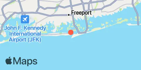
Location & Map
Latitude
40° 35' 12" N (40.5867)
Longitude
73° 34' 42" W (-73.5783)
State
County
Nearest ZIP
11569
Nearby
Tides
0.6 mi
Point Lookout, Long Island
2.8 mi
Neds Creek, Hempstead Bay
3.0 mi
Deep Creek Meadow, Hempstead Bay
3.3 mi
Freeport, Baldwin Bay, Hempstead Bay
3.7 mi
Cuba Island, Hempstead Bay
3.8 mi
Parsonnage Cove, Long Island
3.9 mi
Long Beach (Inside), Hempstead Bay
4.1 mi
Long Beach (Bridgeview Yacht Club)
4.8 mi
Green Island, Hempstead Bay
5.7 mi
Bay Park, East Rockaway, Hewlett Bay
6.1 mi
Bellmore, Bellmore Creek, Hempstead Bay
6.7 mi
Woodmere, Brosewere Bay, Hempstead Bay
8.0 mi
Biltmore Shores, South Oyster Bay, Long Island
8.7 mi
Atlantic Beach, East Rockaway Inlet, Long Island
9.5 mi
Norton Point, Head of Bay, Jamaica Bay
9.6 mi
Amityville, Great South Bay
9.7 mi
Motts Basin, Jamaica Bay
9.9 mi
Gilgo Heading, Great South Bay
11.1 mi
J.F.K. International Airport, Jamaica Bay
Currents
0.7 mi
Jones Inlet
4.3 mi
Long Beach, inside, between bridges
9.3 mi
East Rockaway Inlet
11.0 mi
Grass Hassock Channel
Note: Tide predictions are an estimate and NOT FOR NAVIGATION.
We also offer free widgets if you want to add tide or solunar tables to your own site.