Long Branch (Fishing Pier) Weekly Tide Tables and Charts
Tide Chart for Next 7 Days
Long Branch (Fishing Pier) weekly tide chart key:
The tide chart above shows the times and heights of high tide and low tide for Long Branch (Fishing Pier), for the next seven days. The red line highlights the current time and estimated height.The tidal range at Long Branch (Fishing Pier) for the next seven days is approximately 4.96 ft with a minimum tide of 0.13 ft and maximum tide of 5.09 ft. You can also check out all the daily details on tides & fishing times on the Day tab for Long Branch (Fishing Pier).
Tide Table for Next 7 Days
▲ Blue = High Tide
▼ Red = Low Tide
| Day | 1st Tide | 2nd Tide | 3rd Tide | 4th Tide | ☀ Sun |
Major Solunars
|
Minor Solunars
|
|
|---|---|---|---|---|---|---|---|---|
| 29 Wed |
|
▼ 0.35 ft |
▲ 4.18 ft |
▼ 0.74 ft |
▲ 5.09 ft |
▲ 5:51 AM ▼ 8:13 PM |
11:46 PM → 1:46 AM 12:03 PM → 2:03 PM |
5:06 AM → 6:06 AM 8:01 PM → 9:01 PM |
| 30 Thu |
|
▼ 0.23 ft |
▲ 4.28 ft |
▼ 0.69 ft |
▲ 5.07 ft |
▲ 5:52 AM ▼ 8:12 PM |
12:32 AM → 2:32 AM 12:49 PM → 2:49 PM |
6:11 AM → 7:11 AM 8:27 PM → 9:27 PM |
| 31 Fri |
|
▼ 0.15 ft |
▲ 4.36 ft |
▼ 0.66 ft |
▲ 4.99 ft |
▲ 5:53 AM ▼ 8:11 PM |
1:17 AM → 3:17 AM 1:33 PM → 3:33 PM |
7:16 AM → 8:16 AM 8:50 PM → 9:50 PM |
| 1 Sat |
|
▼ 0.13 ft |
▲ 4.45 ft |
▼ 0.67 ft |
▲ 4.86 ft |
▲ 5:54 AM ▼ 8:10 PM |
2:00 AM → 4:00 AM 2:16 PM → 4:16 PM |
8:20 AM → 9:20 AM 9:12 PM → 10:12 PM |
| 2 Sun |
|
▼ 0.16 ft |
▲ 4.56 ft |
▼ 0.72 ft |
▲ 4.69 ft |
▲ 5:55 AM ▼ 8:09 PM |
2:43 AM → 4:43 AM 2:59 PM → 4:59 PM |
9:25 AM → 10:25 AM 9:33 PM → 10:33 PM |
| 3 Mon |
|
▼ 0.22 ft |
▲ 4.68 ft |
▼ 0.81 ft |
▲ 4.5 ft |
▲ 5:56 AM ▼ 8:08 PM |
3:27 AM → 5:27 AM 3:43 PM → 5:43 PM |
10:31 AM → 11:31 AM 9:56 PM → 10:56 PM |
| 4 Tue |
|
▼ 0.32 ft |
▲ 4.81 ft |
▼ 0.94 ft |
▲ 5:56 AM ▼ 8:07 PM |
4:12 AM → 6:12 AM 4:30 PM → 6:30 PM |
11:39 AM → 12:39 PM 10:22 PM → 11:22 PM |
Buoy Weather
Air Temperature
74° F
Water Temperature
76° F
Wind
16 knots NW (320°)
Wind Gust
18 knots
Atmospheric Pressure
1005 hPa
Note: Observations are from a weather buoy 11.45 miles from the prediction site. Observations are not available at all prediction sites, and observation types vary between sites.
More details: Station sdhn4 Buoy Weather
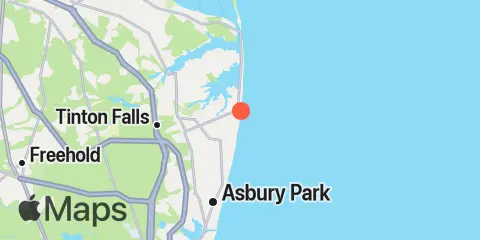
Location & Map
Latitude
40° 18' 12" N (40.3033)
Longitude
73° 58' 36" W (-73.9767)
State
County
Nearest ZIP
07740
Nearby
Tides
1.8 mi
Long Branch Reach, Shrewsbury River
2.7 mi
Gooseneck Point, bridge, Shrewsbury River
4.3 mi
Sea Bright, Shrewsbury River
5.5 mi
Oceanic Bridge, Navesink River, Shrewsbury River
5.9 mi
Red Bank, Navesink River, Shrewsbury River
6.5 mi
Highlands, Route 36 bridge, Shrewsbury River
8.3 mi
Belmar (Ocean)
8.4 mi
Shark River Hills, Shark River
8.5 mi
Shark River Island, fixed RR. bridge, Shark River
8.5 mi
Atlantic Highlands, Sandy Hook Bay
9.4 mi
New Bedford, Shark River
11.4 mi
Sandy Hook
Currents
4.3 mi
Seabright Bridge, Shrewsbury River
6.4 mi
Highlands Bridge, Shrewsbury River
8.2 mi
Shark River Entrance
Note: Tide predictions are an estimate and NOT FOR NAVIGATION.
We also offer free widgets if you want to add tide or solunar tables to your own site.