North Shore Tides
Unfortunately, this tide station is no longer active, and predictions are no longer accurate.
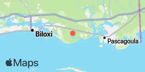
You can check out the map below -- any nearby locations will be displayed on the map and list below. Alternatively, you can browse the site for other active locations.
Location & Map
Latitude
30° 22' 24" N (30.3733)
Longitude
88° 42' 18" W (-88.705)
State
County
Nearest ZIP
39564
Nearby
Tides
2.6 mi
Graveline Bayou entrance
4.2 mi
Hollingsworth Point, Davis Bayou
5.7 mi
Ocean Springs
8.5 mi
Pascagoula NOAA Lab, Pascagoula River
9.1 mi
Biloxi (Cadet Point), Biloxi Bay
9.6 mi
Horn Island, Mississippi Sound
9.7 mi
Deer Island
10.5 mi
Pascagoula Point, Mississippi Sound
12.0 mi
Dock E, Port of Pascagoula
12.1 mi
Biloxi, Biloxi Bay
12.3 mi
Pascagoula, south side