New Bedford, Buzzards Bay Tides
Unfortunately, this tide station is no longer active, and predictions are no longer accurate.
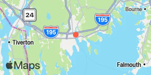
You can check out the map below -- any nearby locations will be displayed on the map and list below. Alternatively, you can browse the site for other active locations.
Location & Map
Latitude
41° 38' 24" N (41.64)
Longitude
70° 55' 6" W (-70.9183)
State
County
Nearest ZIP
02740
Nearby
Tides
1.3 mi
New Bedford Harbor, Marine Terminal, Buzzards Bay
3.4 mi
Clarks Point, New Bedford, Buzzards Bay
5.5 mi
Mattapoisett, Mattapoisett Harbor, Buzzards Bay
7.1 mi
Round Hill Point, Buzzards Bay
9.3 mi
Marion, Sippican Harbor, Buzzards Bay
9.4 mi
Hix Bridge, East Branch, Westport River
10.9 mi
Piney Point, Buzzards Bay
11.6 mi
Great Hill, Buzzards Bay
Currents
1.3 mi
New Bedford Hurricane Barrier
7.4 mi
Dumpling Rocks, 0.2 mile southeast of
7.6 mi
West Island, 1 mile Southeast of
11.5 mi
Cleveland Ledge
12.1 mi
Penikese Island, 0.8 mile northwest of
12.3 mi
Wareham River, off Long Beach Point