Port Tampa Weekly Tide Tables and Charts
Tide Chart for Next 7 Days
Port Tampa weekly tide chart key:
The tide chart above shows the times and heights of high tide and low tide for Port Tampa, for the next seven days. The red line highlights the current time and estimated height.The tidal range at Port Tampa for the next seven days is approximately 2.82 ft with a minimum tide of 0.13 ft and maximum tide of 2.95 ft. You can also check out all the daily details on tides & fishing times on the Day tab for Port Tampa.
Tide Table for Next 7 Days
▲ Blue = High Tide
▼ Red = Low Tide
| Day | 1st Tide | 2nd Tide | 3rd Tide | 4th Tide | ☀ Sun |
Major Solunars
|
Minor Solunars
|
|
|---|---|---|---|---|---|---|---|---|
| 30 Thu |
|
▲ 1.88 ft |
▼ 1.41 ft |
▲ 2.95 ft |
▼ 0.2 ft |
▲ 6:52 AM ▼ 8:21 PM |
1:08 AM → 3:08 AM 1:26 PM → 3:26 PM |
7:10 AM → 8:10 AM 8:43 PM → 9:43 PM |
| 31 Fri |
|
▲ 1.9 ft |
▼ 1.25 ft |
▲ 2.9 ft |
▼ 0.29 ft |
▲ 6:53 AM ▼ 8:20 PM |
1:52 AM → 3:52 AM 2:10 PM → 4:10 PM |
8:07 AM → 9:07 AM 9:14 PM → 10:14 PM |
| 1 Sat |
|
▲ 1.98 ft |
▼ 1.08 ft |
▲ 2.77 ft |
▼ 0.4 ft |
▲ 6:53 AM ▼ 8:20 PM |
2:36 AM → 4:36 AM 2:53 PM → 4:53 PM |
9:03 AM → 10:03 AM 9:43 PM → 10:43 PM |
| 2 Sun |
|
▲ 2.12 ft |
▼ 0.92 ft |
▲ 2.56 ft |
▲ 6:54 AM ▼ 8:19 PM |
3:18 AM → 5:18 AM 3:36 PM → 5:36 PM |
10:00 AM → 11:00 AM 10:13 PM → 11:13 PM |
|
| 3 Mon |
|
▼ 0.56 ft |
▲ 2.29 ft |
▼ 0.78 ft |
▲ 2.27 ft |
▲ 6:54 AM ▼ 8:18 PM |
4:02 AM → 6:02 AM 4:21 PM → 6:21 PM |
10:58 AM → 11:58 AM 10:44 PM → 11:44 PM |
| 4 Tue |
|
▼ 0.77 ft |
▲ 2.48 ft |
▼ 0.65 ft |
▲ 1.93 ft |
▲ 6:55 AM ▼ 8:18 PM |
4:47 AM → 6:47 AM 5:08 PM → 7:08 PM |
11:58 AM → 12:58 PM 11:19 PM → 12:19 AM |
| 5 Wed |
|
▼ 1.01 ft |
▲ 2.64 ft |
▼ 0.54 ft |
▲ 1.63 ft |
▲ 6:55 AM ▼ 8:17 PM |
5:36 AM → 7:36 AM 5:59 PM → 7:59 PM |
1:01 PM → 2:01 PM |
Buoy Weather
Air Temperature
85° F
Wind
11 knots W (270°)
Wind Gust
13 knots
Atmospheric Pressure
1015 hPa
Note: Observations are from a weather buoy 0.02 miles from the prediction site. Observations are not available at all prediction sites, and observation types vary between sites.
More details: Station optf1 Buoy Weather
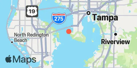
Location & Map
Latitude
27° 51' 28" N (27.85778)
Longitude
82° 33' 10" W (-82.55278)
State
County
Nearest ZIP
33616
Nearby
Tides
2.6 mi
Gandy Bridge, Old Tampa Bay
5.0 mi
Ballast Point, Tampa
7.1 mi
Davis Island, Hillsborough Bay
8.1 mi
St. Petersburg, Tampa Bay
8.2 mi
Pendola Point, Hillsborough Bay
8.7 mi
CSX Rockport, Mckay Bay Entrance
9.1 mi
Apollo Beach, Hillsborough Bay, Tampa Bay
9.2 mi
East Bay, Tampa Bay
10.3 mi
Newman Branch, Tampa Bay
10.6 mi
Shell Point
11.8 mi
Bay Aristocrat Village, Old Tampa Bay
12.0 mi
Point Pinellas
12.1 mi
Safety Harbor, Old Tampa Bay
12.3 mi
Little Manatee River
Currents
0.4 mi
Old Tampa Bay Entrance (Port Tampa)
1.8 mi
Gandy Bridge, east channel
1.9 mi
Ross Island, 1 mile east of, marker '4'
2.0 mi
Weedon I. powerplant channel, marker '10'
2.2 mi
Gandy Bridge, west channel
4.6 mi
Snell Isle, 1.8 miles east of
5.1 mi
W Howard Frankland Bridge
6.7 mi
Cut C Channel, marker '21', Hillsborough Bay
7.2 mi
Cut A Channel, marker '10', Hillsborough Bay
8.8 mi
Courtney Campbell Parkway
9.2 mi
Cut E Channel, marker '2E'
9.9 mi
Lewis Island, 0.9 mile east of
10.4 mi
Camp Key, 1.9 miles northwest of
12.1 mi
Pinellas Point, 0.5 mile southeast of
Note: Tide predictions are an estimate and NOT FOR NAVIGATION.
We also offer free widgets if you want to add tide or solunar tables to your own site.