Eleven Mile Weekly Tide Tables and Charts
Tide Chart for Next 7 Days
Eleven Mile weekly tide chart key:
The tide chart above shows the times and heights of high tide and low tide for Eleven Mile, for the next seven days. The red line highlights the current time and estimated height.The tidal range at Eleven Mile for the next seven days is approximately 1.8 ft with a minimum tide of -0.05 ft and maximum tide of 1.75 ft. You can also check out all the daily details on tides & fishing times on the Day tab for Eleven Mile.
Tide Table for Next 7 Days
▲ Blue = High Tide
▼ Red = Low Tide
| Day | 1st Tide | 2nd Tide | 3rd Tide | 4th Tide | ☀ Sun |
Major Solunars
|
Minor Solunars
|
|
|---|---|---|---|---|---|---|---|---|
| 30 Thu |
|
▼ -0.05 ft |
▲ 1.6 ft |
▼ 1.43 ft |
▲ 1.58 ft |
▲ 6:59 AM ▼ 8:35 PM |
1:18 AM → 3:18 AM 1:37 PM → 3:37 PM |
7:18 AM → 8:18 AM 8:56 PM → 9:56 PM |
| 31 Fri |
|
▼ 0.05 ft |
▲ 1.55 ft |
▼ 1.28 ft |
▲ 1.53 ft |
▲ 7:00 AM ▼ 8:34 PM |
2:03 AM → 4:03 AM 2:21 PM → 4:21 PM |
8:16 AM → 9:16 AM 9:26 PM → 10:26 PM |
| 1 Sat |
|
▼ 0.21 ft |
▲ 1.51 ft |
▼ 1.09 ft |
▲ 1.49 ft |
▲ 7:00 AM ▼ 8:33 PM |
2:46 AM → 4:46 AM 3:03 PM → 5:03 PM |
9:13 AM → 10:13 AM 9:54 PM → 10:54 PM |
| 2 Sun |
|
▼ 0.43 ft |
▲ 1.48 ft |
▼ 0.87 ft |
▲ 1.42 ft |
▲ 7:01 AM ▼ 8:33 PM |
3:29 AM → 5:29 AM 3:47 PM → 5:47 PM |
10:11 AM → 11:11 AM 10:23 PM → 11:23 PM |
| 3 Mon |
|
▼ 0.69 ft |
▲ 1.5 ft |
▼ 0.62 ft |
▲ 1.37 ft |
▲ 7:01 AM ▼ 8:32 PM |
4:13 AM → 6:13 AM 4:31 PM → 6:31 PM |
11:10 AM → 12:10 PM 10:53 PM → 11:53 PM |
| 4 Tue |
|
▼ 0.97 ft |
▲ 1.55 ft |
▼ 0.38 ft |
▲ 7:02 AM ▼ 8:31 PM |
4:58 AM → 6:58 AM 5:18 PM → 7:18 PM |
12:11 PM → 1:11 PM 11:26 PM → 12:26 AM |
|
| 5 Wed |
|
▲ 1.37 ft |
▼ 1.25 ft |
▲ 1.64 ft |
▼ 0.16 ft |
▲ 7:03 AM ▼ 8:30 PM |
5:47 AM → 7:47 AM 6:10 PM → 8:10 PM |
1:15 PM → 2:15 PM |
Buoy Weather
Air Temperature
82° F
Water Temperature
89° F
Wind
9 knots W (280°)
Wind Gust
13 knots
Atmospheric Pressure
1014 hPa
Note: Observations are from a weather buoy 10.48 miles from the prediction site. Observations are not available at all prediction sites, and observation types vary between sites.
More details: Station apcf1 Buoy Weather
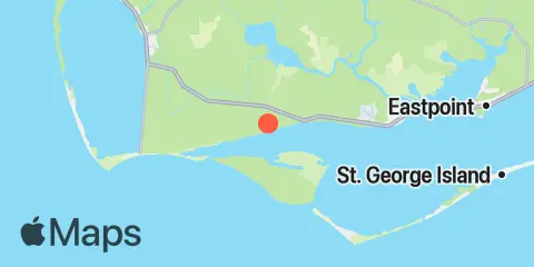
Location & Map
Latitude
29° 42' 24" N (29.7067)
Longitude
85° 9' 12" W (-85.1533)
State
County
Nearest ZIP
32456
Nearby
Tides
4.4 mi
Indian Pass, St. Vincent Sound
6.0 mi
Huckleberry Landing, Jackson River
6.1 mi
West Pass, Apalachicola Bay
8.0 mi
Lake Wimico
8.2 mi
Apalachicola River (A&N RR bridge), Apalachicola Bay
9.7 mi
Little St. George Island, Apalachicola Bay
10.4 mi
Apalachicola, Apalachicola Bay
12.2 mi
Port Saint Joe, St. Joseph Bay
Note: Tide predictions are an estimate and NOT FOR NAVIGATION.
We also offer free widgets if you want to add tide or solunar tables to your own site.