TidesPro
  • Recents
    • Cut 1N front range, St. Marys River
  • Tides
    United States
    Alabama Alaska California Connecticut Delaware District of Columbia Florida Georgia Hawaii
    Louisiana Maine Maryland Massachusetts Mississippi New Hampshire New Jersey New York North Carolina
    Oregon Pennsylvania Rhode Island South Carolina Texas US Outlying Islands Virginia Washington Puerto Rico
    Caribbean
    The Bahamas Cayman Islands Cuba Dominican Republic Haiti Jamaica Virgin Islands (US)
  • Fishing  Coordinates
    Alabama - Alabama Inshore Public Reefs Alabama - Alabama Nearshore Public Reefs Alabama - Alabama Offshore Public Reefs California - California Artificial Reefs Delaware - Delaware Artificial Reefs Florida - Bay County Florida - Brevard County Florida - Broward County Florida - Charlote and Lee Counties Florida - Citrus County Florida - Collier County Florida - Dixie County Florida - Duval County Florida - Escambia County Florida - Flagler County Florida - Florida Keys Florida - Franklin County Florida - Gulf County Florida - Hernando County
    Florida - Indian River County Florida - Levy County Florida - Manatee County Florida - Martin County Florida - Miami-Dade County Florida - Monroe County Florida - Nassau County Florida - Okaloosa County Florida - Palm Beach County Florida - Pasco County Florida - Santa Rosa County Florida - Sarasota County Florida - St. Johns County Florida - St. Lucie County Florida - Tampa Bay Florida - Taylor County Florida - Volusia County Florida - Wakulla County Florida - Walton County
    Georgia - Georgia Reefs Hawaii - Hawaii Artificial Reefs Louisiana - Louisiana Artificial Reefs Maryland - Maryland Artificial Reefs Massachusetts - Massachusetts Artificial Reefs Mississippi - Mississippi Inshore Artificial Reefs Mississippi - Mississippi Offshore Artificial Reefs New Jersey - New Jersey Artificial Reefs New York - New York Artificial Reefs North Carolina - Estuarine North Carolina - Long Bay North Carolina - Onslow Bay North Carolina - Outer Banks North Carolina - Raleigh Bay Puerto Rico - Puerto Rico Artificial Reefs Rhode Island - Rhode Island Artificial Reefs South Carolina - South Carolina Reefs Texas - Texas Artificial Reefs Virginia - Virginia Artificial Reefs
  • Solunar Tables
Cut 1N Front Range Location
  1. United States
  2. Florida
  3. Cut 1N front range, St. Marys River

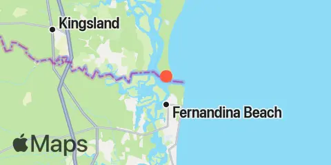
Cut 1N Front Range Map

Day Week Month Table Month Chart Map
Latitude
30° 42' 30" N (30.7083)
Longitude
81° 27' 54" W (-81.465)
State
Florida
County
Nassau County
Nearest ZIP
32034
Nearby
Tides 1.4 mi St. Marys Entrance, North Jetty 1.5 mi Beach Creek ent., Cumberland Island 2.6 mi Fernandina Beach, Amelia River 3.8 mi Dungeness, Seacamp Dock 4.4 mi Chester, Bells River 5.0 mi St. Marys, St. Marys River 5.1 mi Kings Bay, MSF Pier, Cumberland Sound 5.3 mi Kingsley Creek, RR. bridge 5.7 mi Lofton, Lanceford Creek 6.7 mi Roses Bluff, Bells River 6.8 mi Kings Bay, Navy Base 8.4 mi Amelia City, South Amelia River 8.6 mi Vaughns Landing 9.4 mi Crandall, St. Marys River 9.4 mi Crooked River, Cumberland Dividings 10.1 mi Nassauville, Nassau River East 11.1 mi Cuno, Lofton Creek, Nassau River Currents 0.3 mi Quarantine Reach, 0.4nm W of Fort Clinch 0.4 mi Range A, LB 23, St Marys River 0.5 mi Fort Clinch, 1.1 n.mi. NW of 1.2 mi St. Mary's River Entrance 1.6 mi Old Fernandina, Amelia River, Old Town Reach 1.6 mi Range A2, LB 29, Cumberland Sound 2.6 mi Fernandina Beach, City Front Reach, Amelia River 3.0 mi St Marys Entrance, LB 19 3.7 mi Drum Point Island, Range D Channel 3.9 mi south jetty 4.8 mi Range E, LB 43, Cumberland Sound 5.5 mi St Marys Entrance, LB 13 5.7 mi Kingsley Creek, highway bridge 5.8 mi Kings Bay, Site VI 7.2 mi Stafford Island, west of 7.8 mi Kings Bay, North Turning Basin 11.9 mi South Amelia River, off Walker Creek 12.1 mi Nassau River, SW of Mesa Marsh 12.3 mi Cabin Bluff, Cumberland River

About

TidesPro was created as an easy-to-use tides and solunar site. It provides tide predictions and marine weather for many types of people, whether you’re fishing, going to the beach, boating, kayaking, surfing, or planning a trip. With anglers in mind, it also provides an accessible way to find fishing spots and the best times to fish in those locations.

More About TidesPro

App

Apple App Store
[More Info]
Quick Links
  • When to Fish
  • Solunar Theory
  • Tide & Solunar Widgets for Your Site
  • Tide & Solunar Predictions in Google Earth
  • Things to Do
  • About

© Copyright 2017 - 2025 ASR Concepts LLC. All rights reserved.

  • Privacy Policy
  • •
  • Terms of Use
  • •
  • Contact
  • •
  • Bluesky
  • •
  • Mastodon