Elkhorn Slough Railroad Bridge Tides & Fishing Times
Tides
Elkhorn Slough Railroad Bridge tide chart key:
The tide chart above shows the times and heights of high tide and low tide for Elkhorn Slough Railroad Bridge, as well as solunar period times (represented by fish icons). The red line highlights the current time and estimated height.| Day | Time | Tide | Height | |
|---|---|---|---|---|
| 1 Sat | ▼ Low | 1.97 ft | ||
| 2 Sun | ▲ High | 4.88 ft | ||
| 2 Sun | ▼ Low | 0.29 ft | ||
| 2 Sun | ▲ High | 4.7 ft | ||
| 2 Sun | ▼ Low | 1.74 ft | ||
| 3 Mon | ▲ High | 4.38 ft |
Sunday, August 2, 2026 7:51 AM: The tide is currently falling at Elkhorn Slough Railroad Bridge with a current estimated height of 0.3 ft. The last tide was High at 1:17 AM and the next tide is a Low of 0.29 ft at 7:53 AM. The tidal range today is approximately 4.59 ft with a minimum tide of 0.29 ft and maximum tide of 4.88 ft.
Next 7 Days
▲ Blue = High Tide
▼ Red = Low Tide
| Day | 1st Tide | 2nd Tide | 3rd Tide | 4th Tide | ☀ Sun |
Major Solunars
|
Minor Solunars
|
|
|---|---|---|---|---|---|---|---|---|
| 2 Sun |
|
▲ 4.88 ft |
▼ 0.29 ft |
▲ 4.7 ft |
▼ 1.74 ft |
▲ 6:14 AM ▼ 8:13 PM |
3:00 AM → 5:00 AM 3:16 PM → 5:16 PM |
9:44 AM → 10:44 AM 9:49 PM → 10:49 PM |
| 3 Mon |
|
▲ 4.38 ft |
▼ 0.73 ft |
▲ 4.95 ft |
▼ 1.47 ft |
▲ 6:14 AM ▼ 8:12 PM |
3:43 AM → 5:43 AM 4:01 PM → 6:01 PM |
10:48 AM → 11:48 AM 10:15 PM → 11:15 PM |
| 4 Tue |
|
▲ 3.81 ft |
▼ 1.21 ft |
▲ 5.22 ft |
▼ 1.16 ft |
▲ 6:15 AM ▼ 8:11 PM |
4:29 AM → 6:29 AM 4:49 PM → 6:49 PM |
11:54 AM → 12:54 PM 10:44 PM → 11:44 PM |
| 5 Wed |
|
▲ 3.28 ft |
▼ 1.7 ft |
▲ 5.47 ft |
▼ 0.77 ft |
▲ 6:16 AM ▼ 8:09 PM |
5:18 AM → 7:18 AM 5:40 PM → 7:40 PM |
1:03 PM → 2:03 PM 11:18 PM → 12:18 AM |
| 6 Thu |
|
▲ 2.96 ft |
▼ 2.14 ft |
▲ 5.73 ft |
▲ 6:17 AM ▼ 8:08 PM |
6:12 AM → 8:12 AM 6:37 PM → 8:37 PM |
2:14 PM → 3:14 PM | |
| 7 Fri |
|
▼ 0.3 ft |
▲ 3 ft |
▼ 2.47 ft |
▲ 6.01 ft |
▲ 6:18 AM ▼ 8:07 PM |
7:11 AM → 9:11 AM 7:39 PM → 9:39 PM |
12:00 AM → 1:00 AM 3:26 PM → 4:26 PM |
| 8 Sat |
|
▼ -0.2 ft |
▲ 3.25 ft |
▼ 2.62 ft |
▲ 6.3 ft |
▲ 6:18 AM ▼ 8:06 PM |
8:14 AM → 10:14 AM 8:48 PM → 10:48 PM |
12:53 AM → 1:53 AM 4:35 PM → 5:35 PM |
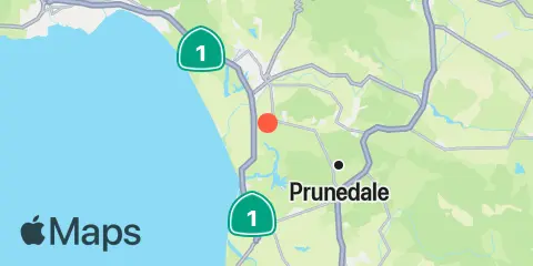
Location & Map
Latitude
36° 51' 24" N (36.85667)
Longitude
121° 45' 18" W (-121.755)
State
County
Nearest ZIP
95076
Nearby
Tides
1.2 mi
Kirby Park, Elkhorn Slough, Monterey Bay, Port San Luis
1.7 mi
Tidal Creek, Elkhorn Slough, Monterey Bay, Port San Luis
2.7 mi
Elkhorn Slough at Elkhorn, Monterey Bay
3.0 mi
Pacific Mariculture Dock, Monterey Bay
3.5 mi
Elkhorn Yacht Club, Monterey Bay
3.6 mi
Elkhorn Slough, Highway 1 Bridge, Monterey Bay
4.2 mi
General Fish Company Pier, Moss Landing, Monterey Bay
4.3 mi
Ocean Pier, Moss Landing, Monterey Bay
Note: Tide predictions are an estimate and NOT FOR NAVIGATION.
We also offer free widgets if you want to add tide or solunar tables to your own site.