Provorotni Island Tides & Fishing Times
Tides
Provorotni Island tide chart key:
The tide chart above shows the times and heights of high tide and low tide for Provorotni Island, as well as solunar period times (represented by fish icons). The red line highlights the current time and estimated height.| Day | Time | Tide | Height | |
|---|---|---|---|---|
| 1 Sat | ▼ Low | 2.08 ft | ||
| 2 Sun | ▲ High | 14.23 ft | ||
| 2 Sun | ▼ Low | -0.48 ft | ||
| 2 Sun | ▲ High | 14.41 ft | ||
| 2 Sun | ▼ Low | 1.78 ft | ||
| 3 Mon | ▲ High | 13.59 ft |
Sunday, August 2, 2026 7:46 AM: The tide is currently falling at Provorotni Island with a current estimated height of 4 ft. The last tide was High at 3:43 AM and the next tide is a Low of -0.48 ft at 10:06 AM. The tidal range today is approximately 14.89 ft with a minimum tide of -0.48 ft and maximum tide of 14.41 ft.
Next 7 Days
▲ Blue = High Tide
▼ Red = Low Tide
| Day | 1st Tide | 2nd Tide | 3rd Tide | 4th Tide | ☀ Sun |
Major Solunars
|
Minor Solunars
|
|
|---|---|---|---|---|---|---|---|---|
| 2 Sun |
|
▲ 14.23 ft |
▼ -0.48 ft |
▲ 14.41 ft |
▼ 1.78 ft |
▲ 5:01 AM ▼ 9:15 PM |
2:57 AM → 4:57 AM 3:08 PM → 5:08 PM |
9:47 AM → 10:47 AM 9:29 PM → 10:29 PM |
| 3 Mon |
|
▲ 13.59 ft |
▼ 0.39 ft |
▲ 14.62 ft |
▼ 1.59 ft |
▲ 5:03 AM ▼ 9:12 PM |
3:40 AM → 5:40 AM 3:53 PM → 5:53 PM |
11:12 AM → 12:12 PM 9:34 PM → 10:34 PM |
| 4 Tue |
|
▲ 12.74 ft |
▼ 1.49 ft |
▲ 14.68 ft |
▲ 5:05 AM ▼ 9:10 PM |
4:26 AM → 6:26 AM 4:40 PM → 6:40 PM |
12:40 PM → 1:40 PM 9:40 PM → 10:40 PM |
|
| 5 Wed |
|
▼ 1.52 ft |
▲ 11.72 ft |
▼ 2.74 ft |
▲ 14.57 ft |
▲ 5:07 AM ▼ 9:08 PM |
5:15 AM → 7:15 AM 5:31 PM → 7:31 PM |
2:13 PM → 3:13 PM 9:49 PM → 10:49 PM |
| 6 Thu |
|
▼ 1.51 ft |
▲ 10.75 ft |
▼ 4.02 ft |
▲ 14.38 ft |
▲ 5:09 AM ▼ 9:06 PM |
6:09 AM → 8:09 AM 6:35 PM → 8:35 PM |
3:49 PM → 4:49 PM 10:06 PM → 11:06 PM |
| 7 Fri |
|
▼ 1.31 ft |
▲ 10.27 ft |
▼ 5.01 ft |
▲ 14.35 ft |
▲ 5:11 AM ▼ 9:03 PM |
7:08 AM → 9:08 AM 7:38 PM → 9:38 PM |
5:39 PM → 6:39 PM 10:38 PM → 11:38 PM |
| 8 Sat |
|
▼ 0.67 ft |
▲ 10.64 ft |
▼ 5.3 ft |
▲ 14.72 ft |
▲ 5:13 AM ▼ 9:01 PM |
8:11 AM → 10:11 AM 8:46 PM → 10:46 PM |
6:55 PM → 7:55 PM |
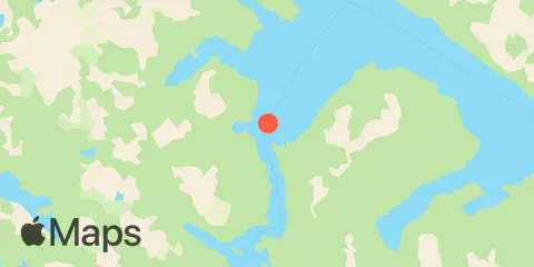
Location & Map
Nearby
Tides
6.2 mi
Nismeni Cove
6.8 mi
Bear Bay
7.7 mi
Sergius Narrows
10.1 mi
Point Elizabeth
10.2 mi
Haley Anchorage, Fish Bay
Currents
0.4 mi
Povorotni Island, 0.23 n.mi. WSW of
4.3 mi
Big Rose Island, 0.2 n.mi. SE of
5.7 mi
Middle Point
6.1 mi
Otstoia Island Light, 1 mile north of
6.9 mi
Point Siroi
7.0 mi
Nismeni Point, 1 mile north of
8.0 mi
Sergius Narrows
9.1 mi
Suloia Point, 0.32 n.mi. ENE of
9.6 mi
Peschani Point, 1 mile east of
10.7 mi
Point Elizabeth, 1 mile northeast of
11.3 mi
Kakul Narrows
Note: Tide predictions are an estimate and NOT FOR NAVIGATION.
We also offer free widgets if you want to add tide or solunar tables to your own site.